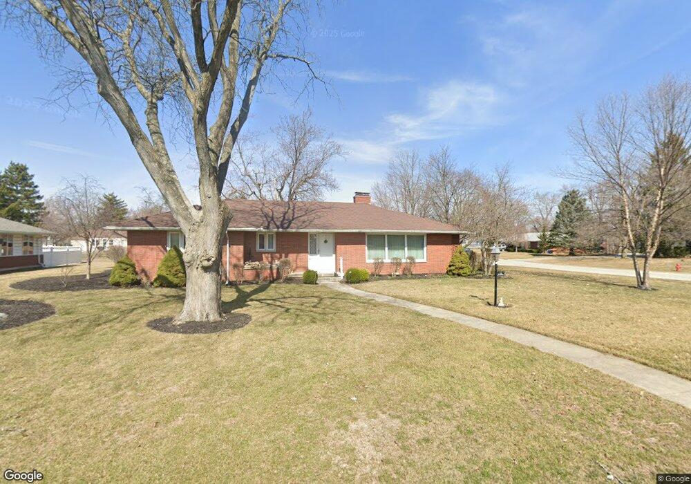
734 W Circle Dr Findlay, OH 45840
Estimated Value: $297,944 - $334,000
3
Beds
2
Baths
2,320
Sq Ft
$134/Sq Ft
Est. Value
About This Home
This home is located at 734 W Circle Dr, Findlay, OH 45840 and is currently estimated at $310,736, approximately $133 per square foot. 734 W Circle Dr is a home located in Hancock County with nearby schools including Wilson Vance Elementary School, Whittier Elementary School, and Donnell Middle School.
Ownership History
Date
Name
Owned For
Owner Type
Purchase Details
Closed on
Jul 28, 2004
Sold by
Benard Albert Eugene and Benard Leona M
Bought by
Erven Michael E and Erven Judy Mae
Current Estimated Value
Purchase Details
Closed on
Dec 9, 1985
Bought by
Jackson Paul B and Jackson Elizabeth
Create a Home Valuation Report for This Property
The Home Valuation Report is an in-depth analysis detailing your home's value as well as a comparison with similar homes in the area
Home Values in the Area
Average Home Value in this Area
Purchase History
| Date | Buyer | Sale Price | Title Company |
|---|---|---|---|
| Erven Michael E | $185,000 | Hancock Title | |
| Jackson Paul B | $76,000 | -- |
Source: Public Records
Tax History
| Year | Tax Paid | Tax Assessment Tax Assessment Total Assessment is a certain percentage of the fair market value that is determined by local assessors to be the total taxable value of land and additions on the property. | Land | Improvement |
|---|---|---|---|---|
| 2024 | $3,098 | $87,210 | $12,690 | $74,520 |
| 2023 | $3,103 | $87,210 | $12,690 | $74,520 |
| 2022 | $3,092 | $87,210 | $12,690 | $74,520 |
| 2021 | $3,186 | $78,270 | $12,700 | $65,570 |
| 2020 | $3,185 | $78,270 | $12,700 | $65,570 |
| 2019 | $3,121 | $78,270 | $12,700 | $65,570 |
| 2018 | $2,783 | $64,030 | $11,550 | $52,480 |
| 2017 | $2,784 | $64,030 | $11,550 | $52,480 |
| 2016 | $2,740 | $64,030 | $11,550 | $52,480 |
| 2015 | $3,100 | $70,890 | $12,650 | $58,240 |
| 2014 | $3,100 | $70,890 | $12,650 | $58,240 |
| 2012 | $3,121 | $70,890 | $12,650 | $58,240 |
Source: Public Records
Map
Nearby Homes
- 1308 Greendale Ave
- 630 Winterhaven Dr
- 1450 Fostoria Ave
- 631 Winterhaven Dr
- 1209 Heather Dr
- 1125 Glen Meadow Dr
- 1331 Countryside Dr
- 1108 Glen Meadow Dr
- 1724 Queenswood Dr Unit 10 (2-C)
- 1642 Cherry Ln
- 1020 Country Club Dr
- 1828 Queenswood Dr
- 1825 Greendale Ave
- 1312 Bernard Ave
- 1142 Concord Ct
- 1216 Concord Ct
- 439 Carnahan Ave
- 716 Winfield Ave
- 100 Warrington Ave
- 626 Central Ave
- 728 W Circle Dr
- 1439 Tiffin Ave
- 1445 Tiffin Ave
- 801 E Circle Dr
- 720 E Circle Dr
- 811 E Circle Dr
- 1433 Tiffin Ave
- 722 W Circle Dr
- 721 W Circle Dr
- 721 E Circle Dr
- 821 - 831 Circle Dr
- 1421 Tiffin Ave
- 715 W Circle Dr
- 821 E Circle Dr
- 711 E Circle Dr
- 1521 North Ct
- 1520 Middle Ct
- 710 E Circle Dr
- 716 W Circle Dr
- 1520 North Ct
Your Personal Tour Guide
Ask me questions while you tour the home.