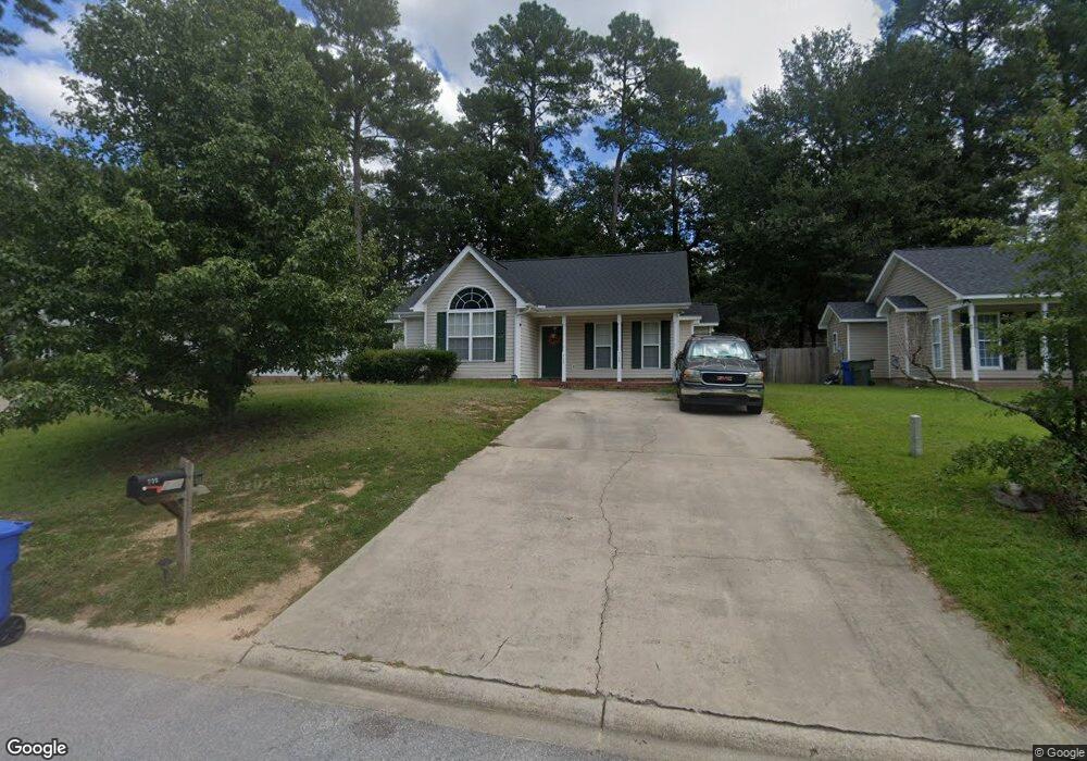
739 Burnside Dr Columbia, SC 29209
The Hamptons NeighborhoodEstimated Value: $229,000 - $245,000
About This Home
This home is located at 739 Burnside Dr, Columbia, SC 29209 and is currently estimated at $234,852, approximately $180 per square foot. 739 Burnside Dr is a home located in Richland County with nearby schools including Meadowfield Elementary School, Hand Middle School, and Dreher High School.
Ownership History
We collect this data history from publicly available records. To have your information removed, we recommend requesting removal directly through your county’s website.
Purchase Details
Purchase Details
Home Financials for this Owner
Home Financials are based on the most recent Mortgage that was taken out on this home.Purchase Details
Home Financials for this Owner
Home Financials are based on the most recent Mortgage that was taken out on this home.Purchase Details
Home Values in the Area
Average Home Value in this Area
Purchase History
We collect this data history from publicly available records. To have your information removed, we recommend requesting removal directly through your county’s website.
| Date | Buyer | Sale Price | Title Company |
|---|---|---|---|
| -- | None Listed On Document | ||
| -- | None Available | ||
| $103,306 | -- | ||
| $21,500 | -- | ||
| $20,800 | -- |
Mortgage History
We collect this data history from publicly available records. To have your information removed, we recommend requesting removal directly through your county’s website.
| Date | Status | Borrower | Loan Amount |
|---|---|---|---|
| Previous Owner | $58,325 | ||
| Previous Owner | $84,000 |
Tax History
We collect this data history from publicly available records. To have your information removed, we recommend requesting removal directly through your county’s website.
| Year | Tax Paid | Tax Assessment Tax Assessment Total Assessment is a certain percentage of the fair market value that is determined by local assessors to be the total taxable value of land and additions on the property. | Land | Improvement |
|---|---|---|---|---|
| 2025 | $4,138 | $148,200 | $0 | $0 |
| 2024 | $4,138 | $148,200 | $0 | $0 |
| 2023 | $4,054 | $5,152 | $0 | $0 |
| 2022 | $3,725 | $128,800 | $25,000 | $103,800 |
| 2021 | $3,756 | $7,730 | $0 | $0 |
| 2020 | $3,809 | $7,730 | $0 | $0 |
| 2019 | $3,819 | $7,730 | $0 | $0 |
| 2018 | $3,371 | $6,740 | $0 | $0 |
| 2017 | $3,278 | $6,740 | $0 | $0 |
| 2016 | $3,188 | $6,740 | $0 | $0 |
| 2015 | $3,169 | $6,740 | $0 | $0 |
| 2014 | $3,140 | $112,300 | $0 | $0 |
| 2013 | -- | $6,740 | $0 | $0 |
Map
- 628 Burnside Dr
- 759 Burnside Dr
- 1000 Coatesdale Rd
- 1167 Rockwood Rd
- 612 Lake Forest Rd
- 1273 Rockwood Rd
- 407 Hampton Forest Dr
- 184 Springway Dr
- 180 Springway Dr
- 235 Forest Green Dr
- 1247 Rockwood Rd
- 7005 John Edward St
- 29 Wild Iris Ct
- 196 Cottage Lake Way
- 613 Veterans Rd
- 19 Fountain Lake Place
- 1019 Veterans Rd
- 40 Brooksby Ct
- 6965 Shelley Rd
- 48 Castle Cary Ct
- 735 Burnside Dr
- 743 Burnside Dr
- 747 Burnside Dr
- 731 Burnside Dr
- 627 Burnside Dr
- 623 Burnside Dr
- 631 Burnside Dr
- 635 Burnside Dr
- 727 Burnside Dr
- 619 Burnside Dr
- 751 Burnside Dr
- 639 Burnside Dr
- 615 Burnside Dr
- 723 Burnside Dr
- 609 Burnside Dr
- 643 Burnside Dr
- 620 Burnside Dr
- 719 Burnside Dr
- 616 Burnside Dr
- 605 Burnside Dr
Ask me questions while you tour the home.