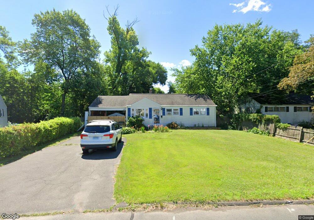
74 Brookside Cir Wethersfield, CT 06109
Estimated Value: $276,000 - $317,000
2
Beds
2
Baths
888
Sq Ft
$338/Sq Ft
Est. Value
About This Home
This home is located at 74 Brookside Cir, Wethersfield, CT 06109 and is currently estimated at $299,970, approximately $337 per square foot. 74 Brookside Cir is a home located in Hartford County with nearby schools including Emerson-Williams School, Silas Deane Middle School, and Wethersfield High School.
Ownership History
Date
Name
Owned For
Owner Type
Purchase Details
Closed on
May 9, 2011
Sold by
Nisyrios Barbara K
Bought by
Nisyrios Michael P
Current Estimated Value
Purchase Details
Closed on
Dec 11, 2001
Sold by
Oporto Nancy Elizabeth
Bought by
Nisyrios Michael P
Purchase Details
Closed on
Aug 22, 1994
Sold by
Lucente Michael A and Lucente Donna M
Bought by
Oporto Nancy Elizabeth
Create a Home Valuation Report for This Property
The Home Valuation Report is an in-depth analysis detailing your home's value as well as a comparison with similar homes in the area
Home Values in the Area
Average Home Value in this Area
Purchase History
| Date | Buyer | Sale Price | Title Company |
|---|---|---|---|
| Nisyrios Michael P | -- | -- | |
| Nisyrios Michael P | $137,000 | -- | |
| Oporto Nancy Elizabeth | $110,000 | -- |
Source: Public Records
Mortgage History
| Date | Status | Borrower | Loan Amount |
|---|---|---|---|
| Previous Owner | Oporto Nancy Elizabeth | $72,800 | |
| Previous Owner | Oporto Nancy Elizabeth | $213,750 |
Source: Public Records
Tax History
| Year | Tax Paid | Tax Assessment Tax Assessment Total Assessment is a certain percentage of the fair market value that is determined by local assessors to be the total taxable value of land and additions on the property. | Land | Improvement |
|---|---|---|---|---|
| 2025 | $6,345 | $153,930 | $58,630 | $95,300 |
| 2024 | $4,986 | $115,370 | $58,100 | $57,270 |
| 2023 | $4,820 | $115,370 | $58,100 | $57,270 |
| 2022 | $4,739 | $115,370 | $58,100 | $57,270 |
| 2021 | $4,692 | $115,370 | $58,100 | $57,270 |
| 2020 | $4,694 | $115,370 | $58,100 | $57,270 |
| 2019 | $4,700 | $115,370 | $58,100 | $57,270 |
| 2018 | $4,527 | $111,000 | $54,300 | $56,700 |
| 2017 | $4,414 | $111,000 | $54,300 | $56,700 |
| 2016 | $4,278 | $111,000 | $54,300 | $56,700 |
| 2015 | $4,239 | $111,000 | $54,300 | $56,700 |
| 2014 | $4,078 | $111,000 | $54,300 | $56,700 |
Source: Public Records
Map
Nearby Homes
- 1 Brussels Ave
- 19 Albert Ave
- 1 Bristol St
- 219-221 Jordan Ln
- 192 Wolcott Hill Rd
- 55 Rutledge Rd
- 295 Ridge Rd Unit 8
- 144 Brown St
- 23 Hillcrest Ave
- 107 Harmund Place
- 18 Avalon Place
- 28 Bolton St
- 166 George St
- 51 Hanmer St
- 43 Yale St
- 317-319 Garden St
- 1 Fernwood St
- 173 Timber Trail
- 273 Forest Dr
- 208 Mountain St
- 80 Brookside Cir
- 70 Brookside Cir
- 71 Brookside Cir
- 82 Brookside Cir
- 66 Brookside Cir
- 94 Brookside Cir
- 62 Brookside Cir
- 59 Brookside Cir
- 102 Brookside Cir
- 86 Brookside Cir
- 56 Brookside Cir
- 55 Brookside Cir
- 90 Brookside Cir
- 91 Brookside Cir
- 106 Brookside Cir
- 97 Brookside Cir
- 50 Brookside Cir
- 49 Brookside Cir
- 101 Brookside Cir
- 112 Brookside Cir
Your Personal Tour Guide
Ask me questions while you tour the home.