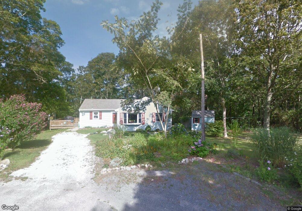
74 Cape Cod Ln Barnstable, MA 02630
Barnstable Village NeighborhoodEstimated Value: $580,068 - $786,000
About This Home
This home is located at 74 Cape Cod Ln, Barnstable, MA 02630 and is currently estimated at $692,267, approximately $534 per square foot. 74 Cape Cod Ln is a home located in Barnstable County with nearby schools including West Barnstable Elementary School, Barnstable United Elementary School, and Barnstable Intermediate School.
Ownership History
We collect this data history from publicly available records. To have your information removed, we recommend requesting removal directly through your county’s website.
Purchase Details
Home Financials for this Owner
Home Financials are based on the most recent Mortgage that was taken out on this home.Purchase Details
Home Values in the Area
Average Home Value in this Area
Purchase History
We collect this data history from publicly available records. To have your information removed, we recommend requesting removal directly through your county’s website.
| Date | Buyer | Sale Price | Title Company |
|---|---|---|---|
| $150,000 | None Available | ||
| -- | -- |
Mortgage History
We collect this data history from publicly available records. To have your information removed, we recommend requesting removal directly through your county’s website.
| Date | Status | Borrower | Loan Amount |
|---|---|---|---|
| Open | $142,500 |
Tax History
We collect this data history from publicly available records. To have your information removed, we recommend requesting removal directly through your county’s website.
| Year | Tax Paid | Tax Assessment Tax Assessment Total Assessment is a certain percentage of the fair market value that is determined by local assessors to be the total taxable value of land and additions on the property. | Land | Improvement |
|---|---|---|---|---|
| 2025 | $4,636 | $501,700 | $213,100 | $288,600 |
| 2024 | $4,304 | $491,300 | $213,100 | $278,200 |
| 2023 | $3,873 | $431,300 | $193,800 | $237,500 |
| 2022 | $3,721 | $333,400 | $133,300 | $200,100 |
| 2021 | $3,409 | $291,100 | $135,300 | $155,800 |
| 2020 | $3,531 | $288,000 | $135,300 | $152,700 |
| 2019 | $3,367 | $275,500 | $143,500 | $132,000 |
| 2018 | $3,419 | $271,800 | $167,300 | $104,500 |
| 2017 | $3,306 | $264,500 | $167,300 | $97,200 |
| 2016 | $3,271 | $265,300 | $168,600 | $96,700 |
| 2015 | $3,153 | $260,400 | $163,300 | $97,100 |
Map
- 61 Old Phinneys Ln
- 284 Braggs Ln
- 79 Sturgis Ln
- 45 Old Phinney's Ln
- 0 Indian Trail
- 121 Salt Rock Rd
- 122 Salt Rock Rd
- 22 Kent Rd
- 417 Commerce Rd
- 1431 Iyannough Rd Unit 1
- 54 Captain Cook Ln Unit 54
- 54 Captain Cook Ln
- 11 Shepherds Way
- 30 Indian Trail
- 50 & 0 Indian Trail
- 15 Camrose Ct
- 578 Huckins Neck Rd
- 100 Statice Ln
- 29 Waterview Cir
- 79 Bayberry Ln
- 73 Cape Cod Ln
- 1909 Phinneys Ln
- 58 Cape Cod Ln
- 55 Cape Cod Ln
- 40 Cape Cod Ln
- 35 Cape Cod Ln
- 28 Cape Cod Ln
- 45 Kehtean Dr
- 44 Dorcas Dr
- 1879 Phinneys Ln
- 45 Dorcas Dr
- 44 Kehtean Dr
- 44 Kehtean Dr Unit D
- 1865 Phinneys Ln
- 1903 Phinneys Ln
- 10 Cape Cod Ln
- 32 Dorcas Dr
- 37 Dorcas Dr
- 1537 Hyannis Rd
- 1511 Hyannis Rd
Ask me questions while you tour the home.