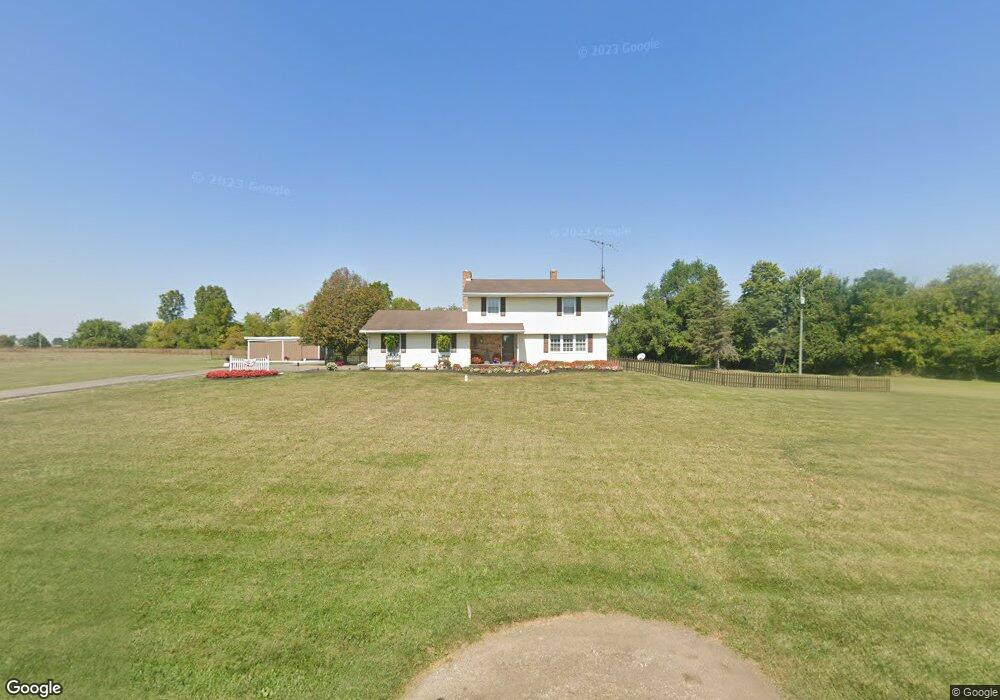
7400 Stott Rd Springfield, OH 45502
Estimated Value: $299,000 - $387,000
3
Beds
2
Baths
1,749
Sq Ft
$195/Sq Ft
Est. Value
About This Home
This home is located at 7400 Stott Rd, Springfield, OH 45502 and is currently estimated at $341,284, approximately $195 per square foot. 7400 Stott Rd is a home located in Clark County with nearby schools including Northwestern Elementary School and Northwestern Junior/Senior High School.
Ownership History
Date
Name
Owned For
Owner Type
Purchase Details
Closed on
Nov 25, 1996
Sold by
Rutledge Roger N
Bought by
Jeffrey R Ayres
Current Estimated Value
Home Financials for this Owner
Home Financials are based on the most recent Mortgage that was taken out on this home.
Original Mortgage
$55,000
Outstanding Balance
$4,244
Interest Rate
7.94%
Mortgage Type
New Conventional
Estimated Equity
$337,040
Create a Home Valuation Report for This Property
The Home Valuation Report is an in-depth analysis detailing your home's value as well as a comparison with similar homes in the area
Purchase History
| Date | Buyer | Sale Price | Title Company |
|---|---|---|---|
| Jeffrey R Ayres | $139,000 | -- |
Source: Public Records
Mortgage History
| Date | Status | Borrower | Loan Amount |
|---|---|---|---|
| Open | Jeffrey R Ayres | $55,000 |
Source: Public Records
Tax History
| Year | Tax Paid | Tax Assessment Tax Assessment Total Assessment is a certain percentage of the fair market value that is determined by local assessors to be the total taxable value of land and additions on the property. | Land | Improvement |
|---|---|---|---|---|
| 2025 | $3,826 | $95,220 | $26,880 | $68,340 |
| 2024 | $3,794 | $80,860 | $21,920 | $58,940 |
| 2023 | $3,794 | $80,860 | $21,920 | $58,940 |
| 2022 | $3,896 | $80,860 | $21,920 | $58,940 |
| 2021 | $3,227 | $59,220 | $16,000 | $43,220 |
| 2020 | $3,198 | $59,220 | $16,000 | $43,220 |
| 2019 | $3,228 | $59,220 | $16,000 | $43,220 |
| 2018 | $3,043 | $55,480 | $14,550 | $40,930 |
| 2017 | $3,045 | $55,479 | $14,546 | $40,933 |
| 2016 | $2,985 | $55,479 | $14,546 | $40,933 |
| 2015 | $2,785 | $52,847 | $14,546 | $38,301 |
| 2014 | $2,783 | $52,847 | $14,546 | $38,301 |
| 2013 | $2,765 | $52,847 | $14,546 | $38,301 |
Source: Public Records
Map
Nearby Homes
- 6568 Dialton Rd
- 3961 Shrine Rd
- 6580 Shaler Dr
- 6970 Coffin Station Rd
- 0 St Rt 55 Unit 25869228
- 4402 Kite Rd
- 1 Folk Ream Rd
- 3831 Crescent Hill Rd
- 4661 Rosswood Ln
- 4100 Troy Rd Unit Lot 24
- 5770 Storms Creek Rd
- 9775 Conrad Rd
- 3526 Dallas Dr
- 10877 Christiansburg Jackson Rd
- 3430 Michael Dr
- 3406 Christina Dr
- 3410 Michael Dr
- 3535 Ruby Dr
- 4472 Saint Paris Pike
- 4211 Grey Stone Crossing
- 6027 Dialton Rd
- 6075 Dialton Rd
- 6125 Dialton Rd
- 6075 Dialton Rd
- 6125 Dialton Rd
- 7522 Stott Rd
- 6301 Dialton Rd
- 6425 Dialton Rd
- 6479 Dialton Rd
- 7640 Stott Rd
- 7161 Stott Rd
- 6241 Dialton Rd
- 6310 Dialton Rd
- 6364 Dialton Rd
- 6365 Dialton Rd
- 6365 Dialton Rd
- 6402 Dialton Rd
- 6426 Dialton Rd
- 6115 N Hampton Rd
- 7413 Ballentine Pike
Your Personal Tour Guide
Ask me questions while you tour the home.