Estimated Value: $303,000 - $492,000
3
Beds
2
Baths
1,793
Sq Ft
$199/Sq Ft
Est. Value
About This Home
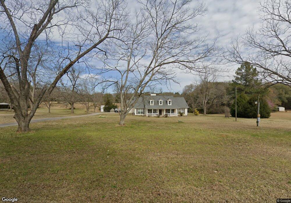
This home is located at 7409 Buckeye Rd, Perry, GA 31069 and is currently estimated at $357,090, approximately $199 per square foot. 7409 Buckeye Rd is a home located in Peach County with nearby schools including Kay Road Elementary School, Fort Valley Middle School, and Peach County High School.
Ownership History
Date
Name
Owned For
Owner Type
Purchase Details
Closed on
Jun 11, 2008
Sold by
Batchelor Vonda B
Bought by
Batchelor Alan Leroy
Current Estimated Value
Purchase Details
Closed on
Oct 1, 2007
Sold by
Batchelor Alan L
Bought by
Batchelor Vonda B
Purchase Details
Closed on
Oct 2, 2006
Sold by
Batchelor Alan Leroy
Bought by
Batchelor Alan L and Batchelor Deborah M
Purchase Details
Closed on
Sep 1, 2006
Sold by
Batchelor Vonda B
Bought by
Batchelor Alan Leroy
Purchase Details
Closed on
Mar 3, 1999
Sold by
Batchelor Vonda B
Bought by
Batchelor Vonda B and Batchelor Alan L
Purchase Details
Closed on
Feb 5, 1996
Sold by
Batchelor Roy Lee
Bought by
Batchelor Roy Lee and Batchelor Vonda B
Create a Home Valuation Report for This Property
The Home Valuation Report is an in-depth analysis detailing your home's value as well as a comparison with similar homes in the area
Purchase History
We collect this data history from publicly available records. To have your information removed, we recommend requesting removal directly through your county’s website.
| Date | Buyer | Sale Price | Title Company |
|---|---|---|---|
| Batchelor Alan Leroy | -- | -- | |
| Batchelor Vonda B | -- | -- | |
| Batchelor Alan L | -- | -- | |
| Batchelor Alan Leroy | -- | -- | |
| Batchelor Vonda B | -- | -- | |
| Batchelor Roy Lee | -- | -- |
Source: Public Records
Tax History
| Year | Tax Paid | Tax Assessment Tax Assessment Total Assessment is a certain percentage of the fair market value that is determined by local assessors to be the total taxable value of land and additions on the property. | Land | Improvement |
|---|---|---|---|---|
| 2025 | $2,252 | $105,520 | $21,480 | $84,040 |
| 2024 | $2,523 | $105,040 | $21,480 | $83,560 |
| 2023 | $1,964 | $83,360 | $14,320 | $69,040 |
| 2022 | $1,820 | $78,000 | $14,320 | $63,680 |
| 2021 | $2,022 | $60,240 | $14,320 | $45,920 |
| 2020 | $2,201 | $65,960 | $14,320 | $51,640 |
| 2019 | $2,151 | $64,040 | $14,320 | $49,720 |
| 2018 | $2,160 | $64,040 | $14,320 | $49,720 |
| 2017 | $2,170 | $64,040 | $14,320 | $49,720 |
| 2016 | $2,162 | $64,040 | $14,320 | $49,720 |
| 2015 | $2,081 | $61,400 | $11,680 | $49,720 |
| 2014 | $2,084 | $61,400 | $11,680 | $49,720 |
| 2013 | -- | $61,400 | $11,680 | $49,720 |
Source: Public Records
Map
Nearby Homes
- 0 Todd Rd Unit 253674
- 604 Beaver Ct
- 600 Beaver Ct
- 0 Woodhaven Rd
- 101 Chaparral Dr
- 501 Longhorn Trail
- 2327 Us Hwy 41
- 2327 U S 41
- 113 Lake Lillian Dr
- 1695 Harper Rd
- 150 MacK Thompson Rd
- 0 MacK Thompson Rd Unit 253661
- 149 MacK Thompson Road Common
- 0 Airport Rd Unit 250304
- 2XX Airport Rd
- 117 Bramblewood Ln
- 115 Bramblewood Ln
- 0 Hwy 41 & Langston Rd Unit M170042
- 161 Overton Dr
- 0 Langston Rd Unit 16828609
- 0 Buckeye Rd Unit PAR C 3185634
- 0 Buckeye Rd Unit L2A,AC9000 7439580
- 0 Buckeye Rd Unit L2b 8048500
- 0 Buckeye Rd Unit 8065245
- 0 Buckeye Rd Unit 214166
- 0 Buckeye Rd Unit Tract A 8079804
- 0 Buckeye Rd Unit M136761
- 0 Buckeye Rd Unit M137165
- 0 Buckeye Rd Unit 8743545
- 0 Buckeye Rd Unit 201195
- 0 Buckeye Rd Unit 122838
- 0 Buckeye Rd Unit Parcel D 185411
- 7287 Buckeye Rd
- 7314 Buckeye Rd
- 7221 Buckeye Rd
- 7363 Buckeye Rd
- 7199 Buckeye Rd
- 7400 Buckeye Rd
- 293 Todd Rd Unit A
- 293 Todd Rd
Your Personal Tour Guide
Ask me questions while you tour the home.