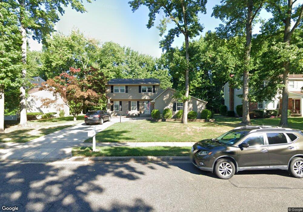
741 Cornwallis Dr Mount Laurel, NJ 08054
Estimated Value: $501,959 - $580,000
Studio
--
Bath
1,970
Sq Ft
$275/Sq Ft
Est. Value
About This Home
This home is located at 741 Cornwallis Dr, Mount Laurel, NJ 08054 and is currently estimated at $542,240, approximately $275 per square foot. 741 Cornwallis Dr is a home located in Burlington County with nearby schools including Hillside Elementary School, T.E. Harrington Middle School, and Mount Laurel Hartford School.
Ownership History
Date
Name
Owned For
Owner Type
Purchase Details
Closed on
Oct 18, 2010
Sold by
Koch John D and Karp Merideth B
Bought by
Koch John D and Koch Merideth B
Current Estimated Value
Home Financials for this Owner
Home Financials are based on the most recent Mortgage that was taken out on this home.
Original Mortgage
$165,000
Outstanding Balance
$55,964
Interest Rate
4.25%
Mortgage Type
New Conventional
Estimated Equity
$486,276
Purchase Details
Closed on
Jun 30, 2000
Sold by
Aungst Richard and Aungst Roberta C
Bought by
Koch John D and Karp Merideth B
Home Financials for this Owner
Home Financials are based on the most recent Mortgage that was taken out on this home.
Original Mortgage
$173,850
Interest Rate
8.5%
Create a Home Valuation Report for This Property
The Home Valuation Report is an in-depth analysis detailing your home's value as well as a comparison with similar homes in the area
Home Values in the Area
Average Home Value in this Area
Purchase History
| Date | Buyer | Sale Price | Title Company |
|---|---|---|---|
| Koch John D | -- | The Title Group Agency Inc | |
| Koch John D | $183,000 | -- |
Source: Public Records
Mortgage History
| Date | Status | Borrower | Loan Amount |
|---|---|---|---|
| Open | Koch John D | $165,000 | |
| Closed | Koch John D | $173,850 |
Source: Public Records
Tax History
| Year | Tax Paid | Tax Assessment Tax Assessment Total Assessment is a certain percentage of the fair market value that is determined by local assessors to be the total taxable value of land and additions on the property. | Land | Improvement |
|---|---|---|---|---|
| 2025 | $8,082 | $256,000 | $87,500 | $168,500 |
| 2024 | $7,777 | $256,000 | $87,500 | $168,500 |
| 2023 | $7,777 | $256,000 | $87,500 | $168,500 |
| 2022 | $7,752 | $256,000 | $87,500 | $168,500 |
| 2021 | $7,606 | $256,000 | $87,500 | $168,500 |
| 2020 | $7,457 | $256,000 | $87,500 | $168,500 |
| 2019 | $7,380 | $256,000 | $87,500 | $168,500 |
| 2018 | $7,324 | $256,000 | $87,500 | $168,500 |
| 2017 | $7,135 | $256,000 | $87,500 | $168,500 |
| 2016 | $6,909 | $251,700 | $87,500 | $164,200 |
| 2015 | $6,829 | $251,700 | $87,500 | $164,200 |
| 2014 | $6,761 | $251,700 | $87,500 | $164,200 |
Source: Public Records
Map
Nearby Homes
- 745 Cornwallis Dr
- 42 Falmouth Dr
- 725 Cornwallis Dr
- 704 Cornwallis Dr
- 2 Emory Ln
- 3 Newtown Ct
- 107 Bastian Dr
- 12 Taconia Ct
- 790 Carteret Ct
- 23 E Oleander Dr
- 83 Eddystone Way
- 6 E Cortland Ct
- 98B Red Cedar Ct
- 88B Red Cedar Ct
- 91 Center Ln Unit 91
- 73 Hearthstone Ln
- 112 Village Ln Unit 112
- 20 Rose Ct
- 4873 Church Rd
- 305A Kelly Cove Unit 309
- 739 Cornwallis Dr
- 737 Cornwallis Dr
- 22 Falmouth Dr
- 20 Falmouth Dr
- 728 Decatur Dr
- 24 Falmouth Dr
- 729 Decatur Dr
- 26 Falmouth Dr
- 747 Cornwallis Dr
- 735 Cornwallis Dr
- 16 Falmouth Dr
- 28 Falmouth Dr
- 733 Liberty Rd
- 726 Decatur Dr
- 726 Lincoln Dr
- 727 Decatur Dr
- 30 Falmouth Dr
- 14 Falmouth Dr
- 749 Cornwallis Dr
- 733 Cornwallis Dr
Your Personal Tour Guide
Ask me questions while you tour the home.