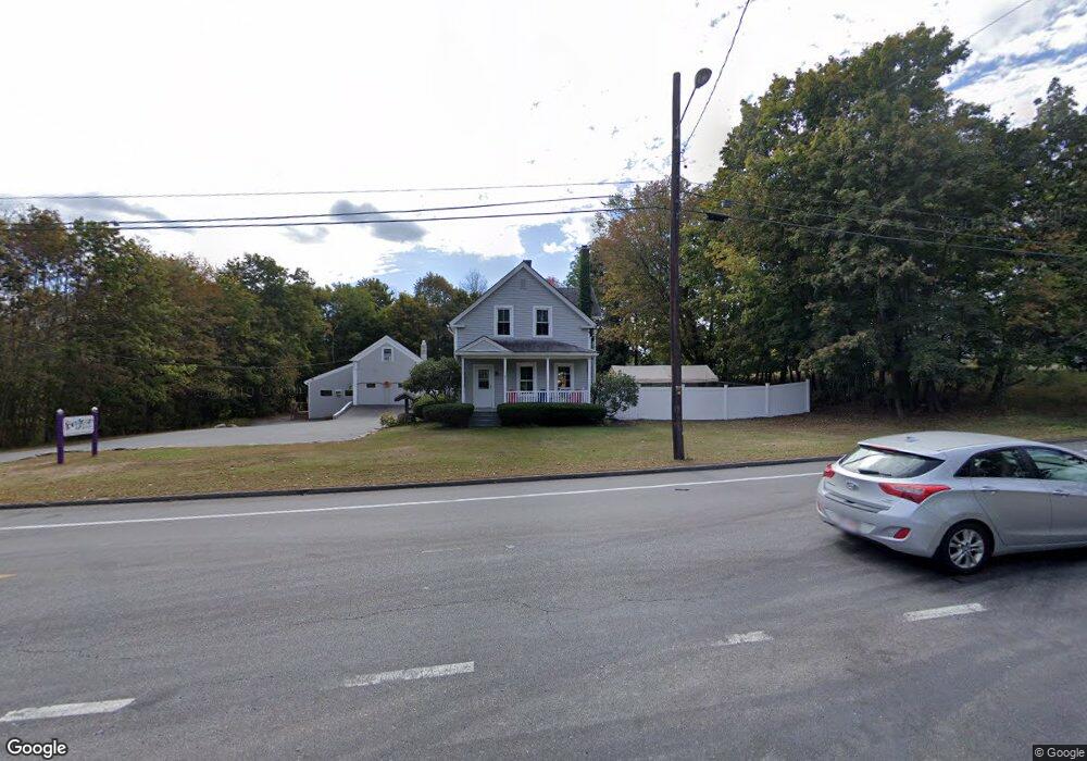
742 Massachusetts Ave Lunenburg, MA 01462
Estimated Value: $653,160
Studio
2
Baths
1,932
Sq Ft
$338/Sq Ft
Est. Value
About This Home
This home is located at 742 Massachusetts Ave, Lunenburg, MA 01462 and is currently estimated at $653,160, approximately $338 per square foot. 742 Massachusetts Ave is a home located in Worcester County with nearby schools including Lunenburg Primary School, Lunenburg High School, and St Bernards Elementary School.
Ownership History
Date
Name
Owned For
Owner Type
Purchase Details
Closed on
Jan 9, 2012
Sold by
Martha Lane Browne and Martha Browne
Bought by
Gqc Rt and Smith
Current Estimated Value
Home Financials for this Owner
Home Financials are based on the most recent Mortgage that was taken out on this home.
Original Mortgage
$250,000
Interest Rate
3.98%
Mortgage Type
Commercial
Purchase Details
Closed on
Apr 20, 2011
Sold by
Browne Martha
Bought by
Martha Lane Browne and Martha Browne
Purchase Details
Closed on
Nov 4, 2004
Sold by
Ahokas Curtis
Bought by
Lane-Browne Martha
Purchase Details
Closed on
Aug 31, 1988
Sold by
Cloherty Nancy F
Bought by
Browne F P
Home Financials for this Owner
Home Financials are based on the most recent Mortgage that was taken out on this home.
Original Mortgage
$144,000
Interest Rate
10.38%
Mortgage Type
Purchase Money Mortgage
Create a Home Valuation Report for This Property
The Home Valuation Report is an in-depth analysis detailing your home's value as well as a comparison with similar homes in the area
Home Values in the Area
Average Home Value in this Area
Purchase History
| Date | Buyer | Sale Price | Title Company |
|---|---|---|---|
| Gqc Rt | $280,000 | -- | |
| Martha Lane Browne | -- | -- | |
| Lane-Browne Martha | -- | -- | |
| Lane-Browne Martha | -- | -- | |
| Browne F P | $180,000 | -- |
Source: Public Records
Mortgage History
| Date | Status | Borrower | Loan Amount |
|---|---|---|---|
| Closed | Browne F P | $250,000 | |
| Previous Owner | Browne F P | $144,000 |
Source: Public Records
Tax History
| Year | Tax Paid | Tax Assessment Tax Assessment Total Assessment is a certain percentage of the fair market value that is determined by local assessors to be the total taxable value of land and additions on the property. | Land | Improvement |
|---|---|---|---|---|
| 2025 | $5,926 | $412,700 | $149,000 | $263,700 |
| 2024 | $5,701 | $404,300 | $140,600 | $263,700 |
| 2023 | $5,920 | $404,900 | $134,000 | $270,900 |
| 2022 | $12,377 | $720,000 | $265,500 | $454,500 |
| 2020 | $6,945 | $383,300 | $133,000 | $250,300 |
| 2019 | $6,915 | $370,200 | $133,000 | $237,200 |
| 2018 | $6,233 | $316,400 | $101,200 | $215,200 |
| 2017 | $5,536 | $277,100 | $66,100 | $211,000 |
| 2016 | $5,432 | $277,000 | $69,600 | $207,400 |
| 2015 | $5,100 | $278,400 | $66,100 | $212,300 |
Source: Public Records
Map
Nearby Homes
- 2 Riley Rd Unit B
- 189 Electric Unit A
- 41 Riley Rd
- 114 Chestnut St
- 21 Beal St
- 164 Leominster Rd
- 115 Oak Ave
- 142 Whiting St
- 46 Rolling Acres Rd
- 36 Gilchrest St
- 77 Electric Ave
- 348 Leominster Rd
- Lot C Chase Rd
- 18 Wintergreen Ct Unit 18
- 365 Hollis Rd
- 254 Massachusetts Ave
- Lot 3 Leominster Rd
- 70 Laurel Ln Unit 1
- 72 Laurel Ln Unit 2
- 249 Pleasant St
- 742 Massachusetts Ave
- 724 Massachusetts Ave
- 712 Massachusetts Ave
- 7 Riley Rd Unit Benson
- 7 Riley Rd
- 15 Chestnut St
- 2 Riley Rd
- 2 Riley Rd Unit Benson
- 2 Riley Rd Unit 54
- 2 Riley Rd Unit C
- 2 Riley Rd Unit 1
- 700 Massachusetts Ave
- 779 Massachusetts Ave
- 711 Massachusetts Ave
- 29 Chestnut St
- 790 Massachusetts Ave
- 790 Massachusetts Ave Unit 792
- 790 Massachusetts Ave
- 790 Massachusetts Ave
- 785 Massachusetts Ave
Your Personal Tour Guide
Ask me questions while you tour the home.