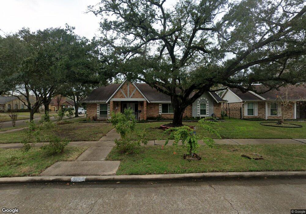
7426 Burning Tree Dr Houston, TX 77036
Sharpstown NeighborhoodEstimated Value: $315,833 - $323,000
About This Home
This home is located at 7426 Burning Tree Dr, Houston, TX 77036 and is currently estimated at $319,208, approximately $132 per square foot. 7426 Burning Tree Dr is a home located in Harris County with nearby schools including Neff Elementary School, Sugar Grove Academy, and Sharpstown High School.
Ownership History
We collect this data history from publicly available records. To have your information removed, we recommend requesting removal directly through your county’s website.
Purchase Details
Home Financials for this Owner
Home Financials are based on the most recent Mortgage that was taken out on this home.Home Values in the Area
Average Home Value in this Area
Purchase History
We collect this data history from publicly available records. To have your information removed, we recommend requesting removal directly through your county’s website.
| Date | Buyer | Sale Price | Title Company |
|---|---|---|---|
| -- | Fidelity National Title |
Mortgage History
We collect this data history from publicly available records. To have your information removed, we recommend requesting removal directly through your county’s website.
| Date | Status | Borrower | Loan Amount |
|---|---|---|---|
| Open | $139,050 |
Tax History
We collect this data history from publicly available records. To have your information removed, we recommend requesting removal directly through your county’s website.
| Year | Tax Paid | Tax Assessment Tax Assessment Total Assessment is a certain percentage of the fair market value that is determined by local assessors to be the total taxable value of land and additions on the property. | Land | Improvement |
|---|---|---|---|---|
| 2025 | $121 | $310,000 | $136,877 | $173,123 |
| 2024 | $96 | $289,425 | $98,856 | $190,569 |
| 2023 | $96 | $289,000 | $98,856 | $190,144 |
| 2022 | $5,336 | $272,340 | $60,834 | $211,506 |
| 2021 | $4,955 | $212,584 | $60,834 | $151,750 |
| 2020 | $5,608 | $224,192 | $60,834 | $163,358 |
| 2019 | $5,913 | $232,400 | $45,626 | $186,774 |
| 2018 | $1,048 | $205,920 | $45,626 | $160,294 |
| 2017 | $5,090 | $217,313 | $45,626 | $171,687 |
| 2016 | $4,627 | $198,000 | $45,626 | $152,374 |
| 2015 | -- | $188,906 | $45,626 | $143,280 |
| 2014 | -- | $161,835 | $45,626 | $116,209 |
Map
- 8530 Roos Rd
- 8506 Langdon Ln
- 8834 Sandstone St
- 8826 Rowan Ln
- 7902 La Roche Ln
- 8218 Hazen St
- 8119 Concho St
- 8910 Neff St
- 8314 Edgemoor Dr
- 8022 Stroud Dr
- 9011 Roos Rd
- 8811 Leader St
- 7230 Pella Dr
- 7103 Pella Dr
- 8103 Mobud Dr
- 8531 Hiawatha Dr
- 7919 Mobud Dr
- 8918 Grape St
- 7915 Kendalia Dr
- 9235 Sharpview Dr
- 7418 Burning Tree Dr
- 7414 Burning Tree Dr
- 7422 Burning Tree Dr
- 7415 Redding Rd
- 7419 Redding Rd
- 7410 Burning Tree Dr
- 7411 Redding Rd
- 7423 Redding Rd
- 7407 Redding Rd
- 7415 Burning Tree Dr
- 7419 Burning Tree Dr
- 7406 Burning Tree Dr
- 7427 Redding Rd
- 7411 Burning Tree Dr
- 7423 Burning Tree Dr
- 7403 Redding Rd
- 7407 Burning Tree Dr
- 7402 Burning Tree Dr
- 7403 Burning Tree Dr
- 8502 Triola Ln
Ask me questions while you tour the home.