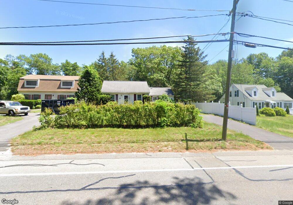
745 Monponsett St Hanson, MA 02341
Estimated Value: $370,000 - $517,000
3
Beds
1
Bath
919
Sq Ft
$473/Sq Ft
Est. Value
About This Home
This home is located at 745 Monponsett St, Hanson, MA 02341 and is currently estimated at $434,800, approximately $473 per square foot. 745 Monponsett St is a home located in Plymouth County.
Ownership History
Date
Name
Owned For
Owner Type
Purchase Details
Closed on
Oct 18, 2010
Sold by
Catton William J and Catton Julie E
Bought by
Cleckley James D and Cleckley Aletha
Current Estimated Value
Purchase Details
Closed on
May 3, 2010
Sold by
Catton William J and Catton Julie E
Bought by
Cleckley James D and Cleckley Althea
Purchase Details
Closed on
Jun 30, 2004
Sold by
Haskell Scott A and Haskell Allison H
Bought by
Catton William J and Ottina Julie E
Home Financials for this Owner
Home Financials are based on the most recent Mortgage that was taken out on this home.
Original Mortgage
$200,000
Interest Rate
6.3%
Mortgage Type
Purchase Money Mortgage
Purchase Details
Closed on
Sep 15, 1992
Sold by
Currier Jean B
Bought by
Haskell Scott A and Haskell Allison H
Home Financials for this Owner
Home Financials are based on the most recent Mortgage that was taken out on this home.
Original Mortgage
$97,000
Interest Rate
8.08%
Mortgage Type
Purchase Money Mortgage
Create a Home Valuation Report for This Property
The Home Valuation Report is an in-depth analysis detailing your home's value as well as a comparison with similar homes in the area
Home Values in the Area
Average Home Value in this Area
Purchase History
| Date | Buyer | Sale Price | Title Company |
|---|---|---|---|
| Cleckley James D | $225,000 | -- | |
| Cleckley James D | $225,000 | -- | |
| Catton William J | $254,000 | -- | |
| Haskell Scott A | $97,000 | -- |
Source: Public Records
Mortgage History
| Date | Status | Borrower | Loan Amount |
|---|---|---|---|
| Previous Owner | Haskell Scott A | $18,000 | |
| Previous Owner | Haskell Scott A | $200,000 | |
| Previous Owner | Haskell Scott A | $92,000 | |
| Previous Owner | Haskell Scott A | $97,000 |
Source: Public Records
Tax History
| Year | Tax Paid | Tax Assessment Tax Assessment Total Assessment is a certain percentage of the fair market value that is determined by local assessors to be the total taxable value of land and additions on the property. | Land | Improvement |
|---|---|---|---|---|
| 2025 | $4,393 | $328,300 | $159,800 | $168,500 |
| 2024 | $4,235 | $316,500 | $155,200 | $161,300 |
| 2023 | $3,721 | $262,400 | $155,200 | $107,200 |
| 2022 | $3,703 | $245,400 | $141,100 | $104,300 |
| 2021 | $3,308 | $219,100 | $135,700 | $83,400 |
| 2020 | $3,257 | $213,300 | $131,100 | $82,200 |
| 2019 | $2,957 | $190,400 | $114,200 | $76,200 |
| 2018 | $2,922 | $184,600 | $109,900 | $74,700 |
| 2017 | $2,830 | $177,100 | $104,600 | $72,500 |
| 2016 | $2,880 | $174,000 | $104,600 | $69,400 |
| 2015 | $2,797 | $175,700 | $104,600 | $71,100 |
Source: Public Records
Map
Nearby Homes
- 115 Waltham St
- 0 Union Park St
- 102 Leon Ct
- 0 Thompson St
- 143 Plymouth St
- 22 Ocean Ave
- 561 Twin Lakes Dr
- 553 Monponsett St
- 25 Lawrence Rd
- 10 Mattakeesett Ave
- 102 Twin Lakes Dr
- 37 Annawon Dr
- 290 School St
- 11 Carol Ave
- 8 10th Ave
- 343 Monponsett St
- 1054 Main St
- 151 Plymouth St Unit 151A
- 38 High St Unit 8
- 10 Fir Rd
- 745 Monponsett St
- 745 Monponsett St Unit None
- 739 Monponsett St
- 755 Monponsett St
- 733 Monponsett St
- 781 Monponsett St
- 724 Monponsett St
- 18 Briggs St
- 793 Monponsett St
- 48 Briggs St
- 647 Monponsett St
- 9 Ferris St
- 18 Ferris St
- 79 Hawthorne St
- 688 Monponsett St
- 75 Hawthorne St
- 21 Ferris St
- 2 Woodbine Ave
- 59 Hawthorne St
- 45 Hawthorne St
Your Personal Tour Guide
Ask me questions while you tour the home.