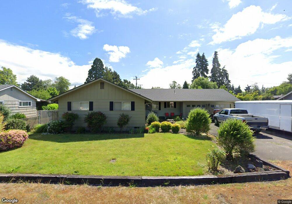
745 Randall St Eugene, OR 97401
Harlow NeighborhoodEstimated Value: $457,000 - $476,000
3
Beds
2
Baths
1,348
Sq Ft
$346/Sq Ft
Est. Value
About This Home
This home is located at 745 Randall St, Eugene, OR 97401 and is currently estimated at $466,627, approximately $346 per square foot. 745 Randall St is a home located in Lane County with nearby schools including Holt Elementary School, Monroe Middle School, and Sheldon High School.
Ownership History
Date
Name
Owned For
Owner Type
Purchase Details
Closed on
Oct 8, 2014
Sold by
Elmore Burrle
Bought by
Lucker Stanley W
Current Estimated Value
Home Financials for this Owner
Home Financials are based on the most recent Mortgage that was taken out on this home.
Original Mortgage
$222,687
Outstanding Balance
$169,735
Interest Rate
4.1%
Mortgage Type
VA
Estimated Equity
$296,892
Purchase Details
Closed on
Jan 22, 2008
Sold by
Rader Lois A
Bought by
Rader Lois Arlene and Lois Arlene Rader Trust
Create a Home Valuation Report for This Property
The Home Valuation Report is an in-depth analysis detailing your home's value as well as a comparison with similar homes in the area
Home Values in the Area
Average Home Value in this Area
Purchase History
| Date | Buyer | Sale Price | Title Company |
|---|---|---|---|
| Lucker Stanley W | $218,000 | Cascade Title Company | |
| Rader Lois Arlene | -- | None Available |
Source: Public Records
Mortgage History
| Date | Status | Borrower | Loan Amount |
|---|---|---|---|
| Open | Lucker Stanley W | $222,687 |
Source: Public Records
Tax History
| Year | Tax Paid | Tax Assessment Tax Assessment Total Assessment is a certain percentage of the fair market value that is determined by local assessors to be the total taxable value of land and additions on the property. | Land | Improvement |
|---|---|---|---|---|
| 2025 | $4,164 | $213,730 | -- | -- |
| 2024 | $4,112 | $207,505 | -- | -- |
| 2023 | $4,112 | $201,462 | $0 | $0 |
| 2022 | $3,853 | $195,595 | $0 | $0 |
| 2021 | $3,619 | $189,899 | $0 | $0 |
| 2020 | $3,631 | $184,368 | $0 | $0 |
| 2019 | $3,507 | $178,999 | $0 | $0 |
| 2018 | $3,301 | $168,724 | $0 | $0 |
| 2017 | $3,146 | $168,724 | $0 | $0 |
| 2016 | $3,038 | $163,810 | $0 | $0 |
| 2015 | $2,931 | $159,039 | $0 | $0 |
| 2014 | $2,484 | $154,407 | $0 | $0 |
Source: Public Records
Map
Nearby Homes
- 825 Waverly St
- 2994 Dapple Way
- 2872 Suffolk Ct
- 280 Roan Dr
- 2746 Harlow Rd
- 280 Regal Ct
- 600 Cherry Dr Unit 8
- 600 Cherry Dr Unit 3
- 394 Cherry Dr
- 950 Coburg Rd
- 2746 Norbert Ln
- 2345 Pioneer Pike
- 1271 Arcadia Dr
- 3700 Babcock Ln Unit 106
- 327 Rustic Place Unit 35
- 347 Rustic Place Unit 14
- 367 Rustic Place
- 1491 Victorian Way
- 1090 Corydon St
- 0 Sprig Ln Unit Lot 3
- 763 Randall St
- 3335 Harlow Rd
- 3325 Harlow Rd
- 744 N van Duyn St
- 765 Randall St
- 3345 Harlow Rd
- 770 N van Duyn St
- 732 Randall St
- 750 Randall St
- 716 Randall St
- 3393 Harlow Rd
- 720 N van Duyn St
- 780 N van Duyn St
- 781 Randall St
- 768 Randall St
- 733 Leigh St
- 777 Leigh St
- 715 Leigh St
- 793 Randall St
- 798 N van Duyn St
Your Personal Tour Guide
Ask me questions while you tour the home.