Estimated Value: $237,550 - $257,000
Studio
1
Bath
840
Sq Ft
$294/Sq Ft
Est. Value
About This Home
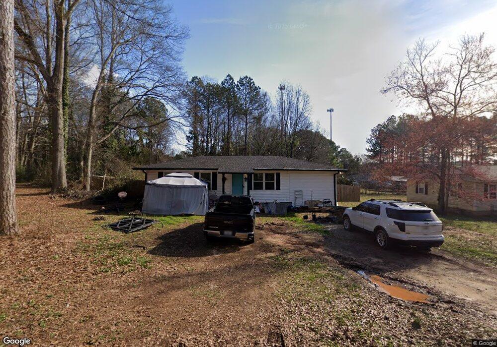
This home is located at 75 Davis St, Hull, GA 30646 and is currently estimated at $246,888, approximately $293 per square foot. 75 Davis St is a home located in Madison County with nearby schools including Madison County High School.
Ownership History
Date
Name
Owned For
Owner Type
Purchase Details
Closed on
Jun 14, 2024
Sold by
New Leaf Georgia Llc
Bought by
Jackson Cherie
Current Estimated Value
Home Financials for this Owner
Home Financials are based on the most recent Mortgage that was taken out on this home.
Original Mortgage
$225,000
Outstanding Balance
$221,727
Interest Rate
7.02%
Mortgage Type
VA
Estimated Equity
$25,161
Purchase Details
Closed on
Mar 4, 2020
Sold by
King Shirley
Bought by
New Leaf Georgia Llc
Purchase Details
Closed on
Jun 4, 2019
Sold by
Dalton Lamar Sheriff
Bought by
Blueprint Fund Ii Lp
Purchase Details
Closed on
Apr 8, 2014
Sold by
King Shirley M
Bought by
Mason Joyce
Purchase Details
Closed on
Jan 1, 1992
Bought by
King Shirley M
Create a Home Valuation Report for This Property
The Home Valuation Report is an in-depth analysis detailing your home's value as well as a comparison with similar homes in the area
Purchase History
| Date | Buyer | Sale Price | Title Company |
|---|---|---|---|
| Jackson Cherie | $225,000 | -- | |
| New Leaf Georgia Llc | $90,000 | -- | |
| Blueprint Fund Ii Lp | $20,000 | -- | |
| Mason Joyce | $65,000 | -- | |
| King Shirley M | -- | -- |
Source: Public Records
Mortgage History
| Date | Status | Borrower | Loan Amount |
|---|---|---|---|
| Open | Jackson Cherie | $225,000 |
Source: Public Records
Tax History
| Year | Tax Paid | Tax Assessment Tax Assessment Total Assessment is a certain percentage of the fair market value that is determined by local assessors to be the total taxable value of land and additions on the property. | Land | Improvement |
|---|---|---|---|---|
| 2025 | -- | $68,920 | $12,966 | $55,954 |
| 2024 | $1,047 | $38,529 | $12,966 | $25,563 |
| 2023 | $1,995 | $62,139 | $12,611 | $49,528 |
| 2022 | $1,463 | $52,269 | $8,672 | $43,597 |
| 2021 | $1,156 | $37,799 | $8,672 | $29,127 |
| 2020 | $1,179 | $36,539 | $7,412 | $29,127 |
| 2019 | $1,171 | $35,877 | $7,412 | $28,465 |
| 2018 | $1,126 | $34,379 | $6,781 | $27,598 |
| 2017 | $1,009 | $33,668 | $6,306 | $27,362 |
| 2016 | $867 | $28,773 | $5,733 | $23,040 |
| 2015 | $781 | $28,773 | $5,733 | $23,040 |
| 2014 | $865 | $28,769 | $5,809 | $22,960 |
| 2013 | -- | $28,769 | $5,809 | $22,960 |
Source: Public Records
Map
Nearby Homes
- 19 Glenn Carrie Rd
- 232 Glenn Carrie Rd Unit 1
- 240 Glenn Carrie Rd Unit 2
- 226 Hidden Falls Dr
- 1361 Hull Rd
- 194 Woodland Creek Place
- 3013 Lawton Ln
- 105 Hidden Lake Ct
- 741 Harve Mathis Rd
- 540 & 542 Harve Mathis Rd
- 151 Rolling Woods Ln
- 31 Rolling Woods Ln
- 152 Wellington Dr
- 1080 Spratlin Mill Dr
- 200 Lem Edwards Rd
- 0 Reese Ln Unit 7703910
- 0 Reese Ln Unit CL346847
- 8576 Highway 72 W
- 8986 Highway 29 S
- 360 Joe Graham Rd
- 111 Davis St
- 51 Davis St
- 51 & 75 Davis St
- 51 Davis St
- 84 Davis St
- 48 Davis St
- 48 & 26 Davis St
- 48 Davis St
- 155 Easy St
- 105 Easy St
- 10533 Highway 72 W
- 10535 Hwy 72w
- 10535 Highway 72 W
- 155 Davis St
- 55 Easy St
- 10390 Highway 72 W
- 1401 Old Elberton Rd
- 10370 Highway 72 W
- 10446 Highway 72 W
- 10446 Georgia 72
Your Personal Tour Guide
Ask me questions while you tour the home.