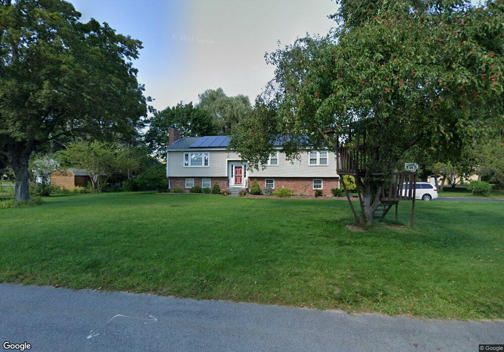
75 Philip Farm Rd Concord, MA 01742
Estimated Value: $1,169,000 - $1,260,000
4
Beds
2
Baths
2,060
Sq Ft
$590/Sq Ft
Est. Value
About This Home
This home is located at 75 Philip Farm Rd, Concord, MA 01742 and is currently estimated at $1,216,338, approximately $590 per square foot. 75 Philip Farm Rd is a home located in Middlesex County with nearby schools including Alcott Elementary School, Concord Middle School, and Concord Carlisle High School.
Ownership History
Date
Name
Owned For
Owner Type
Purchase Details
Closed on
Dec 6, 2007
Sold by
Cahill Eva W and Georgaklis Gregory
Bought by
Zhang Ling and Cheung Pak
Current Estimated Value
Home Financials for this Owner
Home Financials are based on the most recent Mortgage that was taken out on this home.
Original Mortgage
$400,000
Outstanding Balance
$254,098
Interest Rate
6.37%
Mortgage Type
Purchase Money Mortgage
Estimated Equity
$962,240
Purchase Details
Closed on
Jul 30, 2004
Sold by
Newcombe Karen and Laible Linda
Bought by
Cahill Eva W and Georgaklis Gregory
Create a Home Valuation Report for This Property
The Home Valuation Report is an in-depth analysis detailing your home's value as well as a comparison with similar homes in the area
Home Values in the Area
Average Home Value in this Area
Purchase History
We collect this data history from publicly available records. To have your information removed, we recommend requesting removal directly through your county’s website.
| Date | Buyer | Sale Price | Title Company |
|---|---|---|---|
| Zhang Ling | $545,000 | -- | |
| Cahill Eva W | $610,000 | -- |
Source: Public Records
Mortgage History
We collect this data history from publicly available records. To have your information removed, we recommend requesting removal directly through your county’s website.
| Date | Status | Borrower | Loan Amount |
|---|---|---|---|
| Open | Zhang Ling | $400,000 |
Source: Public Records
Tax History
| Year | Tax Paid | Tax Assessment Tax Assessment Total Assessment is a certain percentage of the fair market value that is determined by local assessors to be the total taxable value of land and additions on the property. | Land | Improvement |
|---|---|---|---|---|
| 2025 | $146 | $1,103,000 | $642,200 | $460,800 |
| 2024 | $13,423 | $1,022,300 | $599,300 | $423,000 |
| 2023 | $12,880 | $993,800 | $570,800 | $423,000 |
| 2022 | $11,253 | $762,400 | $415,000 | $347,400 |
| 2021 | $11,090 | $753,400 | $415,000 | $338,400 |
| 2020 | $9,709 | $682,300 | $363,100 | $319,200 |
| 2019 | $9,818 | $691,900 | $372,700 | $319,200 |
| 2018 | $9,746 | $682,000 | $374,100 | $307,900 |
| 2017 | $9,185 | $652,800 | $356,300 | $296,500 |
| 2016 | $8,821 | $633,700 | $319,800 | $313,900 |
| 2015 | $8,863 | $620,200 | $338,400 | $281,800 |
Source: Public Records
Map
Nearby Homes
- 16 Hatch Farm Ln
- 105 Prescott Rd
- 6 Parker Rd
- 51 Revolutionary Rd
- 59 Martin Rd
- 152 Partridge Ln
- 22 Old Cambridge Turnpike
- 38 Ripley Hill Rd
- 105 Lexington Rd
- 8 North Commons Unit C
- 70 Lexington Rd
- 33 Everett St
- 61B Walden St
- 17 Morningside Ln
- 95 Hubbard St
- 353 Thoreau St
- 180 Laurel St
- 46 Sudbury Rd
- 150 Hubbard St Unit B
- 24 Fielding St
- 12 Kenney Ln
- 22 Kenney Ln
- 99 Philip Farm Rd
- 70 Philip Farm Rd
- 80 Philip Farm Rd
- 30 Kenney Ln
- 60 Philip Farm Rd
- 105 Philip Farm Rd
- 86 Philip Farm Rd
- 92 Philip Farm Rd
- 104 Philip Farm Rd
- 48 Philip Farm Rd
- 46 Kenney Ln
- 11 Kenney Ln
- 120 Kenney Ln
- 106 Kenney Ln
- 23 Kenney Ln
- 94 Kenney Ln
- 38 Philip Farm Rd
- 33 Kenney Ln
Your Personal Tour Guide
Ask me questions while you tour the home.