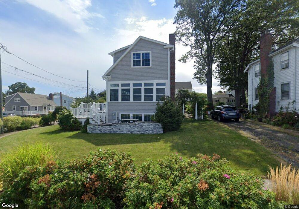
75 Shellton Rd Quincy, MA 02169
Adams Shore NeighborhoodEstimated Value: $621,292 - $792,000
2
Beds
1
Bath
1,228
Sq Ft
$553/Sq Ft
Est. Value
About This Home
This home is located at 75 Shellton Rd, Quincy, MA 02169 and is currently estimated at $679,573, approximately $553 per square foot. 75 Shellton Rd is a home located in Norfolk County with nearby schools including Merrymount Elementary School, Broad Meadows Middle School, and Quincy High School.
Ownership History
Date
Name
Owned For
Owner Type
Purchase Details
Closed on
Jun 21, 2019
Sold by
Margarone Marie E
Bought by
Marie E Margarone T 2019
Current Estimated Value
Purchase Details
Closed on
Aug 31, 2010
Sold by
Gustafson Michael L and Quint Scott B
Bought by
Gustafson Michael L
Home Financials for this Owner
Home Financials are based on the most recent Mortgage that was taken out on this home.
Original Mortgage
$400,000
Interest Rate
4.57%
Purchase Details
Closed on
Jul 1, 2009
Sold by
Jacobs Donald R and Jacobs Paula J
Bought by
Gustafson Michael L and Quint Scott B
Home Financials for this Owner
Home Financials are based on the most recent Mortgage that was taken out on this home.
Original Mortgage
$475,000
Interest Rate
4.86%
Mortgage Type
Purchase Money Mortgage
Purchase Details
Closed on
Feb 23, 2007
Sold by
Pound Donna H
Bought by
Jacobs Donald R and Jacobs Paula J
Purchase Details
Closed on
Sep 1, 1998
Sold by
Day Katherine F
Bought by
Margarone Marie E and Margarone Mary A
Home Financials for this Owner
Home Financials are based on the most recent Mortgage that was taken out on this home.
Original Mortgage
$131,200
Interest Rate
6.9%
Mortgage Type
Purchase Money Mortgage
Create a Home Valuation Report for This Property
The Home Valuation Report is an in-depth analysis detailing your home's value as well as a comparison with similar homes in the area
Home Values in the Area
Average Home Value in this Area
Purchase History
| Date | Buyer | Sale Price | Title Company |
|---|---|---|---|
| Marie E Margarone T 2019 | -- | None Available | |
| Gustafson Michael L | -- | -- | |
| Gustafson Michael L | $955,000 | -- | |
| Jacobs Donald R | $375,000 | -- | |
| Margarone Marie E | $164,000 | -- |
Source: Public Records
Mortgage History
| Date | Status | Borrower | Loan Amount |
|---|---|---|---|
| Previous Owner | Gustafson Michael L | $400,000 | |
| Previous Owner | Gustafson Michael L | $475,000 | |
| Previous Owner | Margarone Marie E | $132,000 | |
| Previous Owner | Margarone Marie E | $131,200 |
Source: Public Records
Tax History
| Year | Tax Paid | Tax Assessment Tax Assessment Total Assessment is a certain percentage of the fair market value that is determined by local assessors to be the total taxable value of land and additions on the property. | Land | Improvement |
|---|---|---|---|---|
| 2025 | $5,878 | $509,800 | $279,500 | $230,300 |
| 2024 | $5,572 | $494,400 | $266,100 | $228,300 |
| 2023 | $5,297 | $475,900 | $253,400 | $222,500 |
| 2022 | $4,943 | $412,600 | $202,800 | $209,800 |
| 2021 | $4,912 | $404,600 | $202,800 | $201,800 |
| 2020 | $4,886 | $393,100 | $202,800 | $190,300 |
| 2019 | $4,581 | $365,000 | $196,800 | $168,200 |
| 2018 | $4,582 | $343,500 | $182,300 | $161,200 |
| 2017 | $4,398 | $310,400 | $173,600 | $136,800 |
| 2016 | $4,111 | $286,300 | $157,800 | $128,500 |
| 2015 | $3,898 | $267,000 | $148,900 | $118,100 |
| 2014 | $3,705 | $249,300 | $148,900 | $100,400 |
Source: Public Records
Map
Nearby Homes
- 59 Terne Rd
- 9 Poplar Rd
- 479 Sea St Unit 2
- 599 Sea St Unit 2
- 599 Sea St Unit 1
- 36 Palmer St
- 96 Utica St
- 245 Sea St Unit 45
- 162 Palmer St
- 10 Forbush Ave
- 40 Virginia Rd
- 51 Stoughton St
- 105 Sea St Unit 105
- 105 Sea St Unit 102
- 200 Cove Way Unit 1004
- 18 Allerton St
- 107 Baxter Ave
- 50 Harrison St
- 148 Furnace Brook Pkwy
- 21 Curtis Ave
- 75 Shellton Rd
- 71 Shellton Rd
- 69 Shellton Rd
- 65 Shellton Rd
- 65 Shellton Rd
- 7 Swan Rd
- 61 Shellton Rd
- 72 Shellton Rd Unit 1st
- 72 Shellton Rd Unit 1
- 72 Shellton Rd
- 59 Shellton Rd
- 15 Swan Rd
- 100 Albatross Rd
- 57 Shellton Rd
- 96 Albatross Rd
- 108 Albatross Rd
- 81 Shellton Rd
- 83 Shellton Rd
- 92 Albatross Rd
- 47 Shellton Rd
Your Personal Tour Guide
Ask me questions while you tour the home.