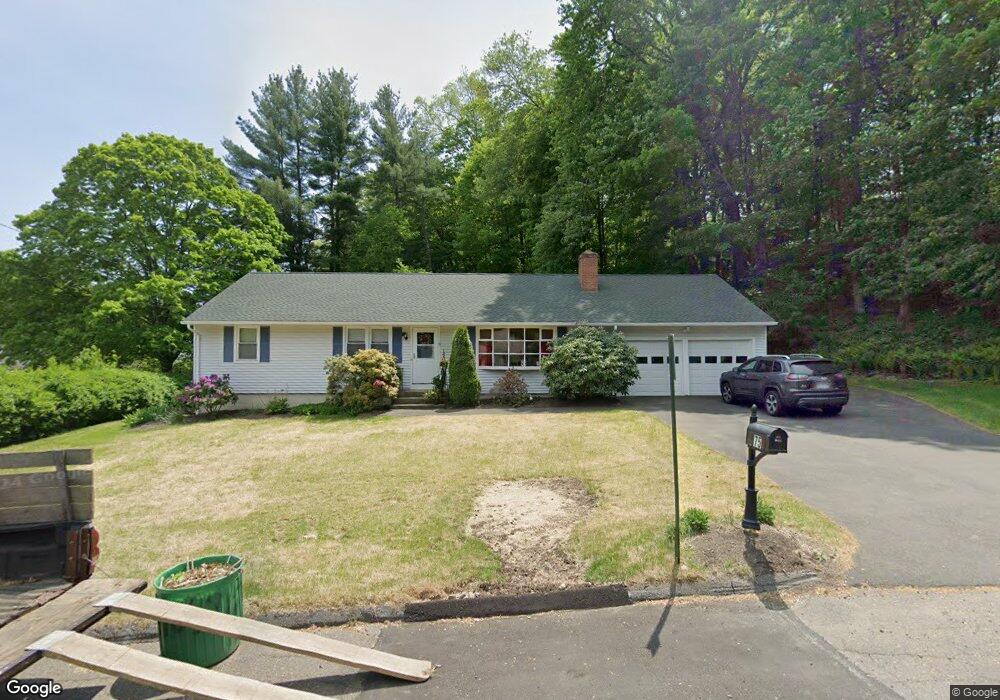
75 Tait Rd Trumbull, CT 06611
Trumbull Center NeighborhoodEstimated Value: $563,857 - $616,000
3
Beds
2
Baths
1,722
Sq Ft
$341/Sq Ft
Est. Value
About This Home
This home is located at 75 Tait Rd, Trumbull, CT 06611 and is currently estimated at $587,464, approximately $341 per square foot. 75 Tait Rd is a home located in Fairfield County with nearby schools including Frenchtown Elementary School, Madison Middle School, and Trumbull High School.
Ownership History
Date
Name
Owned For
Owner Type
Purchase Details
Closed on
Feb 9, 1979
Bought by
Mcgovern Terence J and Mcgovern Sharon
Current Estimated Value
Create a Home Valuation Report for This Property
The Home Valuation Report is an in-depth analysis detailing your home's value as well as a comparison with similar homes in the area
Home Values in the Area
Average Home Value in this Area
Purchase History
We collect this data history from publicly available records. To have your information removed, we recommend requesting removal directly through your county’s website.
| Date | Buyer | Sale Price | Title Company |
|---|---|---|---|
| Mcgovern Terence J | -- | -- |
Source: Public Records
Mortgage History
We collect this data history from publicly available records. To have your information removed, we recommend requesting removal directly through your county’s website.
| Date | Status | Borrower | Loan Amount |
|---|---|---|---|
| Closed | Mcgovern Terence J | $58,500 |
Source: Public Records
Tax History
| Year | Tax Paid | Tax Assessment Tax Assessment Total Assessment is a certain percentage of the fair market value that is determined by local assessors to be the total taxable value of land and additions on the property. | Land | Improvement |
|---|---|---|---|---|
| 2025 | $9,051 | $245,140 | $142,520 | $102,620 |
| 2024 | $8,803 | $245,140 | $142,520 | $102,620 |
| 2023 | $8,661 | $245,140 | $142,520 | $102,620 |
| 2022 | $8,522 | $245,140 | $142,520 | $102,620 |
| 2021 | $40,023 | $201,530 | $118,790 | $82,740 |
| 2020 | $41,975 | $201,530 | $118,790 | $82,740 |
| 2018 | $7,046 | $201,530 | $118,790 | $82,740 |
| 2017 | $6,904 | $201,530 | $118,790 | $82,740 |
| 2016 | $6,765 | $201,530 | $118,790 | $82,740 |
| 2015 | $6,847 | $201,600 | $118,800 | $82,800 |
| 2014 | $6,699 | $201,600 | $118,800 | $82,800 |
Source: Public Records
Map
Nearby Homes
- Lot 31 Valley View Rd
- 36 Lillian Dr
- 315 Church Hill Rd
- 28 Grandview Dr
- 58 Daniels Farm Rd
- 286 Daniels Farm Rd
- 220 Algonquin Trail
- 32 MacMath Dr
- 12 Sunset Ave
- 50 Crown St
- 26 Craig Ln
- 35 Elberta Ave
- 54 Redspire Ct Unit 54
- 5 Arrowhead Rd
- 6 Winding Way Unit 6
- 15 Glenarden Rd
- 253 Mayfield Dr Unit 253
- 26 Grove St
- 7 Cedar Crest Rd
- 34 Bassick Rd
- 29 Rexview Cir
- 25 Rexview Cir
- 34 Rexview Cir
- 57 Tait Rd
- 20 Rexview Cir
- 41 Rexview Cir
- 10 Rexview Cir
- 65 Tait Rd
- 42 Rexview Cir
- 38 Rexview Cir
- 24 Norwood Terrace
- 30 Norwood Terrace
- 17 Rexview Cir
- 76 Tait Rd
- 60 Tait Rd
- 54 Tait Rd
- 20 Norwood Terrace
- 20 Norwood Terrace Unit 2nd floor
- 18 Norwood Terrace
- 46 Rexview Cir
Your Personal Tour Guide
Ask me questions while you tour the home.