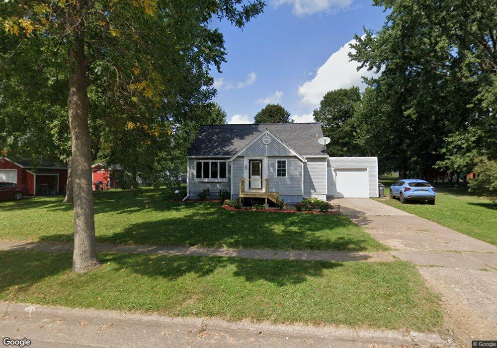
750 Newton St Baldwin, WI 54002
Estimated Value: $229,000 - $253,000
4
Beds
1
Bath
1,120
Sq Ft
$216/Sq Ft
Est. Value
About This Home
This home is located at 750 Newton St, Baldwin, WI 54002 and is currently estimated at $242,129, approximately $216 per square foot. 750 Newton St is a home located in St. Croix County with nearby schools including Greenfield Elementary School, Viking Middle School, and Baldwin-Woodville High School.
Ownership History
Date
Name
Owned For
Owner Type
Purchase Details
Closed on
Sep 10, 2021
Sold by
Karis Matthew
Bought by
Steffe Keinn J
Current Estimated Value
Home Financials for this Owner
Home Financials are based on the most recent Mortgage that was taken out on this home.
Original Mortgage
$175,757
Outstanding Balance
$158,173
Interest Rate
2.8%
Mortgage Type
New Conventional
Estimated Equity
$83,956
Purchase Details
Closed on
Jul 15, 2016
Sold by
Gillen Jeremy A and Gillen Lynn
Bought by
Karis Matthew
Home Financials for this Owner
Home Financials are based on the most recent Mortgage that was taken out on this home.
Original Mortgage
$122,365
Interest Rate
3.54%
Mortgage Type
New Conventional
Create a Home Valuation Report for This Property
The Home Valuation Report is an in-depth analysis detailing your home's value as well as a comparison with similar homes in the area
Home Values in the Area
Average Home Value in this Area
Purchase History
We collect this data history from publicly available records. To have your information removed, we recommend requesting removal directly through your county’s website.
| Date | Buyer | Sale Price | Title Company |
|---|---|---|---|
| Steffe Keinn J | $180,000 | Watermark Title | |
| Karis Matthew | $119,000 | St Croix County Abstract & T |
Source: Public Records
Mortgage History
We collect this data history from publicly available records. To have your information removed, we recommend requesting removal directly through your county’s website.
| Date | Status | Borrower | Loan Amount |
|---|---|---|---|
| Open | Steffe Keinn J | $175,757 | |
| Previous Owner | Karis Matthew | $122,365 |
Source: Public Records
Tax History
| Year | Tax Paid | Tax Assessment Tax Assessment Total Assessment is a certain percentage of the fair market value that is determined by local assessors to be the total taxable value of land and additions on the property. | Land | Improvement |
|---|---|---|---|---|
| 2025 | $3,093 | $162,200 | $39,500 | $122,700 |
| 2024 | $29 | $162,200 | $39,500 | $122,700 |
| 2023 | $2,452 | $162,200 | $39,500 | $122,700 |
| 2022 | $2,409 | $162,200 | $39,500 | $122,700 |
| 2021 | $2,442 | $162,200 | $39,500 | $122,700 |
| 2020 | $2,349 | $114,100 | $29,300 | $84,800 |
| 2019 | $2,304 | $114,100 | $29,300 | $84,800 |
| 2018 | $2,138 | $114,100 | $29,300 | $84,800 |
| 2017 | $2,235 | $114,100 | $29,300 | $84,800 |
| 2016 | $2,235 | $114,100 | $29,300 | $84,800 |
| 2015 | $2,018 | $88,400 | $26,100 | $62,300 |
| 2014 | $1,818 | $88,400 | $26,100 | $62,300 |
| 2013 | $1,853 | $88,400 | $26,100 | $62,300 |
Source: Public Records
Map
Nearby Homes
- xxx Lot #3 38th St
- 1040 7th Ave
- 1020 Franklin St
- 1060 Franklin St
- 1239 Newton St
- 521 Summit Cir
- 183 Pintail St
- 1240 Lokhorst St
- 1450 6th Ave
- 1630 5th Ave
- 1632 Mallard Ave
- 1430 8th Ave
- XXX 220th St
- 199 Wood Duck Ln
- 316 Birch St
- 288 Birch St
- 382 Cedar St
- 1728 Redhead Ave
- 300 Cedar St Unit 72
- 300 Cedar St Unit 77
- 700 Newton St
- 740 Newton St
- 680 Newton St
- 670 Us Highway 12
- 670 Highway 12 E
- 990 Hillcrest St
- 990 Hillcrest St
- 990 Hillcrest St
- 990 Hillcrest St
- 990 Hillcrest St
- 990 Hillcrest St
- 710 Newton St
- 660 Newton St
- 760 Newton St
- 670 U S 12
- 750 Newton St
- 690 Newton St
- 640 Newton St
- 780 Newton St
- 670 Newton St
Your Personal Tour Guide
Ask me questions while you tour the home.