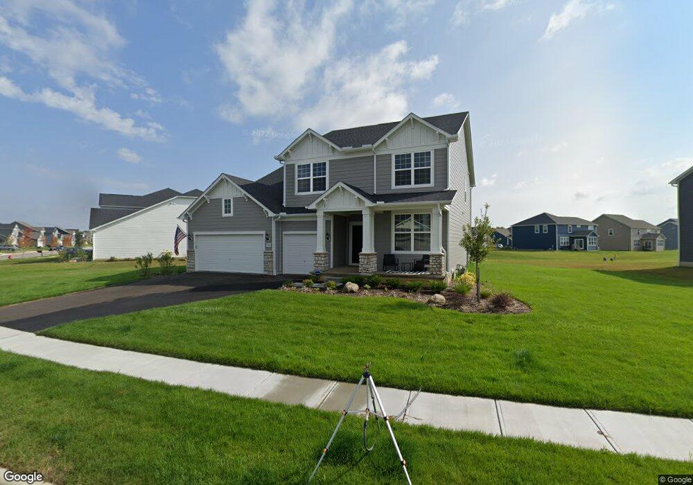
7500 White Cap Dr Powell, OH 43065
Estimated Value: $659,000 - $692,000
4
Beds
3
Baths
3,300
Sq Ft
$205/Sq Ft
Est. Value
About This Home
This home is located at 7500 White Cap Dr, Powell, OH 43065 and is currently estimated at $675,843, approximately $204 per square foot. 7500 White Cap Dr is a home with nearby schools including Liberty Tree Elementary School, Hyatts Middle School, and Olentangy Berlin High School.
Ownership History
Date
Name
Owned For
Owner Type
Purchase Details
Closed on
Oct 18, 2024
Sold by
Mullins Brittany V and Pace Brittany V
Bought by
Mullins Brittany V and Mullins Robert A
Current Estimated Value
Purchase Details
Closed on
Aug 2, 2024
Sold by
Pace David J and Pace Brittany V
Bought by
Pace Brittany V
Purchase Details
Closed on
Jul 16, 2024
Sold by
Pace David J and Pace Brittany V
Bought by
Pace Brittany V
Purchase Details
Closed on
Apr 7, 2021
Bought by
Brittany V Pace and David J Pace
Home Financials for this Owner
Home Financials are based on the most recent Mortgage that was taken out on this home.
Interest Rate
3.18%
Purchase Details
Closed on
Mar 24, 2021
Sold by
Pulte Homes Of Ohio Llc
Bought by
Pace Brittany V and Pace David J
Home Financials for this Owner
Home Financials are based on the most recent Mortgage that was taken out on this home.
Interest Rate
3.18%
Create a Home Valuation Report for This Property
The Home Valuation Report is an in-depth analysis detailing your home's value as well as a comparison with similar homes in the area
Home Values in the Area
Average Home Value in this Area
Purchase History
| Date | Buyer | Sale Price | Title Company |
|---|---|---|---|
| Mullins Brittany V | -- | None Listed On Document | |
| Pace Brittany V | -- | None Listed On Document | |
| Pace Brittany V | -- | None Listed On Document | |
| Brittany V Pace | $481,785 | -- | |
| Pace Brittany V | $481,800 | None Available |
Source: Public Records
Mortgage History
| Date | Status | Borrower | Loan Amount |
|---|---|---|---|
| Previous Owner | Brittany V Pace | -- | |
| Previous Owner | Pace Brittany V | $385,428 |
Source: Public Records
Tax History
| Year | Tax Paid | Tax Assessment Tax Assessment Total Assessment is a certain percentage of the fair market value that is determined by local assessors to be the total taxable value of land and additions on the property. | Land | Improvement |
|---|---|---|---|---|
| 2024 | $10,597 | $196,460 | $39,900 | $156,560 |
| 2023 | $10,637 | $196,460 | $39,900 | $156,560 |
| 2022 | $10,123 | $148,020 | $29,750 | $118,270 |
| 2021 | $5,798 | $80,500 | $29,750 | $50,750 |
| 2020 | $2,140 | $26,780 | $26,780 | $0 |
| 2019 | $922 | $9,380 | $9,380 | $0 |
| 2018 | $622 | $9,380 | $9,380 | $0 |
Source: Public Records
Map
Nearby Homes
- 3296 Home Rd
- 3238 Rossmore Cir
- 7030 Kinsale Ln
- 7024 Kinsale Ln
- 7757 Bridlespur Ln
- 0 Home Rd Unit 225042181
- 7637 Bridlespur Ln
- 3249 Winding Woods Dr
- 3738 Pine Bank Dr
- 3443 Village Club Dr
- 2444 Woodland Glen Dr
- 2932 Beechwood Dr
- 2505 Rangeland Dr Unit Lot 7089
- 8033 Hillingdon Dr Unit 8033
- 7495 Bridlespur Ln
- 2603 Hammersley Loop Unit Lot 7096
- 7089 Ashford Way
- 7045 Ashford Way
- 6427 Longview Dr
- 2594 Hammersley Loop Unit Lot 7104
- 7497 Whitecap Dr Unit Lot 5789
- 7524 White Cap Dr
- 7470 White Cap Dr
- 7483 White Cap Dr
- 7497 White Cap Dr
- 7457 White Cap Dr
- 7454 White Cap Dr
- 7536 White Cap Dr
- 2823 Summerland Loop
- 7517 White Cap Dr
- 2815 Summerland Loop
- Lot 5810 Summerland Loop
- 7471 White Cap Dr
- 7505 White Cap Dr
- 7438 White Cap Dr
- 7550 White Cap Dr
- 7531 White Cap Dr
- 5676 Whitecap Dr
- 5789 Whitecap Dr
- 7457 Whitecap Dr
Your Personal Tour Guide
Ask me questions while you tour the home.