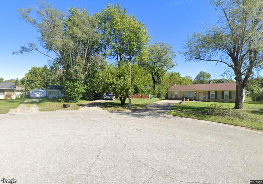
751 Maple Ln Mooresville, IN 46158
Estimated Value: $203,000 - $231,000
2
Beds
1
Bath
1,225
Sq Ft
$176/Sq Ft
Est. Value
About This Home
This home is located at 751 Maple Ln, Mooresville, IN 46158 and is currently estimated at $215,935, approximately $176 per square foot. 751 Maple Ln is a home located in Morgan County with nearby schools including Mooresville High School and Mooresville Christian Academy.
Ownership History
Date
Name
Owned For
Owner Type
Purchase Details
Closed on
Apr 1, 2020
Sold by
Nealand Co Llc
Bought by
Nealand Co Llc
Current Estimated Value
Home Financials for this Owner
Home Financials are based on the most recent Mortgage that was taken out on this home.
Original Mortgage
$540,458
Outstanding Balance
$93,253
Interest Rate
3.4%
Mortgage Type
Future Advance Clause Open End Mortgage
Estimated Equity
$122,682
Purchase Details
Closed on
Oct 21, 2016
Sold by
Mcnalley Neal
Bought by
Nealand Co Llc
Purchase Details
Closed on
Dec 12, 2014
Sold by
The Bank Of New York Mellon
Bought by
Mcnalley Neal
Purchase Details
Closed on
Oct 20, 2014
Sold by
Smith Jeri M and Smith Jeri Melisa
Bought by
The Bank Of New York Mellon
Create a Home Valuation Report for This Property
The Home Valuation Report is an in-depth analysis detailing your home's value as well as a comparison with similar homes in the area
Home Values in the Area
Average Home Value in this Area
Purchase History
| Date | Buyer | Sale Price | Title Company |
|---|---|---|---|
| Nealand Co Llc | -- | Chicago Title Company Llc | |
| Nealand Co Llc | -- | None Available | |
| Mcnalley Neal | -- | None Available | |
| The Bank Of New York Mellon | $93,324 | None Available |
Source: Public Records
Mortgage History
| Date | Status | Borrower | Loan Amount |
|---|---|---|---|
| Open | Nealand Co Llc | $540,458 |
Source: Public Records
Tax History
| Year | Tax Paid | Tax Assessment Tax Assessment Total Assessment is a certain percentage of the fair market value that is determined by local assessors to be the total taxable value of land and additions on the property. | Land | Improvement |
|---|---|---|---|---|
| 2025 | $2,130 | $158,900 | $46,900 | $112,000 |
| 2024 | $2,130 | $152,500 | $46,900 | $105,600 |
| 2023 | $2,212 | $152,500 | $46,900 | $105,600 |
| 2022 | $1,834 | $134,800 | $46,900 | $87,900 |
| 2021 | $1,391 | $104,700 | $19,300 | $85,400 |
| 2020 | $1,377 | $102,600 | $17,200 | $85,400 |
| 2019 | $1,184 | $89,000 | $17,200 | $71,800 |
| 2018 | $1,099 | $83,100 | $17,200 | $65,900 |
| 2017 | $1,078 | $81,900 | $17,200 | $64,700 |
| 2016 | $850 | $63,200 | $17,200 | $46,000 |
| 2014 | $809 | $64,500 | $17,200 | $47,300 |
| 2013 | $809 | $64,500 | $17,200 | $47,300 |
Source: Public Records
Map
Nearby Homes
- 91 North Dr
- 671 Maple Ln
- 31 Maryvale Ct
- 205 Locust Ln
- 649 Nelson Dr
- 617 Nelson Dr
- 31 Fairlane Dr
- 306 Bishop St
- 1056 Delwood Dr
- 0 E Hadley Rd Unit MBR21956464
- 0 E Hendricks County Line Road Lot 2 Unit MBR22075477
- 154 E Washington St
- 109 E Washington St
- 124 S Indiana St
- 125 W Harrison St
- 10 Commerce Dr
- 54 W High St
- 7897 Hickory Ridge Ln
- 320 Lockerbie St
- 0 N S R 67 Unit 21524902
Your Personal Tour Guide
Ask me questions while you tour the home.