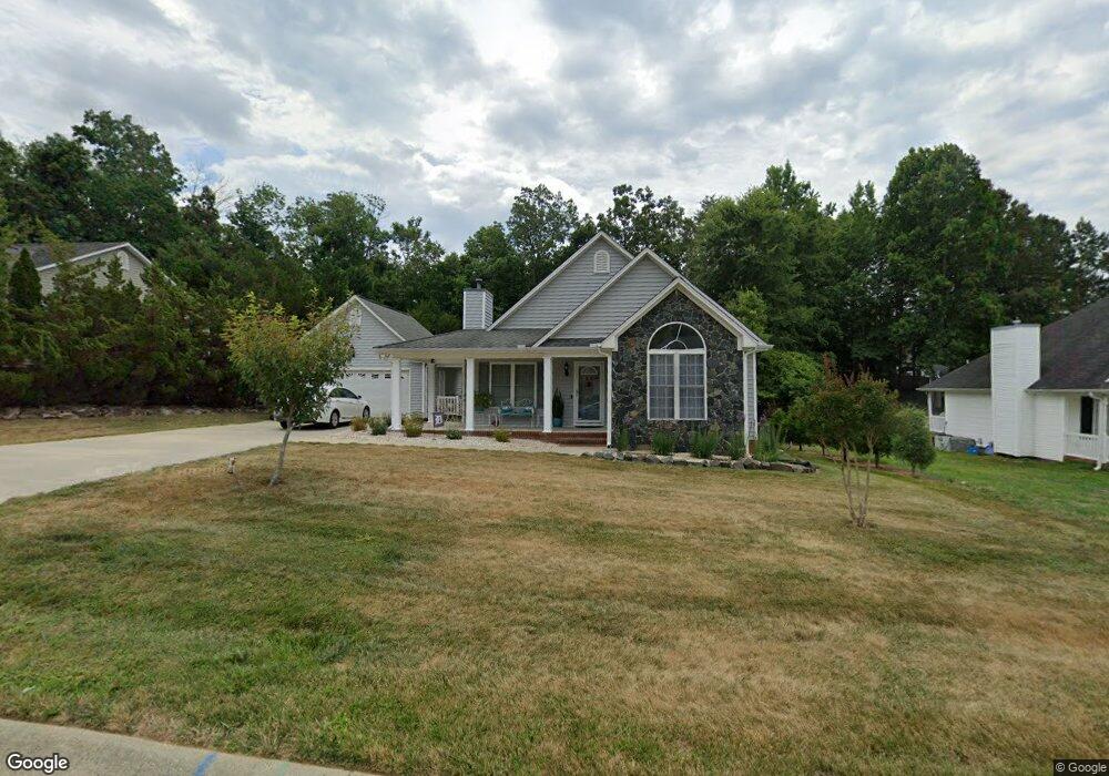
752 Trail's End Dr Graham, NC 27253
Estimated Value: $275,000 - $292,000
About This Home
This home is located at 752 Trail's End Dr, Graham, NC 27253 and is currently estimated at $286,980, approximately $227 per square foot. 752 Trail's End Dr is a home located in Alamance County with nearby schools including South Graham Elementary School, Southern Alamance Middle School, and Southern Alamance High School.
Ownership History
We collect this data history from publicly available records. To have your information removed, we recommend requesting removal directly through your county’s website.
Purchase Details
Home Financials for this Owner
Home Financials are based on the most recent Mortgage that was taken out on this home.Purchase Details
Home Financials for this Owner
Home Financials are based on the most recent Mortgage that was taken out on this home.Purchase Details
Purchase Details
Home Financials for this Owner
Home Financials are based on the most recent Mortgage that was taken out on this home.Home Values in the Area
Average Home Value in this Area
Purchase History
We collect this data history from publicly available records. To have your information removed, we recommend requesting removal directly through your county’s website.
| Date | Buyer | Sale Price | Title Company |
|---|---|---|---|
| $200,000 | None Listed On Document | ||
| $140,000 | None Available | ||
| $107,950 | -- | ||
| $143,500 | -- |
Mortgage History
We collect this data history from publicly available records. To have your information removed, we recommend requesting removal directly through your county’s website.
| Date | Status | Borrower | Loan Amount |
|---|---|---|---|
| Open | $137,464 | ||
| Previous Owner | $137,464 | ||
| Previous Owner | $139,100 |
Tax History
We collect this data history from publicly available records. To have your information removed, we recommend requesting removal directly through your county’s website.
| Year | Tax Paid | Tax Assessment Tax Assessment Total Assessment is a certain percentage of the fair market value that is determined by local assessors to be the total taxable value of land and additions on the property. | Land | Improvement |
|---|---|---|---|---|
| 2025 | $1,370 | $277,257 | $36,000 | $241,257 |
| 2024 | $1,300 | $277,257 | $36,000 | $241,257 |
| 2023 | $1,198 | $277,257 | $36,000 | $241,257 |
| 2022 | $1,571 | $142,560 | $25,000 | $117,560 |
| 2021 | $1,585 | $142,560 | $25,000 | $117,560 |
| 2020 | $1,599 | $142,560 | $25,000 | $117,560 |
| 2019 | $1,604 | $142,560 | $25,000 | $117,560 |
| 2018 | $0 | $142,560 | $25,000 | $117,560 |
| 2017 | $1,476 | $142,560 | $25,000 | $117,560 |
| 2016 | $1,545 | $149,240 | $25,000 | $124,240 |
| 2015 | $861 | $149,240 | $25,000 | $124,240 |
| 2014 | -- | $149,240 | $25,000 | $124,240 |
Map
- 648 Williamsdale Rd
- 728 Aspenwood Dr
- 312 Loon Ct
- 0 Rogers Rd Unit 10122339
- 540 Alamanni Ct
- 518 Wildwood Ln
- 538 Rockwood Dr
- 512 Monroe Holt Rd
- 1911 Meadow Green Dr
- 816 Council Ridge Rd Unit 15
- 816 Council Ridge Rd
- 810 Council Ridge Rd
- 1926 Darrell Dr Unit Lot 13
- 1926 Darrell Dr
- 804 Council Ridge Rd Unit 17
- 804 Council Ridge Rd
- 1923 Darrell Dr Unit 6
- 1923 Darrell Dr
- 1917 Darrell Dr Unit 5
- 1917 Darrell Dr
- 600 Thompson Rd
- 600 Thompson Rd Lot87
- 604 Thompson Rd
- 604 Thompson Rd
- 822 Annistons Ct
- 822 Anniston's Ct
- 608 Thompson Rd
- 825 Anniston's Ct
- 612 Thompson Rd
- 756 Trails End Dr
- 0 Anniston's Ct
- 817 Annistons Ct
- 733 Williamsdale Rd
- 825 Annistons Ct
- 817 Anniston's Ct
- 821 Annistons Ct
- 752 Trails End Dr
- 729 Williamsdale Rd
- 748 Trails End Dr
- 807 Trails End Dr
Ask me questions while you tour the home.