Estimated Value: $139,394 - $219,000
3
Beds
2
Baths
1,220
Sq Ft
$149/Sq Ft
Est. Value
About This Home
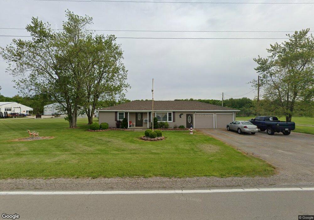
This home is located at 7583 State Route 613, Payne, OH 45880 and is currently estimated at $181,849, approximately $149 per square foot. 7583 State Route 613 is a home located in Paulding County with nearby schools including Wayne Trace High School and Divine Mercy School.
Ownership History
Date
Name
Owned For
Owner Type
Purchase Details
Closed on
Jul 16, 2003
Sold by
Crow William A
Bought by
Branham Ricky Lee
Current Estimated Value
Purchase Details
Closed on
Apr 25, 2001
Bought by
Branham Ricky Lee
Purchase Details
Closed on
Mar 26, 2001
Sold by
Dotson Katrina J
Bought by
Branham Ricky Lee
Purchase Details
Closed on
Apr 22, 1994
Bought by
Branham Ricky Lee
Create a Home Valuation Report for This Property
The Home Valuation Report is an in-depth analysis detailing your home's value as well as a comparison with similar homes in the area
Purchase History
| Date | Buyer | Sale Price | Title Company |
|---|---|---|---|
| Branham Ricky Lee | $37,000 | -- | |
| Branham Ricky Lee | $58,300 | -- | |
| Branham Ricky Lee | $54,900 | -- | |
| Branham Ricky Lee | $45,500 | -- |
Source: Public Records
Tax History
| Year | Tax Paid | Tax Assessment Tax Assessment Total Assessment is a certain percentage of the fair market value that is determined by local assessors to be the total taxable value of land and additions on the property. | Land | Improvement |
|---|---|---|---|---|
| 2025 | $1,330 | $42,670 | $7,460 | $35,210 |
| 2024 | $1,330 | $32,830 | $5,740 | $27,090 |
| 2023 | $1,064 | $32,830 | $5,740 | $27,090 |
| 2022 | $1,058 | $32,830 | $5,740 | $27,090 |
| 2021 | $993 | $23,800 | $5,740 | $18,060 |
| 2020 | $880 | $23,800 | $5,740 | $18,060 |
| 2019 | $884 | $22,160 | $5,740 | $16,420 |
| 2018 | $754 | $22,160 | $5,740 | $16,420 |
| 2017 | $755 | $22,160 | $5,740 | $16,420 |
| 2016 | $754 | $22,160 | $5,740 | $16,420 |
| 2015 | $653 | $19,570 | $3,470 | $16,100 |
| 2014 | $662 | $19,570 | $3,470 | $16,100 |
| 2013 | $731 | $19,570 | $3,470 | $16,100 |
Source: Public Records
Map
Nearby Homes
- 7535 State Route 613
- 7535 State Route
- 7633 State Route 613
- 7511 State Route 613
- 7511 State Route 613 Unit 613
- 7511 Sr 613
- 7658 State Route 613
- 7694 State Route 613
- 7684 State Route 613
- 7387 State Route 613
- 7288 Sr 500
- 7288 Sr 500
- 7202 State Route 613
- 7368 State Route 500
- 7480 State Route 500
- 7452 State Route 500
- 7574 State Route 500
- 7334 State Route 500
- 7425 State Route 500
- 7288 State Route 500
Your Personal Tour Guide
Ask me questions while you tour the home.