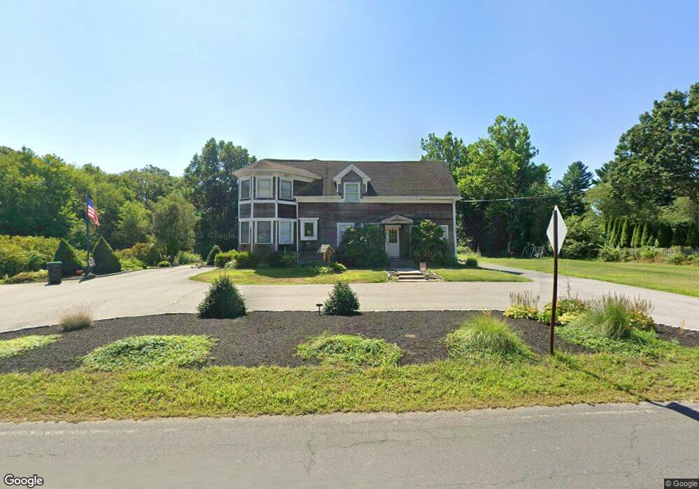
76 Barrows St Norton, MA 02766
Estimated Value: $620,076 - $726,000
4
Beds
3
Baths
2,256
Sq Ft
$299/Sq Ft
Est. Value
About This Home
This home is located at 76 Barrows St, Norton, MA 02766 and is currently estimated at $674,269, approximately $298 per square foot. 76 Barrows St is a home located in Bristol County with nearby schools including J.C. Solmonese Elementary School, Henri A. Yelle Elementary School, and Norton Middle School.
Ownership History
Date
Name
Owned For
Owner Type
Purchase Details
Closed on
Jul 9, 1998
Sold by
W & G Todd Norton Rt
Bought by
Welch William R and Welch Karen J
Current Estimated Value
Purchase Details
Closed on
Mar 30, 1994
Sold by
Brennan Paul M and First Natl Bk Of Bostn
Bought by
14 School St Corp
Purchase Details
Closed on
Feb 25, 1994
Sold by
Brennan Paul M and Frst Natl Bk Of Boston
Bought by
Dlk Rt
Create a Home Valuation Report for This Property
The Home Valuation Report is an in-depth analysis detailing your home's value as well as a comparison with similar homes in the area
Home Values in the Area
Average Home Value in this Area
Purchase History
| Date | Buyer | Sale Price | Title Company |
|---|---|---|---|
| Welch William R | $70,000 | -- | |
| 14 School St Corp | $64,000 | -- | |
| Dlk Rt | $60,000 | -- |
Source: Public Records
Mortgage History
| Date | Status | Borrower | Loan Amount |
|---|---|---|---|
| Open | Dlk Rt | $332,656 | |
| Closed | Dlk Rt | $332,976 |
Source: Public Records
Tax History
| Year | Tax Paid | Tax Assessment Tax Assessment Total Assessment is a certain percentage of the fair market value that is determined by local assessors to be the total taxable value of land and additions on the property. | Land | Improvement |
|---|---|---|---|---|
| 2025 | $67 | $514,900 | $187,100 | $327,800 |
| 2024 | $6,353 | $490,600 | $178,200 | $312,400 |
| 2023 | $6,017 | $463,200 | $168,100 | $295,100 |
| 2022 | $5,821 | $408,200 | $152,800 | $255,400 |
| 2021 | $0 | $368,800 | $145,500 | $223,300 |
| 2020 | $5,303 | $358,300 | $141,300 | $217,000 |
| 2019 | $5,139 | $344,900 | $135,900 | $209,000 |
| 2018 | $5,390 | $328,300 | $135,900 | $192,400 |
| 2017 | $4,831 | $314,300 | $135,900 | $178,400 |
| 2016 | $4,666 | $298,900 | $135,900 | $163,000 |
| 2015 | $4,498 | $292,300 | $133,200 | $159,100 |
| 2014 | $4,287 | $278,900 | $126,900 | $152,000 |
Source: Public Records
Map
Nearby Homes
- 26 Barrows Ct
- 178 S Worcester St
- 170 S Worcester St Unit 3
- 1 Heritage Rd Unit 1
- 3 Heritage Rd Unit 3
- 286 S Worcester St
- 83 W Main St
- 20 Freeman St
- 108 S Worcester St
- 8 Country Cir
- 2 Edgewater Dr Unit 2
- 125 John Scott Blvd
- 127 John Scott Blvd
- 6 Robin Cir Unit 1
- 20 Lloyd Cir Unit 32
- 14 Lloyd Cir Unit 29
- 60 S Worcester St
- 53 Sturdy St
- 55 Sturdy St
- 29 Germain Way Unit 3
Your Personal Tour Guide
Ask me questions while you tour the home.