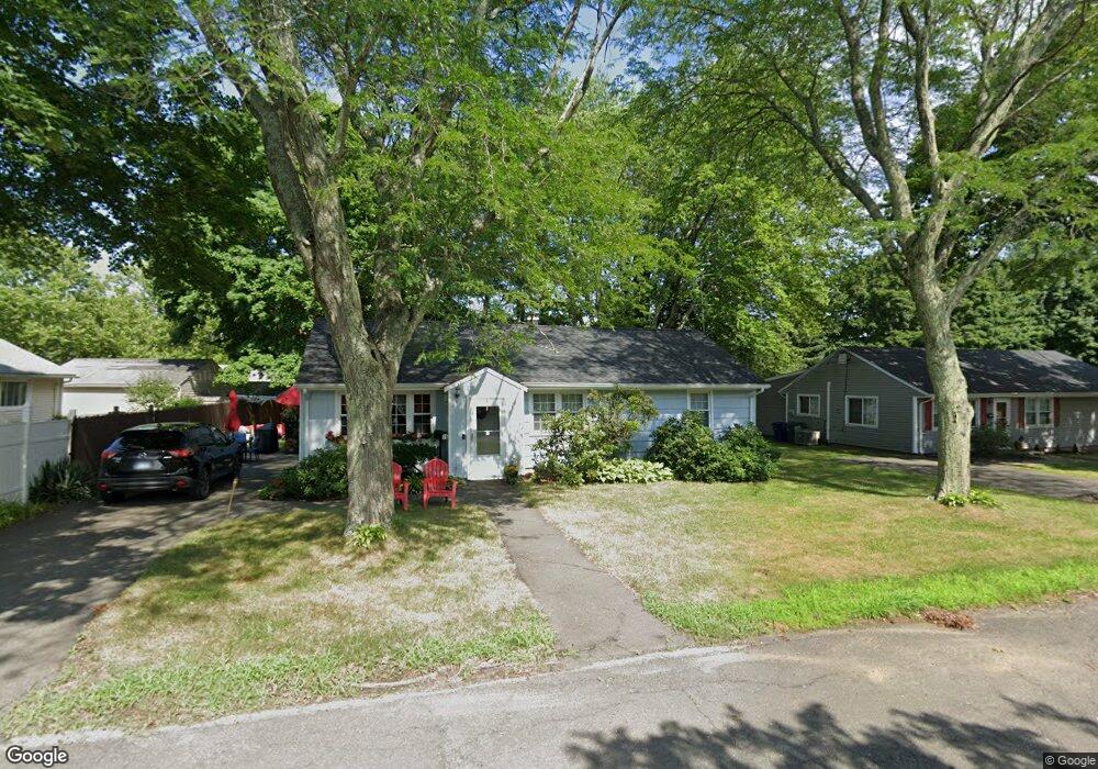
76 Daniel Dr Bridgeport, CT 06606
North End NeighborhoodEstimated Value: $427,000 - $475,000
3
Beds
2
Baths
1,572
Sq Ft
$286/Sq Ft
Est. Value
About This Home
This home is located at 76 Daniel Dr, Bridgeport, CT 06606 and is currently estimated at $449,203, approximately $285 per square foot. 76 Daniel Dr is a home located in Fairfield County with nearby schools including John Winthrop School, Central High School, and St Andrew School.
Ownership History
Date
Name
Owned For
Owner Type
Purchase Details
Closed on
Nov 30, 1999
Sold by
Finkelstein Seth D
Bought by
Sherrod Ricky P and Sherrod Cassandra
Current Estimated Value
Home Financials for this Owner
Home Financials are based on the most recent Mortgage that was taken out on this home.
Original Mortgage
$124,000
Interest Rate
7.77%
Purchase Details
Closed on
Mar 18, 1996
Sold by
Marks David M and Marks Phyllis J
Bought by
Finkelstein Seth D and Finkelstein William S
Create a Home Valuation Report for This Property
The Home Valuation Report is an in-depth analysis detailing your home's value as well as a comparison with similar homes in the area
Home Values in the Area
Average Home Value in this Area
Purchase History
We collect this data history from publicly available records. To have your information removed, we recommend requesting removal directly through your county’s website.
| Date | Buyer | Sale Price | Title Company |
|---|---|---|---|
| Sherrod Ricky P | $134,000 | -- | |
| Sherrod Ricky P | $134,000 | -- | |
| Finkelstein Seth D | $115,500 | -- | |
| Finkelstein Seth D | $115,500 | -- |
Source: Public Records
Mortgage History
We collect this data history from publicly available records. To have your information removed, we recommend requesting removal directly through your county’s website.
| Date | Status | Borrower | Loan Amount |
|---|---|---|---|
| Open | Finkelstein Seth D | $240,000 | |
| Closed | Finkelstein Seth D | $154,000 | |
| Closed | Finkelstein Seth D | $124,000 |
Source: Public Records
Tax History
| Year | Tax Paid | Tax Assessment Tax Assessment Total Assessment is a certain percentage of the fair market value that is determined by local assessors to be the total taxable value of land and additions on the property. | Land | Improvement |
|---|---|---|---|---|
| 2025 | $6,368 | $146,560 | $78,530 | $68,030 |
| 2024 | $6,368 | $146,560 | $78,530 | $68,030 |
| 2023 | $6,368 | $146,560 | $78,530 | $68,030 |
| 2022 | $6,368 | $146,560 | $78,530 | $68,030 |
| 2021 | $6,368 | $146,560 | $78,530 | $68,030 |
| 2020 | $6,497 | $120,330 | $61,520 | $58,810 |
| 2019 | $6,497 | $120,330 | $61,520 | $58,810 |
| 2018 | $6,542 | $120,330 | $61,520 | $58,810 |
| 2017 | $6,542 | $120,330 | $61,520 | $58,810 |
| 2016 | $6,542 | $120,330 | $61,520 | $58,810 |
| 2015 | $5,926 | $140,420 | $60,560 | $79,860 |
| 2014 | $5,926 | $140,420 | $60,560 | $79,860 |
Source: Public Records
Map
Nearby Homes
- 170 Marilyn Dr
- 63 Richfield Rd
- 69 Seaver Cir
- 3850 Old Town Rd
- 4161 Madison Ave
- 4 Walnut Ave
- 217 Macon Dr
- 18 Ridgebury Dr
- 11 Marcy Rd
- 252 Bear Paw Rd
- 12 Chatfield Dr
- 3370 Madison Ave Unit 10B
- 5633 Park Ave
- 26 Maple St
- 7 Merrill Rd
- 18 Maple St
- 105 Bear Paw Rd
- 472 Anton St
- 5763 Park Ave
- 50 Greenhouse Rd Unit 26B
- 173 Jourmire Rd
- 60 Daniel Dr
- 255 Marilyn Dr
- 153 Jourmire Rd
- 46 Daniel Dr
- 75 Daniel Dr
- 235 Marilyn Dr
- 59 Daniel Dr
- 89 Daniel Dr
- 101 Daniel Dr Unit 91
- 115 Daniel Dr Unit 95
- 164 Jourmire Rd
- 45 Daniel Dr
- 30 Daniel Dr
- 120 Daniel Dr
- 150 Jourmire Rd
- 306 Folino Dr
- 326 Folino Dr
- 134 Jourmire Rd
- 119 Jourmire Rd
Your Personal Tour Guide
Ask me questions while you tour the home.