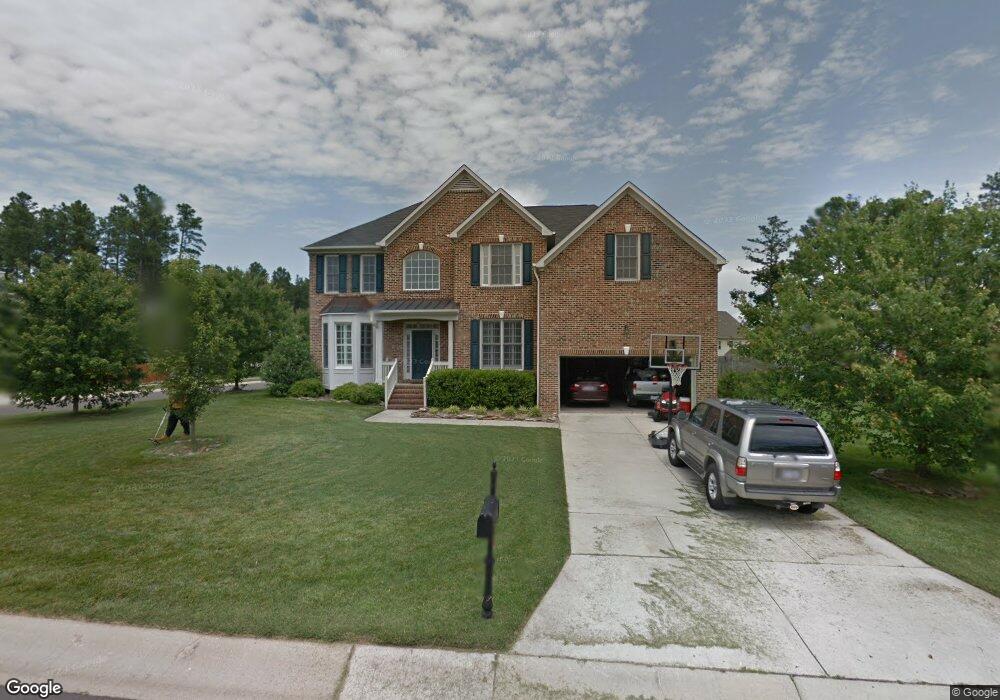
7601 Leapale Ln Durham, NC 27713
South Durham NeighborhoodEstimated Value: $700,000 - $772,000
About This Home
This home is located at 7601 Leapale Ln, Durham, NC 27713 and is currently estimated at $733,431, approximately $225 per square foot. 7601 Leapale Ln is a home located in Durham County with nearby schools including Lyons Farm Elementary, Lowe's Grove Middle, and Hillside High School.
Ownership History
We collect this data history from publicly available records. To have your information removed, we recommend requesting removal directly through your county’s website.
Purchase Details
Home Financials for this Owner
Home Financials are based on the most recent Mortgage that was taken out on this home.Home Values in the Area
Average Home Value in this Area
Purchase History
We collect this data history from publicly available records. To have your information removed, we recommend requesting removal directly through your county’s website.
| Date | Buyer | Sale Price | Title Company |
|---|---|---|---|
| $280,000 | -- |
Mortgage History
We collect this data history from publicly available records. To have your information removed, we recommend requesting removal directly through your county’s website.
| Date | Status | Borrower | Loan Amount |
|---|---|---|---|
| Open | $217,600 | ||
| Closed | $229,500 | ||
| Closed | $251,756 |
Tax History
We collect this data history from publicly available records. To have your information removed, we recommend requesting removal directly through your county’s website.
| Year | Tax Paid | Tax Assessment Tax Assessment Total Assessment is a certain percentage of the fair market value that is determined by local assessors to be the total taxable value of land and additions on the property. | Land | Improvement |
|---|---|---|---|---|
| 2025 | $6,436 | $649,218 | $153,925 | $495,293 |
| 2024 | $5,200 | $372,791 | $71,885 | $300,906 |
| 2023 | $4,883 | $372,791 | $71,885 | $300,906 |
| 2022 | $4,771 | $372,791 | $71,885 | $300,906 |
| 2021 | $4,749 | $372,791 | $71,885 | $300,906 |
| 2020 | $4,637 | $372,791 | $71,885 | $300,906 |
| 2019 | $4,637 | $372,791 | $71,885 | $300,906 |
| 2018 | $4,696 | $346,173 | $58,815 | $287,358 |
| 2017 | $4,661 | $346,173 | $58,815 | $287,358 |
| 2016 | $4,504 | $346,173 | $58,815 | $287,358 |
| 2015 | $4,893 | $353,458 | $61,235 | $292,223 |
| 2014 | $4,893 | $353,458 | $61,235 | $292,223 |
Map
- 707 Martry Rd
- 7409 Chesley Ln
- 714 Adeline Ct
- 507 Stinhurst Dr
- 7 Monteith Ct
- 218 Landreth Ct
- 102 Settlers Mill Ln
- 4916 Wineberry Dr
- 84 Candytuff Ln
- 605 Swift Creek Crossing
- 1013 Pondfield Way
- 114 Wenonah Way
- 4517 Grandale Dr
- 106 Silver Pine Ct
- 6353 Grandale Dr
- 5320 Mccormick Rd
- 124 Wicklow Ln
- 8029 Rosemont Pkwy
- 5 Bobcat Ct
- 7 Bobcat Ct
- 7603 Leapale Ln
- 615 Cheselden Dr
- 7509 Leapale Ln
- 703 Cheselden Dr
- 7605 Leapale Ln
- 7505 Leapale Ln
- 609 Cheselden Dr
- 704 Cheselden Dr
- 7604 Leapale Ln
- 7606 Leapale Ln
- 614 Cheselden Dr
- 204 Bennington Pkwy
- 705 Cheselden Dr
- 206 Bennington Pkwy
- 7503 Leapale Ln
- 603 Cheselden Dr
- 612 Cheselden Dr
- 208 Bennington Pkwy
- 7510 Leapale Ln
- 708 Cheselden Dr
Ask me questions while you tour the home.