Estimated Value: $392,000 - $432,000
3
Beds
2
Baths
2,680
Sq Ft
$155/Sq Ft
Est. Value
About This Home
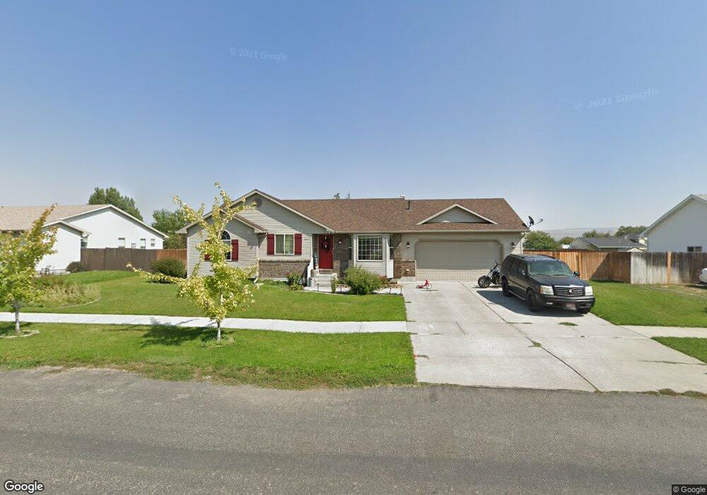
This home is located at 761 Ensign Dr, Ammon, ID 83406 and is currently estimated at $416,389, approximately $155 per square foot. 761 Ensign Dr is a home located in Bonneville County with nearby schools including Hillview Elementary School, Sandcreek Middle School, and Hillcrest High School.
Ownership History
Date
Name
Owned For
Owner Type
Purchase Details
Closed on
Feb 7, 2005
Sold by
Greathead Simon and Greathead Brooke
Bought by
Mchan David and Mchan Kanlayani
Current Estimated Value
Home Financials for this Owner
Home Financials are based on the most recent Mortgage that was taken out on this home.
Original Mortgage
$158,230
Outstanding Balance
$80,743
Interest Rate
5.81%
Mortgage Type
VA
Estimated Equity
$335,646
Create a Home Valuation Report for This Property
The Home Valuation Report is an in-depth analysis detailing your home's value as well as a comparison with similar homes in the area
Purchase History
We collect this data history from publicly available records. To have your information removed, we recommend requesting removal directly through your county’s website.
| Date | Buyer | Sale Price | Title Company |
|---|---|---|---|
| Mchan David | -- | First American Title Company |
Source: Public Records
Mortgage History
We collect this data history from publicly available records. To have your information removed, we recommend requesting removal directly through your county’s website.
| Date | Status | Borrower | Loan Amount |
|---|---|---|---|
| Open | Mchan David | $158,230 |
Source: Public Records
Tax History
| Year | Tax Paid | Tax Assessment Tax Assessment Total Assessment is a certain percentage of the fair market value that is determined by local assessors to be the total taxable value of land and additions on the property. | Land | Improvement |
|---|---|---|---|---|
| 2025 | $2,891 | $490,788 | $87,919 | $402,869 |
| 2024 | $2,926 | $0 | $0 | $0 |
| 2023 | $2,716 | $404,480 | $90,180 | $314,300 |
| 2022 | $2,778 | $354,841 | $60,851 | $293,990 |
| 2021 | $2,780 | $268,760 | $55,350 | $213,410 |
| 2019 | $3,055 | $229,586 | $45,056 | $184,530 |
| 2018 | $2,654 | $224,244 | $39,184 | $185,060 |
| 2017 | $2,453 | $189,054 | $25,414 | $163,640 |
| 2016 | $2,394 | $175,091 | $23,051 | $152,040 |
| 2015 | $2,076 | $150,101 | $23,051 | $127,050 |
| 2014 | $32,365 | $150,101 | $23,051 | $127,050 |
| 2013 | $2,037 | $149,881 | $23,051 | $126,830 |
Source: Public Records
Map
Nearby Homes
- 1186 Cobie Ln
- 3930 John Adams Pkwy
- 4016 Journee Cir
- 4094 Mathews Dr
- 4566 E Botanical Dr
- 141 Robison Dr
- 171 Robison Dr
- 3823 E Summerridge Cir
- 3736 Ellendale Cir
- 820 S Adam Ln
- 169 S Heath Ln
- 4020 Gateway Cir
- 3729 Heartland Cir
- 225 Monte Vista Ave
- 352 Kimberly Dr
- 3714 Heartland Cir
- 3845 Ridgeview Cir
- 3698 Heartland Cir
- 369 S Adam Ln
- 4439 E Ladino Dr
- 731 Ensign Dr
- 791 Ensign Dr
- 760 Ensign Dr
- 732 Ensign Dr
- 790 Ensign Dr
- 701 Ensign Dr
- 705 Ensign Dr
- 704 Ensign Dr
- 704 Ensign Dr
- 732 S Wheatfield Ln
- 822 Ensign Dr
- 827 Ensign Dr
- 733 Barnwood Dr
- 700 S Wheatfield Ln
- 822 S Wheatfield Ln
- 667 Ensign Dr
- 760 S Wheatfield Ln
- 792 S Wheatfield Ln
- 761 Barnwood Dr
- 670 Ensign Dr
Your Personal Tour Guide
Ask me questions while you tour the home.