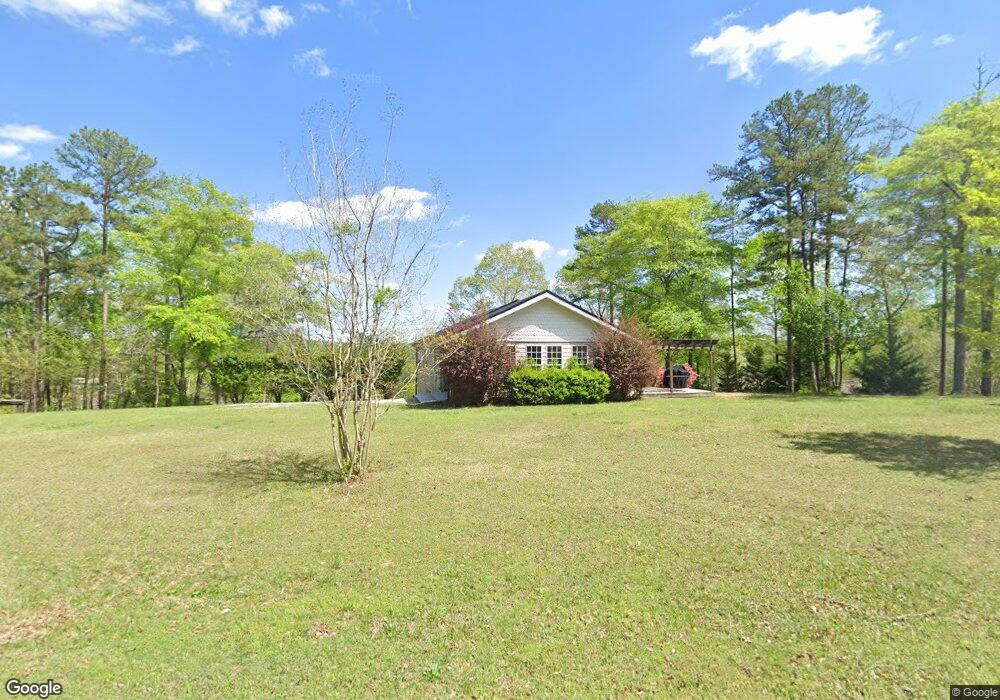
763 Wright Way Dr Wedowee, AL 36278
Estimated Value: $344,000 - $562,000
3
Beds
2
Baths
2,842
Sq Ft
$156/Sq Ft
Est. Value
About This Home
This home is located at 763 Wright Way Dr, Wedowee, AL 36278 and is currently estimated at $443,242, approximately $155 per square foot. 763 Wright Way Dr is a home located in Randolph County.
Ownership History
Date
Name
Owned For
Owner Type
Purchase Details
Closed on
Jan 14, 2021
Sold by
Bruce Allen Ii Michael
Bought by
Allen Vivian Mitchell
Current Estimated Value
Purchase Details
Closed on
Apr 25, 2016
Sold by
Harris Adam
Bought by
Allen Michael Bruce
Home Financials for this Owner
Home Financials are based on the most recent Mortgage that was taken out on this home.
Original Mortgage
$196,411
Interest Rate
3.71%
Mortgage Type
Purchase Money Mortgage
Purchase Details
Closed on
Aug 29, 2006
Sold by
Alabama Timber Frame Inc
Bought by
Shaddix Pulpwood Comp Inc
Create a Home Valuation Report for This Property
The Home Valuation Report is an in-depth analysis detailing your home's value as well as a comparison with similar homes in the area
Purchase History
| Date | Buyer | Sale Price | Title Company |
|---|---|---|---|
| Allen Vivian Mitchell | -- | None Listed On Document | |
| Allen Michael Bruce | $175,000 | -- | |
| Shaddix Pulpwood Comp Inc | -- | -- |
Source: Public Records
Mortgage History
| Date | Status | Borrower | Loan Amount |
|---|---|---|---|
| Previous Owner | Allen Michael Bruce | $196,411 |
Source: Public Records
Tax History
| Year | Tax Paid | Tax Assessment Tax Assessment Total Assessment is a certain percentage of the fair market value that is determined by local assessors to be the total taxable value of land and additions on the property. | Land | Improvement |
|---|---|---|---|---|
| 2024 | $1,089 | $34,040 | $15,000 | $19,040 |
| 2023 | $1,089 | $31,560 | $16,500 | $15,060 |
| 2022 | $970 | $31,560 | $16,500 | $15,060 |
| 2021 | $970 | $31,560 | $16,500 | $15,060 |
| 2020 | $1,010 | $31,560 | $16,500 | $15,060 |
| 2018 | $949 | $29,660 | $15,000 | $14,660 |
| 2017 | $1,922 | $60,060 | $30,000 | $30,060 |
| 2016 | $1,853 | $57,920 | $30,000 | $27,920 |
| 2015 | $1,875 | $292,904 | $0 | $0 |
| 2014 | -- | $292,904 | $0 | $0 |
| 2013 | $1,875 | $292,904 | $0 | $0 |
Source: Public Records
Map
Nearby Homes
- 967 Wright Way Dr
- 358 Muffet Dr
- 487 Poplar Place
- 0 Muffet Dr Unit 21446807
- 0 Muffet Dr Unit 10722831
- LOT 94 Wright Way Dr
- lot 12 Wright Way Dr
- Lot 78 Wright Way Dr
- Lot 11 Wright Way Dr
- Lot 9 Peninsula Dr
- Lot 34 Peninsula Dr
- 0 Peninsula Dr Unit 21442085
- 111 Warren Dr
- 293 Misty Ln
- 343 Pleasure Point Rd
- 0 Lakeview Dr Unit 21445724
- 0 Lakeview Dr Unit 21445726
- 0 Lakeview Dr Unit 21445728
- 0 Lakeview Dr Unit 21445725
- 0 Lakeview Dr Unit 21445727
- 488 Wright Way Dr
- 787 Wright Way Dr
- 885 Wright Way Dr
- Lot 64 Inez Dr Unit 64
- 909 Wright Way Dr
- 22 Inez Dr
- 0 Wrightway Dr Unit 8011777
- 0 Wrightway Dr Unit 8205435
- Lot 22 Peninsula Dr
- Lot 22 Peninsula Dr Unit 22
- 919 Wright Way Dr
- 676 Peninsula Dr
- 65 Katie Dr
- 629 Peninsula Dr
- 94 Inez Dr Unit 64
- 0 Katie Dr Unit 24-1132
- 0 Katie Dr Unit 1 21390623
- 0 Katie Dr Unit 15 21381570
- 0 Katie Dr Unit LOT 6 AND 7 10236945
- 0 Katie Dr Unit 7314710
Your Personal Tour Guide
Ask me questions while you tour the home.