
Seller's Agent in 2023
Norris Bishop
Norris Bishop Realty, LLC
(229) 589-1044
451 Total Sales

Estimated Value: $218,000 - $265,958
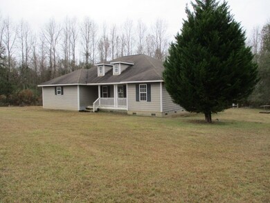
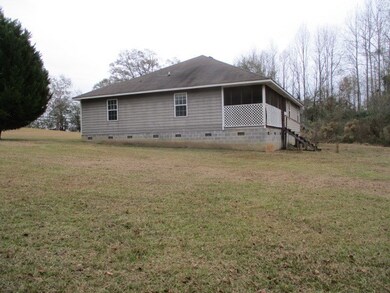
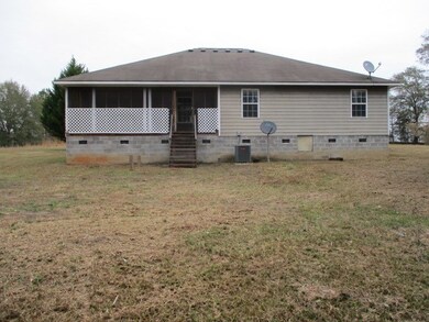
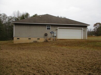
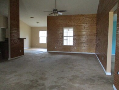
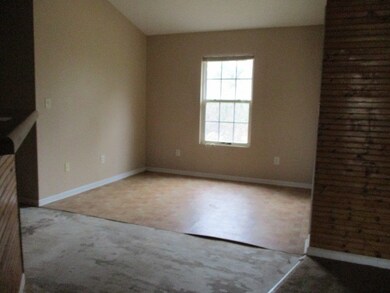
Affordable 3 bed/2 bath home with 7 acres! Kitchen with bar and dining area. Primary bedroom with en-suite bath featuring double vanities, separate shower, and tub. Double garage and rear screened porch. Equal Housing Opportunity. Sold “as is”. For FHA 203B financing purposes, property considered Uninsured. Case # 106-045781
Last Agent to Sell the Property
Norris Bishop Realty, LLC Brokerage Phone: 2298901186 License #263490 Listed on: 01/12/2023
Last Buyer's Agent
Non-Member Agent
Non Member Office
| Date | Buyer | Sale Price | Title Company |
|---|---|---|---|
| Rocket Mtg Llc | $147,676 | -- | |
| Tucker Eric Allen | $102,900 | -- | |
| Walter Mortgage Company Llc | -- | -- |
| Date | Event | Price | List to Sale | Price per Sq Ft |
|---|---|---|---|---|
| 02/23/2023 02/23/23 | Sold | $145,000 | -- | $93 / Sq Ft |
| 01/12/2023 01/12/23 | Pending | -- | -- | -- |
| Year | Tax Paid | Tax Assessment Tax Assessment Total Assessment is a certain percentage of the fair market value that is determined by local assessors to be the total taxable value of land and additions on the property. | Land | Improvement |
|---|---|---|---|---|
| 2025 | $2,403 | $98,297 | $13,425 | $84,872 |
| 2024 | $1,800 | $53,772 | $13,424 | $40,348 |
| 2023 | $1,800 | $53,772 | $13,424 | $40,348 |
| 2022 | $1,745 | $53,772 | $13,424 | $40,348 |
| 2021 | $1,722 | $53,772 | $13,424 | $40,348 |
| 2020 | $1,725 | $53,772 | $13,424 | $40,348 |
| 2019 | $1,725 | $53,772 | $13,424 | $40,348 |
| 2018 | $1,541 | $53,772 | $13,424 | $40,348 |
| 2017 | $1,541 | $53,772 | $13,424 | $40,348 |
| 2016 | $1,485 | $53,772 | $13,424 | $40,348 |
| 2015 | $1,487 | $53,772 | $13,424 | $40,348 |
| 2014 | $1,487 | $53,772 | $13,424 | $40,348 |
| 2013 | -- | $54,209 | $13,861 | $40,348 |
| 2012 | -- | $54,208 | $13,860 | $40,348 |
Seller's Agent in 2023
Norris Bishop
Norris Bishop Realty, LLC
(229) 589-1044
451 Total Sales
N
Buyer's Agent in 2023
Non-Member Agent
Non Member Office
Source: Albany Board of REALTORS®
MLS Number: 152619
APN: 0077A-018-000
Ask me questions while you tour the home.