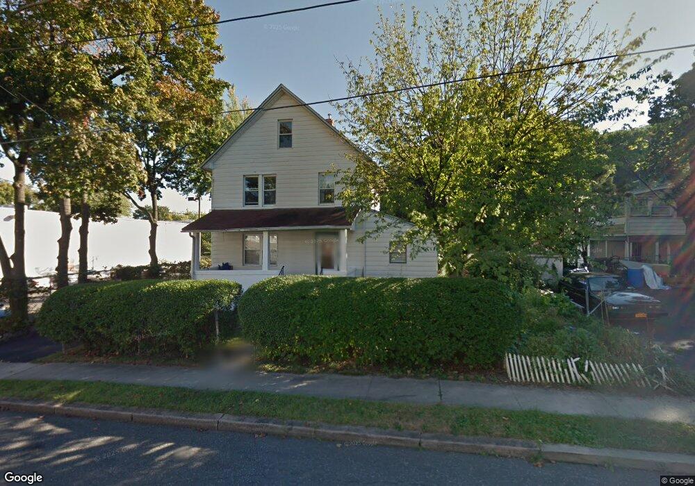
77 Brookside Ave Unit 3 Nyack, NY 10960
South Nyack NeighborhoodEstimated Value: $642,855 - $829,000
1
Bed
1
Bath
600
Sq Ft
$1,259/Sq Ft
Est. Value
About This Home
This home is located at 77 Brookside Ave Unit 3, Nyack, NY 10960 and is currently estimated at $755,214, approximately $1,258 per square foot. 77 Brookside Ave Unit 3 is a home located in Rockland County with nearby schools including Nyack Senior High School and Montessori Center Of Nyack-The River School.
Ownership History
Date
Name
Owned For
Owner Type
Purchase Details
Closed on
Jul 9, 2025
Sold by
Rosenberg Mordechi
Bought by
Sv Property Holdings Llc
Current Estimated Value
Purchase Details
Closed on
Jun 3, 2022
Sold by
Waugh Derick
Bought by
Rosenberg Mordechi
Home Financials for this Owner
Home Financials are based on the most recent Mortgage that was taken out on this home.
Original Mortgage
$397,500
Interest Rate
5.1%
Mortgage Type
New Conventional
Create a Home Valuation Report for This Property
The Home Valuation Report is an in-depth analysis detailing your home's value as well as a comparison with similar homes in the area
Home Values in the Area
Average Home Value in this Area
Purchase History
| Date | Buyer | Sale Price | Title Company |
|---|---|---|---|
| Sv Property Holdings Llc | -- | None Available | |
| Rosenberg Mordechi | $530,000 | Judicial Title | |
| Rosenberg Mordechi | $530,000 | Judicial Title |
Source: Public Records
Mortgage History
| Date | Status | Borrower | Loan Amount |
|---|---|---|---|
| Previous Owner | Rosenberg Mordechi | $397,500 |
Source: Public Records
Tax History
| Year | Tax Paid | Tax Assessment Tax Assessment Total Assessment is a certain percentage of the fair market value that is determined by local assessors to be the total taxable value of land and additions on the property. | Land | Improvement |
|---|---|---|---|---|
| 2024 | $17,335 | $194,300 | $21,300 | $173,000 |
| 2023 | $17,335 | $194,300 | $21,300 | $173,000 |
| 2022 | $14,543 | $194,300 | $21,300 | $173,000 |
| 2021 | $14,543 | $194,300 | $21,300 | $173,000 |
| 2020 | $12,441 | $194,300 | $21,300 | $173,000 |
| 2019 | $3,498 | $194,300 | $21,300 | $173,000 |
| 2018 | $9,537 | $194,300 | $21,300 | $173,000 |
| 2017 | $12,441 | $194,300 | $21,300 | $173,000 |
| 2016 | $12,441 | $194,300 | $21,300 | $173,000 |
| 2015 | -- | $194,300 | $21,300 | $173,000 |
| 2014 | -- | $194,300 | $21,300 | $173,000 |
Source: Public Records
Map
Nearby Homes
- 86 Brookside Ave
- 53 Brookside Ave
- 64 White Ave
- 3 Ross Ave
- 162 S Broadway
- 36 Prospect St
- 10 Prospect St
- 9 Voorhis Point
- 23 Clinton Ave
- 3 Remsen St
- 235 South Blvd
- 2 Shadyside Ave
- 28 Catherine St
- 1 Washington Ave
- 218 High Ave
- 6 Burd St Unit 2406
- 6 Burd St Unit 2403
- 2 Burd St Unit 3102
- 50 N Broadway Unit 17
- 60 W Catherine St
- 77 Brookside Ave
- 77 Brookside Ave Unit 1
- 77 Brookside Ave Unit 2
- 103 Cooper Dr
- 101 Cooper Dr
- 105 Cooper Dr
- 82 Brookside Ave Unit 82-84
- 82 Brookside Ave Unit 84
- 84 Brookside Ave
- 99 Cooper Dr
- 65 Brookside Ave
- 80 Brookside Ave
- 76 Brookside Ave
- 74 Brookside Ave
- 70 Brookside Ave Unit 72
- 88 Brookside Ave
- 90 Brookside Ave
- 92 Brookside Ave Unit 2
- 92 Brookside Ave Unit 1
- 92 Brookside Ave
Your Personal Tour Guide
Ask me questions while you tour the home.