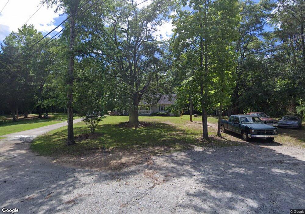
77 Hall Dr Newnan, GA 30263
Estimated Value: $256,025 - $322,000
3
Beds
2
Baths
1,596
Sq Ft
$179/Sq Ft
Est. Value
About This Home
This home is located at 77 Hall Dr, Newnan, GA 30263 and is currently estimated at $285,756, approximately $179 per square foot. 77 Hall Dr is a home located in Coweta County with nearby schools including Northside Elementary School, Evans Middle School, and Newnan High School.
Ownership History
Date
Name
Owned For
Owner Type
Purchase Details
Closed on
Sep 4, 2009
Sold by
Sutton Annie Ruth
Bought by
Sutton Annie Ruth
Current Estimated Value
Purchase Details
Closed on
Aug 19, 2003
Sold by
Sutton Robert W
Bought by
Sutton Annie R
Home Financials for this Owner
Home Financials are based on the most recent Mortgage that was taken out on this home.
Original Mortgage
$176,800
Interest Rate
6%
Mortgage Type
New Conventional
Purchase Details
Closed on
Jul 24, 1996
Bought by
Sutton Robert W
Purchase Details
Closed on
Apr 6, 1977
Bought by
Sutton Robert Est
Create a Home Valuation Report for This Property
The Home Valuation Report is an in-depth analysis detailing your home's value as well as a comparison with similar homes in the area
Purchase History
| Date | Buyer | Sale Price | Title Company |
|---|---|---|---|
| Sutton Annie Ruth | -- | -- | |
| Sutton Annie R | -- | -- | |
| Sutton Robert W | -- | -- | |
| Sutton Robert Est | -- | -- |
Source: Public Records
Mortgage History
| Date | Status | Borrower | Loan Amount |
|---|---|---|---|
| Previous Owner | Sutton Annie R | $176,800 |
Source: Public Records
Tax History
| Year | Tax Paid | Tax Assessment Tax Assessment Total Assessment is a certain percentage of the fair market value that is determined by local assessors to be the total taxable value of land and additions on the property. | Land | Improvement |
|---|---|---|---|---|
| 2025 | $547 | $74,625 | $6,970 | $67,655 |
| 2024 | $495 | $73,189 | $6,970 | $66,219 |
| 2023 | $495 | $73,242 | $9,592 | $63,650 |
| 2022 | $419 | $58,236 | $6,394 | $51,842 |
| 2021 | $372 | $50,158 | $6,090 | $44,068 |
| 2020 | $371 | $50,158 | $6,090 | $44,068 |
| 2019 | $322 | $39,835 | $6,000 | $33,835 |
| 2018 | $325 | $39,835 | $6,000 | $33,835 |
| 2017 | $324 | $39,835 | $6,000 | $33,835 |
| 2016 | $314 | $39,835 | $6,000 | $33,835 |
| 2015 | $297 | $39,835 | $6,000 | $33,835 |
| 2014 | $288 | $39,835 | $6,000 | $33,835 |
Source: Public Records
Map
Nearby Homes
- 64 Hall Dr
- 659 Country Club Rd
- 43 Warner Rd
- 38 Bedford Park Dr
- 55 Summerhill Place
- 136 Baldwin Ct
- 367 Old Atlanta Hwy Unit LOT 4
- 15 Cloverhurst Dr Unit LOT 15
- 448 The Blvd
- 17 Cloverhurst Dr Unit LOT 14
- 442 The Blvd
- 8 Hardin Ct Unit LOT 16
- 150 Longwood Ln
- 14 Nash Ln
- 3 Club Dr
- 351 The Blvd
- 157 Westminster Way
- 50 Longwood Ln
- 21 Vaux Way
- 86 Lancaster Way
- 78 Hall Dr
- 39 Hall Dr
- 52 Hall Dr
- 74 Sutton Dr
- 102 Sutton Dr
- 619 Howard Hughes Rd
- 122 Sutton Dr
- 51 Miller Rd
- 577 Howard Hughes Rd
- 595 Howard Hughes Rd
- 521 Country Club Rd
- 134 Sutton Dr
- 39 Miller Rd
- 134 Sutton Dr Unit LOT 18
- 54 Miller Rd
- 555 Howard Hughes Rd
- 89 Sutton Dr
- 101 Sutton Dr Unit 101
- 36 Miller Rd
- 105 Sutton Dr
Your Personal Tour Guide
Ask me questions while you tour the home.