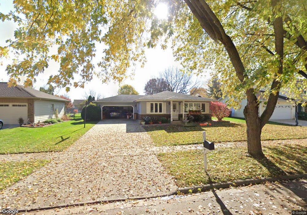
77 Lockman Cir Elgin, IL 60123
Century Oaks West NeighborhoodEstimated Value: $326,000 - $361,000
3
Beds
2
Baths
1,410
Sq Ft
$242/Sq Ft
Est. Value
About This Home
This home is located at 77 Lockman Cir, Elgin, IL 60123 and is currently estimated at $341,533, approximately $242 per square foot. 77 Lockman Cir is a home located in Kane County with nearby schools including Century Oaks Elementary School, Kimball Middle School, and Larkin High School.
Ownership History
Date
Name
Owned For
Owner Type
Purchase Details
Closed on
Nov 14, 1997
Sold by
Union National Bk&Tr Company Of Elgin
Bought by
Calderon Arturo and Calderon Elodia
Current Estimated Value
Home Financials for this Owner
Home Financials are based on the most recent Mortgage that was taken out on this home.
Original Mortgage
$76,000
Outstanding Balance
$12,638
Interest Rate
7.43%
Estimated Equity
$328,895
Create a Home Valuation Report for This Property
The Home Valuation Report is an in-depth analysis detailing your home's value as well as a comparison with similar homes in the area
Home Values in the Area
Average Home Value in this Area
Purchase History
| Date | Buyer | Sale Price | Title Company |
|---|---|---|---|
| Calderon Arturo | $94,000 | -- |
Source: Public Records
Mortgage History
| Date | Status | Borrower | Loan Amount |
|---|---|---|---|
| Open | Calderon Arturo | $76,000 |
Source: Public Records
Tax History
| Year | Tax Paid | Tax Assessment Tax Assessment Total Assessment is a certain percentage of the fair market value that is determined by local assessors to be the total taxable value of land and additions on the property. | Land | Improvement |
|---|---|---|---|---|
| 2024 | $5,936 | $90,173 | $23,605 | $66,568 |
| 2023 | $4,556 | $81,464 | $21,325 | $60,139 |
| 2022 | $5,068 | $74,281 | $19,445 | $54,836 |
| 2021 | $5,215 | $69,448 | $18,180 | $51,268 |
| 2020 | $5,499 | $66,299 | $17,356 | $48,943 |
| 2019 | $5,338 | $63,154 | $16,533 | $46,621 |
| 2018 | $5,022 | $56,794 | $15,575 | $41,219 |
| 2017 | $4,905 | $53,691 | $14,724 | $38,967 |
| 2016 | $4,673 | $49,811 | $13,660 | $36,151 |
| 2015 | -- | $45,657 | $12,521 | $33,136 |
| 2014 | -- | $45,093 | $12,366 | $32,727 |
| 2013 | -- | $46,282 | $12,692 | $33,590 |
Source: Public Records
Map
Nearby Homes
- 1583 Sheffield Dr Unit 85
- 1932 Banks Dr
- 1348 Sheffield Dr
- 14 Devonshire Cir Unit 1
- 43 Creekside Cir Unit A
- 1212 Century Oaks Dr
- 1865 Kevin Ave Unit 5
- 1009 Meadow Ln
- 2176 Jordan Ln
- 801 N Mclean Blvd Unit 320
- 801 N Mclean Blvd Unit 118
- 801 N Mclean Blvd Unit 124
- 801 N Mclean Blvd Unit 222
- 938 Hillcrest Rd
- 1419 Harlan Ave
- 36W628 Oak Hill Dr
- 36W474 Hickory Hollow Dr
- 530 Cumberland Trail
- 527 N Lyle Ave
- 1167 Florimond Dr
- 79 Lockman Cir Unit 4
- 75 Lockman Cir
- 1698 Sheffield Dr
- 81 Lockman Cir
- 73 Lockman Cir
- 1720 Sheffield Dr
- 1692 Sheffield Dr
- 1704 Sheffield Dr Unit 4
- 78 Lockman Cir Unit 4
- 1736 Sheffield Dr
- 76 Lockman Cir
- 80 Lockman Cir
- 83 Lockman Cir
- 74 Lockman Cir
- 71 Lockman Cir
- 1750 Sheffield Dr
- 82 Lockman Cir Unit 4
- Lot 129 Sheffield Dr
- 1550 Sheffield Dr
- 1686 Sheffield Dr
Your Personal Tour Guide
Ask me questions while you tour the home.