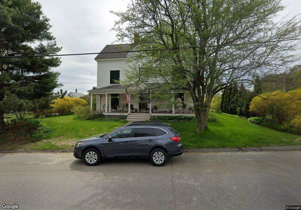
77 Pascal Ave Rockport, ME 04856
Estimated Value: $1,144,000 - $1,627,000
6
Beds
3
Baths
4,602
Sq Ft
$293/Sq Ft
Est. Value
About This Home
This home is located at 77 Pascal Ave, Rockport, ME 04856 and is currently estimated at $1,346,553, approximately $292 per square foot. 77 Pascal Ave is a home located in Knox County with nearby schools including Camden-Rockport Elementary School, Camden-Rockport Middle School, and Camden Hills Regional High School.
Ownership History
Date
Name
Owned For
Owner Type
Purchase Details
Closed on
Nov 7, 2022
Sold by
Shaw Helen A
Bought by
Helen Ann Shaw Irt
Current Estimated Value
Create a Home Valuation Report for This Property
The Home Valuation Report is an in-depth analysis detailing your home's value as well as a comparison with similar homes in the area
Home Values in the Area
Average Home Value in this Area
Purchase History
| Date | Buyer | Sale Price | Title Company |
|---|---|---|---|
| Helen Ann Shaw Irt | -- | None Available |
Source: Public Records
Tax History
| Year | Tax Paid | Tax Assessment Tax Assessment Total Assessment is a certain percentage of the fair market value that is determined by local assessors to be the total taxable value of land and additions on the property. | Land | Improvement |
|---|---|---|---|---|
| 2024 | $12,352 | $866,800 | $175,200 | $691,600 |
| 2023 | $10,965 | $866,800 | $175,200 | $691,600 |
| 2022 | $9,593 | $620,900 | $135,800 | $485,100 |
| 2021 | $10,114 | $593,200 | $179,600 | $413,600 |
| 2020 | $9,972 | $593,200 | $179,600 | $413,600 |
| 2019 | $10,114 | $593,200 | $179,600 | $413,600 |
| 2018 | $9,539 | $593,200 | $179,600 | $413,600 |
| 2017 | $8,750 | $593,200 | $179,600 | $413,600 |
| 2016 | $8,667 | $593,200 | $179,600 | $413,600 |
| 2015 | $8,334 | $593,200 | $179,600 | $413,600 |
| 2014 | $8,480 | $652,800 | $203,200 | $449,600 |
| 2013 | $8,284 | $652,800 | $203,200 | $449,600 |
Source: Public Records
Map
Nearby Homes
- 1 Ship St
- 48 Sea St
- 10 Summer St Unit 7
- 6 Summer St
- 360 Commercial St
- 26 Old Nutt Farm Rd
- 9 Rockport Woods
- 200 Mistic Ave
- 80 Hayfield Way
- Lot #19 Greenfield Dr
- Lot #23 Greenfield Dr
- 34 Curtis Ave
- 21 Penobscot Ave
- 93 Elm St
- 3 Sea Light Ln
- 52 John St
- 84 Elm St
- 103 Chestnut St
- 76 Park St
- 120 Mechanic St
Your Personal Tour Guide
Ask me questions while you tour the home.