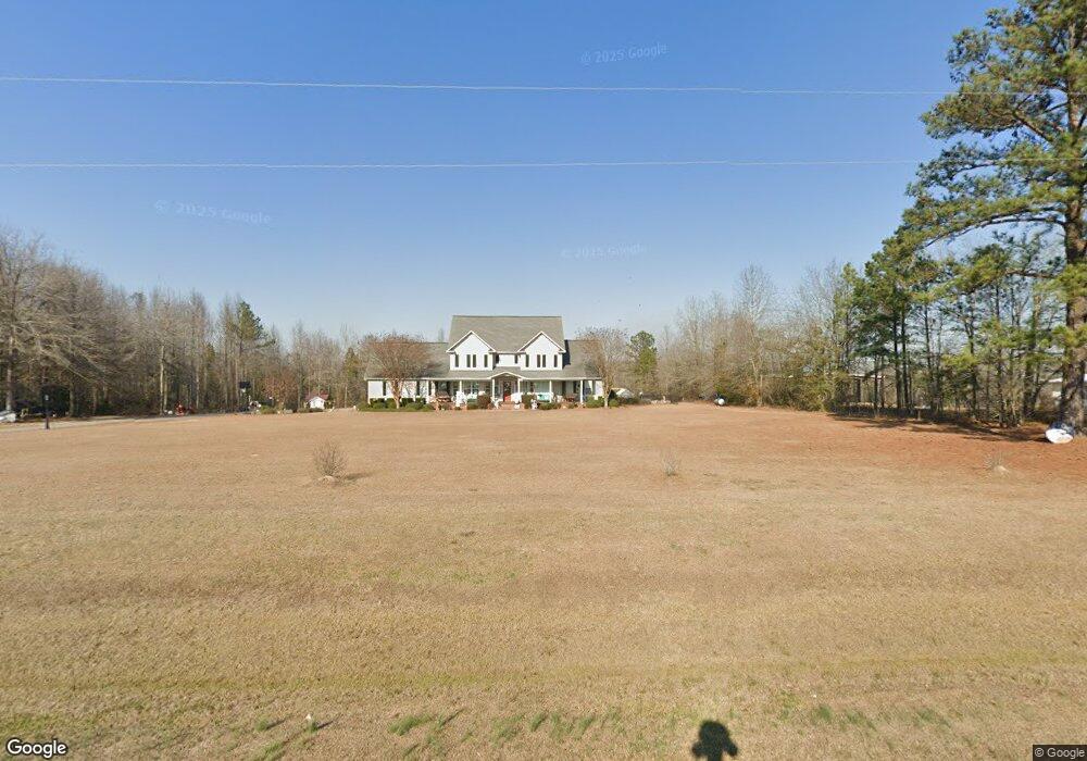
770 Old McLeod Bridge Rd Adrian, GA 31002
Estimated Value: $327,000 - $500,514
4
Beds
3
Baths
3,847
Sq Ft
$104/Sq Ft
Est. Value
About This Home
This home is located at 770 Old McLeod Bridge Rd, Adrian, GA 31002 and is currently estimated at $398,838, approximately $103 per square foot. 770 Old McLeod Bridge Rd is a home located in Emanuel County with nearby schools including Swainsboro Primary School, Swainsboro Elementary School, and Swainsboro Middle School.
Ownership History
Date
Name
Owned For
Owner Type
Purchase Details
Closed on
Aug 8, 2007
Sold by
Collins Bradley James
Bought by
Collins Kimberly Jill
Current Estimated Value
Purchase Details
Closed on
Jun 3, 2004
Sold by
L & M Farms Inc
Bought by
Collins Bradley James and Kimberly Ji
Create a Home Valuation Report for This Property
The Home Valuation Report is an in-depth analysis detailing your home's value as well as a comparison with similar homes in the area
Purchase History
| Date | Buyer | Sale Price | Title Company |
|---|---|---|---|
| Collins Kimberly Jill | -- | -- | |
| Collins Bradley James | $17,500 | -- |
Source: Public Records
Tax History
| Year | Tax Paid | Tax Assessment Tax Assessment Total Assessment is a certain percentage of the fair market value that is determined by local assessors to be the total taxable value of land and additions on the property. | Land | Improvement |
|---|---|---|---|---|
| 2025 | $4,226 | $158,455 | $7,322 | $151,133 |
| 2023 | $3,144 | $137,674 | $5,369 | $132,305 |
| 2022 | $3,214 | $119,505 | $5,369 | $114,136 |
| 2021 | $3,084 | $112,510 | $4,881 | $107,629 |
| 2020 | $3,430 | $118,491 | $7,943 | $110,548 |
| 2019 | $3,410 | $118,491 | $7,943 | $110,548 |
| 2018 | $3,409 | $118,491 | $7,943 | $110,548 |
| 2017 | $3,417 | $118,491 | $7,943 | $110,548 |
| 2016 | $3,359 | $118,491 | $7,943 | $110,548 |
| 2015 | -- | $118,491 | $7,943 | $110,548 |
| 2014 | -- | $109,651 | $7,943 | $101,708 |
| 2013 | -- | $108,174 | $7,920 | $100,253 |
Source: Public Records
Map
Nearby Homes
- 546 Alton Lawson Rd
- 742 Halls Bridge Rd
- 19 Cow Ford Bridge Rd
- 0 Deer Creek W
- 0 Deer Creek Dr Unit 10373260
- 0 S Highway 1 Unit 10340744
- 0 Bill Glenn Rd Off Highway 56 Unit 10679952
- 0 E Highway 80 Unit 10564175
- 459 Prince Ave
- 1457 Paris Ave
- 1513 Paris Ave
- LOT 12 Robin Rd
- 1146 Georgia 56
- 143 Arden Dr
- 1016 Old Wadley Rd
- 102 Pate St
- 154 Atkinson Dr
- 211 Wells St
- 207 Fowler St
- 0 Old Dellwood Rd Unit 10726058
Your Personal Tour Guide
Ask me questions while you tour the home.