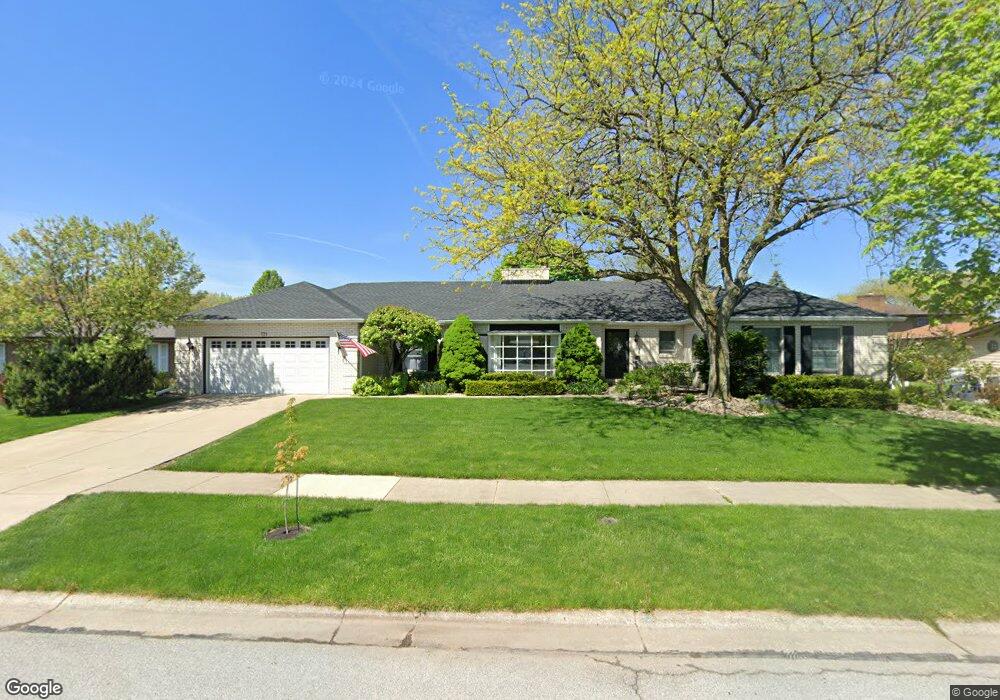
771 Eastbrook Ln Crown Point, IN 46307
Estimated Value: $389,286 - $600,000
4
Beds
3
Baths
2,982
Sq Ft
$155/Sq Ft
Est. Value
About This Home
This home is located at 771 Eastbrook Ln, Crown Point, IN 46307 and is currently estimated at $463,572, approximately $155 per square foot. 771 Eastbrook Ln is a home located in Lake County with nearby schools including Solon Robinson Elementary School, Colonel John Wheeler Middle School, and Crown Point High School.
Ownership History
Date
Name
Owned For
Owner Type
Purchase Details
Closed on
Dec 16, 2011
Sold by
Meier Robert E and Meier Judith D
Bought by
Petry Ryan J and Petry Sarah C
Current Estimated Value
Home Financials for this Owner
Home Financials are based on the most recent Mortgage that was taken out on this home.
Original Mortgage
$224,169
Outstanding Balance
$150,620
Interest Rate
3.87%
Mortgage Type
FHA
Estimated Equity
$312,952
Create a Home Valuation Report for This Property
The Home Valuation Report is an in-depth analysis detailing your home's value as well as a comparison with similar homes in the area
Home Values in the Area
Average Home Value in this Area
Purchase History
| Date | Buyer | Sale Price | Title Company |
|---|---|---|---|
| Petry Ryan J | -- | Community Title Company |
Source: Public Records
Mortgage History
| Date | Status | Borrower | Loan Amount |
|---|---|---|---|
| Open | Petry Ryan J | $224,169 |
Source: Public Records
Tax History
| Year | Tax Paid | Tax Assessment Tax Assessment Total Assessment is a certain percentage of the fair market value that is determined by local assessors to be the total taxable value of land and additions on the property. | Land | Improvement |
|---|---|---|---|---|
| 2025 | $3,612 | $396,400 | $56,900 | $339,500 |
| 2024 | $8,776 | $360,200 | $56,900 | $303,300 |
| 2023 | $3,567 | $319,300 | $49,500 | $269,800 |
| 2022 | $3,620 | $326,300 | $49,500 | $276,800 |
| 2021 | $3,495 | $315,300 | $42,200 | $273,100 |
| 2020 | $3,333 | $299,200 | $42,200 | $257,000 |
| 2019 | $3,256 | $288,500 | $42,200 | $246,300 |
| 2018 | $3,795 | $276,000 | $42,200 | $233,800 |
| 2017 | $3,674 | $266,000 | $42,200 | $223,800 |
| 2016 | $3,549 | $254,900 | $42,200 | $212,700 |
| 2014 | $3,073 | $239,900 | $42,200 | $197,700 |
| 2013 | $3,030 | $235,000 | $42,200 | $192,800 |
Source: Public Records
Map
Nearby Homes
- 1150 Greenview Place
- 1191 Churchill Ln
- 508 W 117th Place
- 10421 Privet Dr
- 10351 Privet Dr
- 347 Sawgrass Dr
- 10330 Privet Dr
- 947 Iroquois Dr
- 206 U S 231
- 615 Alice St
- 868 Clearwater Cove W
- 11840 Broadway
- 1785 E 110th Place
- 1865 E 110th Place
- 13131 Rutledge Place
- 11828 Broadway
- 412 Chessington Dr
- 741 Pettibone St
- 11742 Broadway
- 11664 Broadway
- 1038 Greenview Dr
- 1039 High Meadow Dr
- 1033 High Meadow Dr
- 774 Eastbrook Ct
- 1030 Greenview Dr
- 1285 Greenview Dr
- 772 Eastbrook Ln
- 1025 High Meadow Dr
- 764 Eastbrook Ln
- 780 Eastbrook Ln
- 756 Eastbrook Ln
- 1036 High Meadow Dr
- 1019 High Meadow Dr
- 1030 High Meadow Dr
- 777 Eastbrook Ct
- 779 Trenton St
- 1041 Greenview Dr
- 1042 High Meadow Dr
- 771 Trenton St
- 787 Trenton St
Your Personal Tour Guide
Ask me questions while you tour the home.