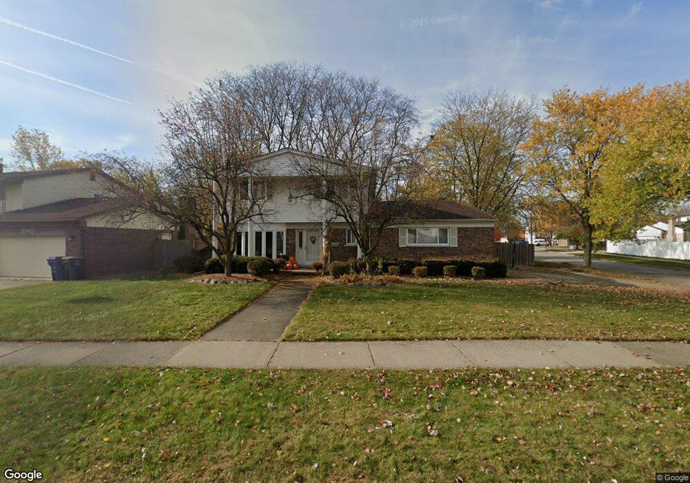
7721 Pointe Dr Canton, MI 48187
Estimated Value: $406,976 - $465,000
Studio
3
Baths
2,135
Sq Ft
$201/Sq Ft
Est. Value
About This Home
This home is located at 7721 Pointe Dr, Canton, MI 48187 and is currently estimated at $429,994, approximately $201 per square foot. 7721 Pointe Dr is a home located in Wayne County with nearby schools including Canton High School, East Middle School, and Salem High School.
Ownership History
Date
Name
Owned For
Owner Type
Purchase Details
Closed on
Mar 29, 2007
Sold by
Lawrence Aaron and Lawrence Amy
Bought by
Patzer Todd
Current Estimated Value
Purchase Details
Closed on
Aug 6, 2001
Sold by
Ode Daniel R
Bought by
Lawrence Aaron
Purchase Details
Closed on
Sep 2, 1999
Sold by
Wolkamer Scott E
Bought by
Ode Daniel R
Purchase Details
Closed on
Jul 23, 1999
Sold by
Bankers Trust
Bought by
Wolkhamer Scott E
Create a Home Valuation Report for This Property
The Home Valuation Report is an in-depth analysis detailing your home's value as well as a comparison with similar homes in the area
Home Values in the Area
Average Home Value in this Area
Purchase History
| Date | Buyer | Sale Price | Title Company |
|---|---|---|---|
| Patzer Todd | $247,000 | Metropolitan Title Company | |
| Lawrence Aaron | $135,000 | -- | |
| Ode Daniel R | $205,000 | -- | |
| Wolkhamer Scott E | $167,000 | -- |
Source: Public Records
Tax History
| Year | Tax Paid | Tax Assessment Tax Assessment Total Assessment is a certain percentage of the fair market value that is determined by local assessors to be the total taxable value of land and additions on the property. | Land | Improvement |
|---|---|---|---|---|
| 2025 | $2,141 | $196,400 | $0 | $0 |
| 2024 | $2,080 | $180,500 | $0 | $0 |
| 2023 | $1,983 | $165,300 | $0 | $0 |
| 2022 | $4,431 | $151,300 | $0 | $0 |
| 2021 | $4,295 | $146,300 | $0 | $0 |
| 2020 | $4,233 | $145,400 | $0 | $0 |
| 2019 | $4,157 | $132,970 | $0 | $0 |
| 2018 | $1,686 | $129,530 | $0 | $0 |
| 2017 | $4,354 | $126,200 | $0 | $0 |
| 2016 | $3,809 | $123,600 | $0 | $0 |
| 2015 | $9,261 | $112,140 | $0 | $0 |
| 2013 | $8,972 | $93,440 | $0 | $0 |
| 2010 | -- | $92,890 | $46,295 | $46,595 |
Source: Public Records
Map
Nearby Homes
- 7533 Hillsboro Dr
- 7264 Irongate Rd
- 43086 Versailles Rd
- 43529 Oakbrook Rd
- 8370 Elmhurst St
- 44432 Newburyport Dr
- 6907 Harvard Ln
- 6852 New Providence Way Unit 104
- 7527 Green Meadow Ln Unit 115
- 42542 Saratoga Rd Unit 26
- 8815 Marlowe Ave
- 835 Coldrose Way
- 8880 Marlowe Ave
- 45193 Quaker Hill Dr
- 47527 Ellery Ln
- 49772 Shoreline Dr
- 44805 Joy Rd
- 9011 Elmhurst Ave
- 7917 N Canton Center Rd
- 9048 Brookline Ave
- 7701 Pointe Dr
- 7708 Sussex Dr
- 7653 Pointe Dr
- 7580 Sussex Dr
- 7723 Hillsboro Dr
- 7608 Sussex Ct
- 7738 Hillsboro Dr
- 7639 Pointe Dr
- 7568 Sussex Dr
- 7735 Hillsboro Dr
- 43688 Hanover Ct
- 7622 Sussex Ct
- 43687 Hanover Ct
- 7627 Pointe Dr
- 7556 Sussex Dr
- 7747 Hillsboro Dr
- 43695 Lombardy Dr
- 7570 Hillsboro Dr
- 7636 Sussex Ct
- 43672 Hanover Ct
Your Personal Tour Guide
Ask me questions while you tour the home.