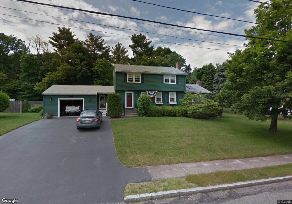
78 Captain Standish Dr Abington, MA 02351
Estimated Value: $786,000 - $849,000
5
Beds
4
Baths
3,008
Sq Ft
$271/Sq Ft
Est. Value
About This Home
This home is located at 78 Captain Standish Dr, Abington, MA 02351 and is currently estimated at $816,156, approximately $271 per square foot. 78 Captain Standish Dr is a home located in Plymouth County with nearby schools including Beaver Brook Elementary School, Abington Middle School, and Woodsdale School.
Ownership History
Date
Name
Owned For
Owner Type
Purchase Details
Closed on
Dec 18, 2012
Sold by
Lavangie Michael D and Lavangie Cecilia D
Bought by
Dr 78 Captain Standish
Current Estimated Value
Purchase Details
Closed on
Jun 1, 1985
Bought by
78 Captain Standish Dr Rt
Create a Home Valuation Report for This Property
The Home Valuation Report is an in-depth analysis detailing your home's value as well as a comparison with similar homes in the area
Home Values in the Area
Average Home Value in this Area
Purchase History
| Date | Buyer | Sale Price | Title Company |
|---|---|---|---|
| Dr 78 Captain Standish | -- | -- | |
| 78 Captain Standish Dr Rt | $123,900 | -- |
Source: Public Records
Mortgage History
| Date | Status | Borrower | Loan Amount |
|---|---|---|---|
| Previous Owner | 78 Captain Standish Dr Rt | $200,000 | |
| Previous Owner | 78 Captain Standish Dr Rt | $200,000 | |
| Previous Owner | 78 Captain Standish Dr Rt | $200,000 |
Source: Public Records
Tax History
| Year | Tax Paid | Tax Assessment Tax Assessment Total Assessment is a certain percentage of the fair market value that is determined by local assessors to be the total taxable value of land and additions on the property. | Land | Improvement |
|---|---|---|---|---|
| 2025 | $9,454 | $723,900 | $267,300 | $456,600 |
| 2024 | $7,780 | $581,500 | $243,400 | $338,100 |
| 2023 | $7,438 | $523,400 | $221,700 | $301,700 |
| 2022 | $7,268 | $477,500 | $185,400 | $292,100 |
| 2021 | $8,895 | $407,800 | $169,300 | $238,500 |
| 2020 | $6,374 | $403,000 | $170,500 | $232,500 |
| 2019 | $6,864 | $394,700 | $163,600 | $231,100 |
| 2018 | $6,036 | $370,100 | $163,600 | $206,500 |
| 2017 | $6,580 | $358,600 | $163,600 | $195,000 |
| 2016 | $6,024 | $336,000 | $149,400 | $186,600 |
| 2015 | $5,423 | $319,000 | $149,400 | $169,600 |
Source: Public Records
Map
Nearby Homes
- 68 Captain Standish Dr
- 90 Captain Standish Dr
- 65 Captain Standish Dr
- 102 Captain Standish Dr
- 77 Captain Standish Dr
- 58 Captain Standish Dr
- 53 Captain Standish Dr
- 89 Captain Standish Dr
- 663 Summer St
- 667 Summer St
- 657 Summer St
- 671 Summer St
- 114 Captain Standish Dr
- 651 Summer St
- 41 Captain Standish Dr
- 681 Summer St
- 101 Captain Standish Dr
- 48 Captain Standish Dr
- 120 Hersey Ln
- 106 Hersey Ln
Your Personal Tour Guide
Ask me questions while you tour the home.