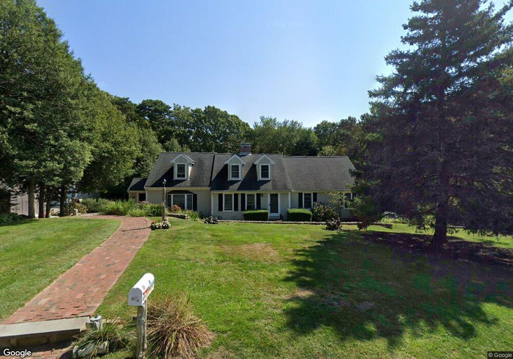
78 Hazel Path Marstons Mills, MA 02648
Marstons Mills NeighborhoodEstimated Value: $886,000 - $1,132,726
About This Home
This home is located at 78 Hazel Path, Marstons Mills, MA 02648 and is currently estimated at $1,009,682, approximately $296 per square foot. 78 Hazel Path is a home located in Barnstable County with nearby schools including West Villages Elementary School, Barnstable United Elementary School, and Barnstable Intermediate School.
Ownership History
We collect this data history from publicly available records. To have your information removed, we recommend requesting removal directly through your county’s website.
Purchase Details
Purchase Details
Purchase Details
Home Values in the Area
Average Home Value in this Area
Purchase History
We collect this data history from publicly available records. To have your information removed, we recommend requesting removal directly through your county’s website.
| Date | Buyer | Sale Price | Title Company |
|---|---|---|---|
| $329,703 | -- | ||
| $770,297 | -- | ||
| -- | -- |
Mortgage History
We collect this data history from publicly available records. To have your information removed, we recommend requesting removal directly through your county’s website.
| Date | Status | Borrower | Loan Amount |
|---|---|---|---|
| Previous Owner | $200,000 | ||
| Previous Owner | $62,245 | ||
| Closed | $75,000 | ||
| Previous Owner | $100,000 | ||
| Previous Owner | $400,000 |
Tax History
We collect this data history from publicly available records. To have your information removed, we recommend requesting removal directly through your county’s website.
| Year | Tax Paid | Tax Assessment Tax Assessment Total Assessment is a certain percentage of the fair market value that is determined by local assessors to be the total taxable value of land and additions on the property. | Land | Improvement |
|---|---|---|---|---|
| 2025 | $7,646 | $945,100 | $177,700 | $767,400 |
| 2024 | $2,186 | $279,900 | $177,700 | $102,200 |
| 2023 | $6,858 | $822,300 | $161,700 | $660,600 |
| 2022 | $6,547 | $679,200 | $120,200 | $559,000 |
| 2021 | $7,514 | $606,400 | $120,200 | $486,200 |
| 2020 | $6,463 | $589,700 | $129,300 | $460,400 |
| 2019 | $1,763 | $542,200 | $129,300 | $412,900 |
| 2018 | $6,470 | $495,400 | $136,000 | $359,400 |
| 2017 | $6,183 | $479,100 | $136,000 | $343,100 |
| 2016 | $5,236 | $480,400 | $137,300 | $343,100 |
| 2015 | $5,140 | $473,700 | $131,400 | $342,300 |
Map
- 303 Turtleback Rd
- 1529 Race Ln
- 78 Jasper Rd
- 81 Redberry Ln
- 168 White Moss Dr
- 42 Hamblins Hayway
- 981 River Rd
- 10 Race Ln
- 1 Katies Way
- 1 Katies Way
- 67 Old Fields Rd
- 34 Newtown Rd
- 18 Old Fields Rd
- 123 Asa Meigs Rd
- 24 Open Space Dr
- 3 Ground Cover Ln
- 10 Open Space Dr
- 635 Santuit Newtown Rd
- 635 Santuit-Newtown Rd
- 17 Claus Way
Ask me questions while you tour the home.