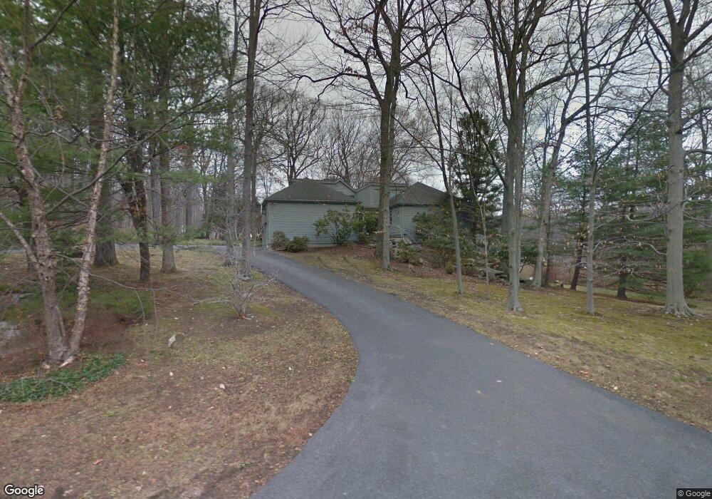
78 Laurel Rd New Canaan, CT 06840
Estimated Value: $1,938,734 - $2,233,000
4
Beds
3
Baths
2,996
Sq Ft
$699/Sq Ft
Est. Value
About This Home
This home is located at 78 Laurel Rd, New Canaan, CT 06840 and is currently estimated at $2,095,434, approximately $699 per square foot. 78 Laurel Rd is a home located in Fairfield County with nearby schools including East Elementary School, Saxe Middle School, and New Canaan High School.
Ownership History
Date
Name
Owned For
Owner Type
Purchase Details
Closed on
Jul 29, 1997
Sold by
Grant Donald R and Grant Barbara B
Bought by
Freedgood Charles O and Poe-Freedgood Susan
Current Estimated Value
Home Financials for this Owner
Home Financials are based on the most recent Mortgage that was taken out on this home.
Original Mortgage
$418,000
Interest Rate
7.13%
Mortgage Type
Unknown
Create a Home Valuation Report for This Property
The Home Valuation Report is an in-depth analysis detailing your home's value as well as a comparison with similar homes in the area
Home Values in the Area
Average Home Value in this Area
Purchase History
We collect this data history from publicly available records. To have your information removed, we recommend requesting removal directly through your county’s website.
| Date | Buyer | Sale Price | Title Company |
|---|---|---|---|
| Freedgood Charles O | $696,000 | -- |
Source: Public Records
Mortgage History
We collect this data history from publicly available records. To have your information removed, we recommend requesting removal directly through your county’s website.
| Date | Status | Borrower | Loan Amount |
|---|---|---|---|
| Open | Freedgood Charles O | $380,000 | |
| Closed | Freedgood Charles O | $420,000 | |
| Closed | Freedgood Charles O | $418,000 |
Source: Public Records
Tax History
| Year | Tax Paid | Tax Assessment Tax Assessment Total Assessment is a certain percentage of the fair market value that is determined by local assessors to be the total taxable value of land and additions on the property. | Land | Improvement |
|---|---|---|---|---|
| 2025 | $17,015 | $1,019,480 | $588,000 | $431,480 |
| 2024 | $16,454 | $1,019,480 | $588,000 | $431,480 |
| 2023 | $13,446 | $709,940 | $527,730 | $182,210 |
| 2022 | $13,042 | $709,940 | $527,730 | $182,210 |
| 2021 | $12,893 | $709,940 | $527,730 | $182,210 |
| 2020 | $12,893 | $709,940 | $527,730 | $182,210 |
| 2019 | $12,949 | $709,940 | $527,730 | $182,210 |
| 2018 | $14,832 | $874,510 | $558,460 | $316,050 |
| 2017 | $14,578 | $874,510 | $558,460 | $316,050 |
| 2016 | $14,263 | $874,510 | $558,460 | $316,050 |
| 2015 | $14,482 | $874,510 | $558,460 | $316,050 |
| 2014 | $13,590 | $874,510 | $558,460 | $316,050 |
Source: Public Records
Map
Nearby Homes
- 2 Sleepy Hollow Rd
- 323 Smith Ridge Rd
- 637 Valley Rd
- 12 Norholt Dr
- 760 Valley Rd
- 122 Brookwood Ln
- 48 Brookwood Ln
- 815 Valley Rd
- 729 Smith Ridge Rd
- 30L Huckleberry Hill Rd
- 372 Brushy Ridge Rd
- 107 Parade Hill Rd
- 101 Parade Hill Rd
- 84 Parade Hill Rd Unit 84
- 35 Canoe Hill Rd
- 537 Oenoke Ridge
- 145 River St
- 565 Oenoke Ridge
- 147 Thayer Pond Rd
- 211 Oenoke Ridge
- 80 Laurel Rd
- 74 Laurel Rd
- 76 Laurel Rd
- 56 Laurel Rd
- 16 Sleepy Hollow Rd
- 563 Canoe Hill Rd
- 583 Canoe Hill Rd
- 57 Laurel Rd
- 507 Canoe Hill Rd
- 571 Canoe Hill Rd
- 551 Canoe Hill Rd
- 85 Laurel Rd
- 481 Canoe Hill Rd
- 15 Turner Hill Rd
- 26 Turner Hill Rd
- 562 Canoe Hill Rd
- 29 Laurel Rd
- 50 Sleepy Hollow Rd
- 33 Sleepy Hollow Rd
- 175 Laurel Rd
Your Personal Tour Guide
Ask me questions while you tour the home.