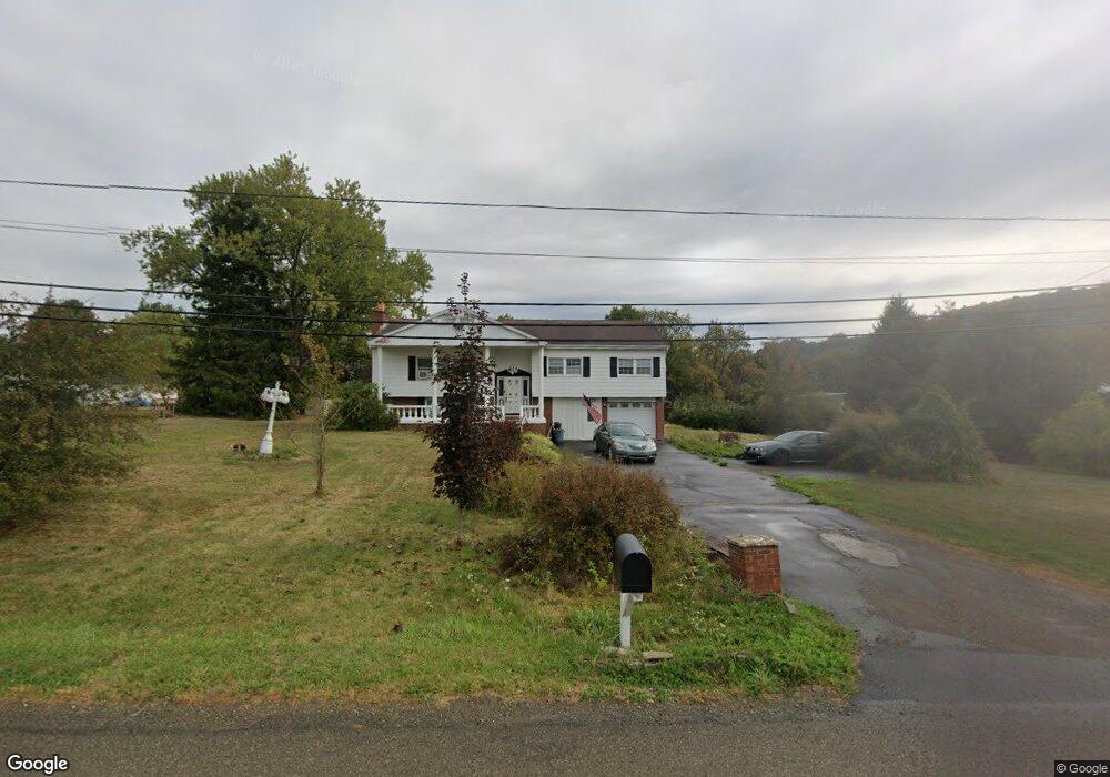
78 Shawmut Rd Brockport, PA 15823
Estimated Value: $188,660 - $251,000
3
Beds
2
Baths
--
Sq Ft
82,764
Sq Ft Lot
About This Home
This home is located at 78 Shawmut Rd, Brockport, PA 15823 and is currently estimated at $216,165. 78 Shawmut Rd is a home located in Elk County with nearby schools including Brockway Area Elementary School, Brockway Area Junior/Senior High School, and Hillside School.
Ownership History
Date
Name
Owned For
Owner Type
Purchase Details
Closed on
Jul 25, 2017
Sold by
Wisor Dorothy J and Aiello Rene
Bought by
Buddenbohn Sarah Grace A
Current Estimated Value
Home Financials for this Owner
Home Financials are based on the most recent Mortgage that was taken out on this home.
Original Mortgage
$110,117
Outstanding Balance
$90,801
Interest Rate
3.62%
Mortgage Type
FHA
Estimated Equity
$125,364
Purchase Details
Closed on
Jul 19, 2008
Sold by
Wisor Jack L and Aiello Rene A
Bought by
Wisor Dorothy J
Create a Home Valuation Report for This Property
The Home Valuation Report is an in-depth analysis detailing your home's value as well as a comparison with similar homes in the area
Purchase History
| Date | Buyer | Sale Price | Title Company |
|---|---|---|---|
| Buddenbohn Sarah Grace A | $112,150 | None Available | |
| Wisor Dorothy J | -- | None Available |
Source: Public Records
Mortgage History
| Date | Status | Borrower | Loan Amount |
|---|---|---|---|
| Open | Buddenbohn Sarah Grace A | $110,117 |
Source: Public Records
Tax History
| Year | Tax Paid | Tax Assessment Tax Assessment Total Assessment is a certain percentage of the fair market value that is determined by local assessors to be the total taxable value of land and additions on the property. | Land | Improvement |
|---|---|---|---|---|
| 2025 | $1,671 | $32,400 | $3,250 | $29,150 |
| 2024 | $1,661 | $32,400 | $3,250 | $29,150 |
| 2023 | $1,604 | $32,400 | $3,250 | $29,150 |
| 2022 | $1,593 | $32,400 | $3,250 | $29,150 |
| 2021 | $1,566 | $32,400 | $3,250 | $29,150 |
| 2020 | $1,566 | $32,400 | $3,250 | $29,150 |
| 2019 | $1,509 | $32,400 | $3,250 | $29,150 |
| 2018 | $1,468 | $32,400 | $3,250 | $29,150 |
| 2017 | $1,424 | $32,400 | $3,250 | $29,150 |
| 2016 | $1,243 | $32,400 | $3,250 | $29,150 |
| 2015 | -- | $32,400 | $3,250 | $29,150 |
| 2013 | -- | $32,400 | $3,250 | $29,150 |
Source: Public Records
Map
Nearby Homes
- 0 Sr2001 Rattlesnake Rd Unit 26-53
- 1981 Shawmut Rd
- 7956 U S 219
- 601 Sandbank Rd
- 565-566 Chester Ln
- 19 - 512 Lynyard Ln
- 181 Dolphin Head Rd
- 744 Dolphin Head Rd Unit 19 83 & 84
- 18 150 Malcolm Rd
- 14 Port-Au-prince Rd
- 323 Flamingo Rd
- 50 Steele Rd
- 246 Whispering Trail Rd
- 285 Saint Martin Rd
- 211 Pimlico Rd
- 360 6 Shilling Rd
- 362 6 Shilling Rd
- 249 Galloway Rd
- 636 Cap Haitien Rd
- 0 Boone Mountain - Heigel Road Rd Unit 1-2-5-6
- 108 Shawmut Rd
- 124 Shawmut Rd
- 101 Shawmut Rd
- 138 Shawmut Rd
- 67 Shawmut Rd
- 129 Shawmut Rd
- 152 Shawmut Rd
- 166 Shawmut Rd
- 182 Shawmut Rd
- 5197 U S 219
- 5188 Route 219
- 5155 Route 219
- 5162 U S 219
- 5119 Route 219
- 266 Shawmut Rd
- 17295 U S 219
- 5093 Route 219
- 0 Lot I Playground Rd
- 5075 Route 219
- 300 Shawmut Rd
Your Personal Tour Guide
Ask me questions while you tour the home.