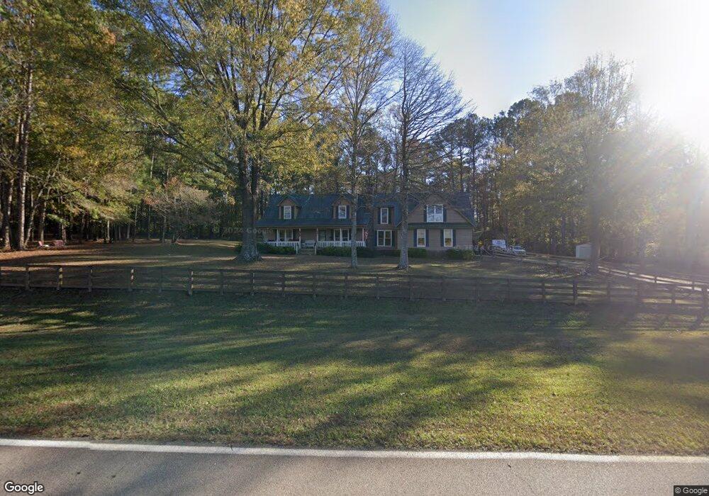
780 Long Cane Rd Lagrange, GA 30240
Estimated Value: $279,000 - $356,000
4
Beds
3
Baths
2,280
Sq Ft
$141/Sq Ft
Est. Value
About This Home
This home is located at 780 Long Cane Rd, Lagrange, GA 30240 and is currently estimated at $320,965, approximately $140 per square foot. 780 Long Cane Rd is a home located in Troup County with nearby schools including Long Cane Elementary School, Whitesville Road Elementary School, and West Point Elementary School.
Ownership History
Date
Name
Owned For
Owner Type
Purchase Details
Closed on
Jun 9, 2010
Sold by
Federal National Mortgage Association
Bought by
Brown Thomas
Current Estimated Value
Home Financials for this Owner
Home Financials are based on the most recent Mortgage that was taken out on this home.
Original Mortgage
$159,565
Outstanding Balance
$105,386
Interest Rate
4.91%
Mortgage Type
New Conventional
Estimated Equity
$215,579
Purchase Details
Closed on
Jan 24, 1991
Sold by
Ronald E Cannon
Bought by
Bowen Michael K and Bowen Kathy R
Create a Home Valuation Report for This Property
The Home Valuation Report is an in-depth analysis detailing your home's value as well as a comparison with similar homes in the area
Purchase History
| Date | Buyer | Sale Price | Title Company |
|---|---|---|---|
| Brown Thomas | -- | -- | |
| Bowen Michael K | -- | -- |
Source: Public Records
Mortgage History
| Date | Status | Borrower | Loan Amount |
|---|---|---|---|
| Open | Brown Thomas | $159,565 |
Source: Public Records
Tax History
| Year | Tax Paid | Tax Assessment Tax Assessment Total Assessment is a certain percentage of the fair market value that is determined by local assessors to be the total taxable value of land and additions on the property. | Land | Improvement |
|---|---|---|---|---|
| 2025 | $2,858 | $104,796 | $6,800 | $97,996 |
| 2024 | $2,579 | $94,564 | $6,800 | $87,764 |
| 2023 | $2,433 | $89,196 | $6,800 | $82,396 |
| 2022 | $2,366 | $84,756 | $6,800 | $77,956 |
| 2021 | $2,117 | $70,200 | $8,480 | $61,720 |
| 2020 | $2,117 | $70,200 | $8,480 | $61,720 |
| 2019 | $2,152 | $71,360 | $8,480 | $62,880 |
| 2018 | $1,981 | $65,680 | $8,480 | $57,200 |
| 2017 | $1,981 | $65,680 | $8,480 | $57,200 |
| 2016 | $1,978 | $65,596 | $8,500 | $57,096 |
| 2015 | $1,844 | $61,032 | $8,500 | $52,532 |
| 2014 | $1,764 | $58,292 | $8,500 | $49,792 |
| 2013 | -- | $60,219 | $8,500 | $51,719 |
Source: Public Records
Map
Nearby Homes
- 102 Bridgewater Dr
- 5714 W Point Rd
- 107 Waters Edge Dr
- Sandtown Road Unit: 1 2+ - Acre
- 0 Sandtown Rd Unit 10255987
- 105 Redwood Dr
- 3009 Old West Point Rd
- 640 Hudson Rd
- 0 Warner Rd Unit 10686116
- 648 Warner Rd
- 22 Freeman Rd
- 90 Hickory Ln
- 0 Glass Bridge Rd Unit 10679358
- 101 Garden Walk
- 101 Garden Walk Unit 85
- 104 Independence Ct
- 288 Bradfield Dr
- 295 Ferrell-Tatum Rd
- 808 S Fling Rd
- 311 Cumberland Dr
- 790 Long Cane Rd
- 186 Robert Taylor Rd
- 176 Robert Taylor Rd
- 210 Robert Taylor Rd
- 0 Long Cane Rd Unit 2936370
- 0 Long Cane Rd Unit 3101008
- 0 Long Cane Rd Unit TR 1 7140389
- 0 Long Cane Rd Unit 10379853
- 0 Long Cane Rd Unit 10183401
- 0 Long Cane Rd Unit 10183398
- 0 Long Cane Rd Unit 20089989
- 0 Long Cane Rd Unit 7459407
- 0 Long Cane Rd Unit 7505623
- 0 Long Cane Rd Unit 7279394
- 0 Long Cane Rd Unit 9053045
- 220 Robert Taylor Rd
- 0 Robert Hayes Rd Unit 8309783
- 0 Robert Hayes Rd Unit 8218274
- 0 Robert Hayes Rd Unit 3243345
- 0 Robert Hayes Rd Unit 7311374
Your Personal Tour Guide
Ask me questions while you tour the home.