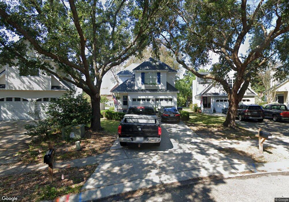
780 Shell Sand Cir Charleston, SC 29412
James Island NeighborhoodEstimated Value: $608,623 - $725,000
3
Beds
3
Baths
1,689
Sq Ft
$398/Sq Ft
Est. Value
About This Home
This home is located at 780 Shell Sand Cir, Charleston, SC 29412 and is currently estimated at $671,906, approximately $397 per square foot. 780 Shell Sand Cir is a home located in Charleston County with nearby schools including Harbor View Elementary School, Camp Road Middle, and James Island Charter High School.
Ownership History
Date
Name
Owned For
Owner Type
Purchase Details
Closed on
Sep 29, 2010
Sold by
Hebert Emilie K
Bought by
Dorn Watson and Collier Lidie
Current Estimated Value
Home Financials for this Owner
Home Financials are based on the most recent Mortgage that was taken out on this home.
Original Mortgage
$188,000
Outstanding Balance
$124,627
Interest Rate
4.44%
Mortgage Type
New Conventional
Estimated Equity
$547,279
Purchase Details
Closed on
Jun 21, 2005
Sold by
Parker Edward F and Parker Susan R C
Bought by
Hebert Emilie K
Create a Home Valuation Report for This Property
The Home Valuation Report is an in-depth analysis detailing your home's value as well as a comparison with similar homes in the area
Home Values in the Area
Average Home Value in this Area
Purchase History
| Date | Buyer | Sale Price | Title Company |
|---|---|---|---|
| Dorn Watson | $235,000 | -- | |
| Hebert Emilie K | $264,900 | -- |
Source: Public Records
Mortgage History
| Date | Status | Borrower | Loan Amount |
|---|---|---|---|
| Open | Dorn Watson | $188,000 |
Source: Public Records
Tax History
| Year | Tax Paid | Tax Assessment Tax Assessment Total Assessment is a certain percentage of the fair market value that is determined by local assessors to be the total taxable value of land and additions on the property. | Land | Improvement |
|---|---|---|---|---|
| 2024 | $1,850 | $11,900 | $0 | $0 |
| 2023 | $1,619 | $11,900 | $0 | $0 |
| 2022 | $1,493 | $11,900 | $0 | $0 |
| 2021 | $1,565 | $11,900 | $0 | $0 |
| 2020 | $1,621 | $11,900 | $0 | $0 |
| 2019 | $1,445 | $10,340 | $0 | $0 |
| 2017 | $1,395 | $10,340 | $0 | $0 |
| 2016 | $1,339 | $10,340 | $0 | $0 |
| 2015 | $1,383 | $10,340 | $0 | $0 |
| 2014 | $1,233 | $0 | $0 | $0 |
| 2011 | -- | $0 | $0 | $0 |
Source: Public Records
Map
Nearby Homes
- 975 Harbor Oaks Dr
- 713 Lake Frances Dr
- 812 Harbor Place Dr
- 1038 Harbor View Rd
- 902 Travers Dr
- 975 Harbor View Rd
- 969 Harbor View Rd
- 1089 Harbor View Rd
- 698 Whispering Marsh Dr
- 764 Whispering Marsh Dr
- 971 Carmel Dr
- 1075 Quail Dr
- 1122 Wellington Dr
- 716 Waites Dr
- 913 Paul Revere Dr
- 838 Quail Dr
- 1149 Quail Dr
- 779 Dills Bluff Rd
- 237 Rebel Kat Ct
- 902 Mikell Dr
- 780 Shell Sand Cir Unit 1
- 782 Shell Sand Cir
- 778 Shell Sand Cir
- 782 Shell Sand Rd
- 776 Shell Sand Cir
- 786 Shell Sand Cir
- 778 Shell Sand Rd
- 774 Shell Sand Cir
- 790 Shell Sand Cir
- 783 Shell Sand Cir
- 773 Shell Sand Cir
- 790 Shell Sand Rd
- 787 Shell Sand Cir
- 200 Key Ct
- 789 Shell Sand Cir
- 787 Shell Sand Rd
- 770 Shell Sand Cir
- 793 Shell Sand Cir
- 765 Shell Sand Rd
- 765 Shell Sand Cir
Your Personal Tour Guide
Ask me questions while you tour the home.