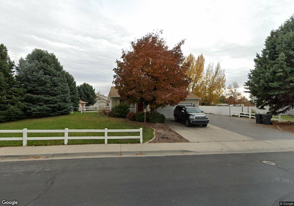
783 W 320 N Lindon, UT 84042
Estimated Value: $563,000 - $808,000
4
Beds
3
Baths
1,919
Sq Ft
$352/Sq Ft
Est. Value
About This Home
This home is located at 783 W 320 N, Lindon, UT 84042 and is currently estimated at $676,235, approximately $352 per square foot. 783 W 320 N is a home located in Utah County with nearby schools including Aspen Elementary School, Oak Canyon Junior High School, and Pleasant Grove High School.
Ownership History
Date
Name
Owned For
Owner Type
Purchase Details
Closed on
Sep 28, 2020
Sold by
Simmons Cori
Bought by
Watabe Foster and Watabe Hannah
Current Estimated Value
Home Financials for this Owner
Home Financials are based on the most recent Mortgage that was taken out on this home.
Original Mortgage
$266,700
Outstanding Balance
$237,215
Interest Rate
2.9%
Mortgage Type
New Conventional
Estimated Equity
$439,020
Purchase Details
Closed on
Nov 8, 2016
Sold by
Simmons Cori and Simmons Shaun
Bought by
Simmons Cori
Home Financials for this Owner
Home Financials are based on the most recent Mortgage that was taken out on this home.
Original Mortgage
$135,000
Interest Rate
3.47%
Mortgage Type
New Conventional
Purchase Details
Closed on
Aug 6, 2003
Sold by
Simmons Cori and Simmons Shaun
Bought by
Simmons Shaun and Simmons Cori
Home Financials for this Owner
Home Financials are based on the most recent Mortgage that was taken out on this home.
Original Mortgage
$131,000
Interest Rate
5.17%
Mortgage Type
Purchase Money Mortgage
Purchase Details
Closed on
Aug 27, 1998
Sold by
Salisbury Development L C
Bought by
Simmons Cori and Simmons Shaun
Home Financials for this Owner
Home Financials are based on the most recent Mortgage that was taken out on this home.
Original Mortgage
$134,100
Interest Rate
6.91%
Create a Home Valuation Report for This Property
The Home Valuation Report is an in-depth analysis detailing your home's value as well as a comparison with similar homes in the area
Home Values in the Area
Average Home Value in this Area
Purchase History
| Date | Buyer | Sale Price | Title Company |
|---|---|---|---|
| Watabe Foster | -- | Union Title | |
| Simmons Cori | -- | Union Title | |
| Simmons Shaun | -- | Pro Title & Escrow Inc | |
| Simmons Cori | -- | Provo Land Title |
Source: Public Records
Mortgage History
| Date | Status | Borrower | Loan Amount |
|---|---|---|---|
| Open | Watabe Foster | $266,700 | |
| Previous Owner | Simmons Cori | $135,000 | |
| Previous Owner | Simmons Shaun | $131,000 | |
| Previous Owner | Simmons Cori | $134,100 |
Source: Public Records
Tax History
| Year | Tax Paid | Tax Assessment Tax Assessment Total Assessment is a certain percentage of the fair market value that is determined by local assessors to be the total taxable value of land and additions on the property. | Land | Improvement |
|---|---|---|---|---|
| 2025 | $1,992 | $285,230 | -- | -- |
| 2024 | $1,992 | $245,575 | $0 | $0 |
| 2023 | $1,752 | $231,990 | $0 | $0 |
| 2022 | $1,720 | $219,945 | $0 | $0 |
| 2021 | $1,564 | $301,700 | $141,200 | $160,500 |
| 2020 | $1,457 | $276,600 | $130,700 | $145,900 |
| 2019 | $1,300 | $257,600 | $130,700 | $126,900 |
| 2018 | $1,334 | $249,200 | $122,300 | $126,900 |
| 2017 | $1,299 | $130,075 | $0 | $0 |
| 2016 | $1,288 | $119,295 | $0 | $0 |
| 2015 | $1,362 | $119,295 | $0 | $0 |
| 2014 | $1,265 | $109,725 | $0 | $0 |
Source: Public Records
Map
Nearby Homes
- 648 W 250 N
- 497 W 490 N
- 469 W 490 N
- 465 W 490 N
- 461 W 490 N
- 1227 W Sweet Corn Ln
- 560 N Buffalo Grass Ln
- 572 N Buffalo Grass Ln
- 556 N Buffalo Grass Ln
- 554 N Buffalo Grass Ln
- 568 N Buffalo Grass Ln
- 578 N Buffalo Grass Ln
- 566 N Buffalo Grass Ln
- 576 N Buffalo Grass Ln
- 564 N Buffalo Grass Ln
- 590 N Buffalo Grass Ln
- 574 N Buffalo Grass Ln
- 588 N Buffalo Grass Ln
- 573 N Sweet Corn Ln
- 341 W 600 N
Your Personal Tour Guide
Ask me questions while you tour the home.