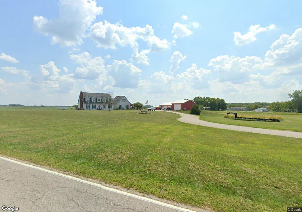
7839 Burns Rd Versailles, OH 45380
Estimated Value: $347,000 - $491,309
3
Beds
3
Baths
2,488
Sq Ft
$164/Sq Ft
Est. Value
About This Home
This home is located at 7839 Burns Rd, Versailles, OH 45380 and is currently estimated at $406,827, approximately $163 per square foot. 7839 Burns Rd is a home located in Darke County with nearby schools including Versailles Elementary School, Versailles Middle School, and Versailles High School.
Ownership History
Date
Name
Owned For
Owner Type
Purchase Details
Closed on
Sep 29, 2010
Sold by
Rhoades Matthew E and Rhoades Nicole A
Bought by
George Gregory W
Current Estimated Value
Home Financials for this Owner
Home Financials are based on the most recent Mortgage that was taken out on this home.
Original Mortgage
$135,474
Outstanding Balance
$87,680
Interest Rate
4.36%
Mortgage Type
Future Advance Clause Open End Mortgage
Estimated Equity
$319,147
Purchase Details
Closed on
Oct 8, 2002
Sold by
Kolling Robert
Bought by
Rhoades Matthew E and Rhoades Nicole
Home Financials for this Owner
Home Financials are based on the most recent Mortgage that was taken out on this home.
Original Mortgage
$176,770
Interest Rate
6.39%
Mortgage Type
New Conventional
Purchase Details
Closed on
Nov 7, 1996
Sold by
Miller Don R
Bought by
Michael Robert and Rolling Julia
Home Financials for this Owner
Home Financials are based on the most recent Mortgage that was taken out on this home.
Original Mortgage
$82,000
Interest Rate
8%
Mortgage Type
New Conventional
Create a Home Valuation Report for This Property
The Home Valuation Report is an in-depth analysis detailing your home's value as well as a comparison with similar homes in the area
Purchase History
| Date | Buyer | Sale Price | Title Company |
|---|---|---|---|
| George Gregory W | $235,000 | Attorney | |
| Rhoades Matthew E | $182,000 | -- | |
| Michael Robert | $180,000 | -- |
Source: Public Records
Mortgage History
| Date | Status | Borrower | Loan Amount |
|---|---|---|---|
| Open | George Gregory W | $135,474 | |
| Previous Owner | Rhoades Matthew E | $176,770 | |
| Previous Owner | Michael Robert | $82,000 |
Source: Public Records
Tax History
| Year | Tax Paid | Tax Assessment Tax Assessment Total Assessment is a certain percentage of the fair market value that is determined by local assessors to be the total taxable value of land and additions on the property. | Land | Improvement |
|---|---|---|---|---|
| 2025 | $4,263 | $128,560 | $20,730 | $107,830 |
| 2024 | $4,263 | $128,560 | $20,730 | $107,830 |
| 2023 | $4,268 | $128,560 | $20,730 | $107,830 |
| 2022 | $3,507 | $108,960 | $18,330 | $90,630 |
| 2021 | $3,674 | $108,960 | $18,330 | $90,630 |
| 2020 | $3,693 | $108,960 | $18,330 | $90,630 |
| 2019 | $3,076 | $90,830 | $18,330 | $72,500 |
| 2018 | $3,089 | $90,830 | $18,330 | $72,500 |
| 2017 | $2,869 | $90,830 | $18,330 | $72,500 |
| 2016 | $2,872 | $89,850 | $14,220 | $75,630 |
| 2015 | $2,872 | $89,850 | $14,220 | $75,630 |
| 2014 | $3,021 | $89,850 | $14,220 | $75,630 |
| 2013 | $3,110 | $85,970 | $13,940 | $72,030 |
Source: Public Records
Map
Nearby Homes
- 00 State Route 121
- 0 St Rt 121 Unit 10041143
- 45 Short St
- 546 Reed Ave
- 140 N Center St
- 547 Reed Ave
- 161 E Main St
- 447 Reed Ave
- 435 Reed Ave
- 9072 Stillwater Dr
- 311 E Canal St
- 157 Mendenhall Rd
- 159 Mendenhall Rd
- 158 Mendenhall Rd
- 231 N Main St
- 7627 Horatio-Harris Creek Rd
- 155 Liberty Dr
- 136 Liberty Dr
- 156 Veterans Dr
- 139 Liberty Dr
- 11140 State Route 185
- 11198 Ohio 185
- 11198 State Route 185
- 11208 Ohio 185
- 11117 State Route 185
- 11193 State Route 185
- 11121 State Route 185
- 11195 State Route 185
- 11208 State Route 185
- 11203 State Route 185
- 11121 Ohio 185
- 11218 State Route 185
- 11213 State Route 185
- 11060 State Route 185
- 11256 State Route 185
- 11268 State Route 185
- 317 Riffle Ave
- 11263 State Route 185
- 7787 Burns Rd
- 11278 State Route 185
Your Personal Tour Guide
Ask me questions while you tour the home.