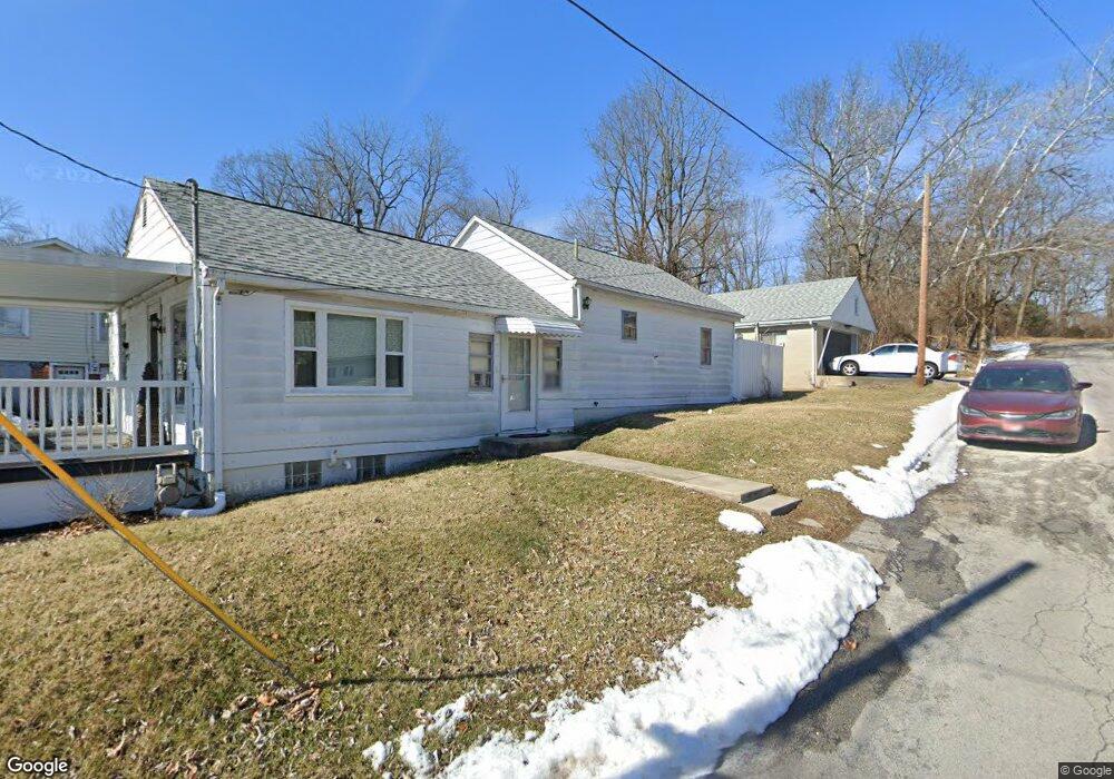
787 Crescent Point Unit 6 Springfield, OH 45503
Estimated Value: $259,000 - $289,000
3
Beds
3
Baths
1,609
Sq Ft
$169/Sq Ft
Est. Value
About This Home
This home is located at 787 Crescent Point Unit 6, Springfield, OH 45503 and is currently estimated at $271,944, approximately $169 per square foot. 787 Crescent Point Unit 6 is a home located in Clark County with nearby schools including Northridge Elementary School, Kenton Ridge Middle & High School, and Emmanuel Christian Academy.
Ownership History
Date
Name
Owned For
Owner Type
Purchase Details
Closed on
Jul 23, 2002
Sold by
Hoppes Builders & Development Co
Bought by
Packard Cooper Vicki
Current Estimated Value
Home Financials for this Owner
Home Financials are based on the most recent Mortgage that was taken out on this home.
Original Mortgage
$105,050
Interest Rate
6.7%
Mortgage Type
Balloon
Create a Home Valuation Report for This Property
The Home Valuation Report is an in-depth analysis detailing your home's value as well as a comparison with similar homes in the area
Home Values in the Area
Average Home Value in this Area
Purchase History
| Date | Buyer | Sale Price | Title Company |
|---|---|---|---|
| Packard Cooper Vicki | $151,100 | -- |
Source: Public Records
Mortgage History
| Date | Status | Borrower | Loan Amount |
|---|---|---|---|
| Previous Owner | Packard Cooper Vicki | $105,050 |
Source: Public Records
Tax History
| Year | Tax Paid | Tax Assessment Tax Assessment Total Assessment is a certain percentage of the fair market value that is determined by local assessors to be the total taxable value of land and additions on the property. | Land | Improvement |
|---|---|---|---|---|
| 2025 | $2,902 | $76,790 | $12,250 | $64,540 |
| 2024 | $2,809 | $65,090 | $10,500 | $54,590 |
| 2023 | $2,809 | $65,090 | $10,500 | $54,590 |
| 2022 | $0 | $65,090 | $10,500 | $54,590 |
| 2021 | $2,886 | $56,520 | $8,750 | $47,770 |
| 2020 | $2,889 | $56,520 | $8,750 | $47,770 |
| 2019 | $2,943 | $56,520 | $8,750 | $47,770 |
| 2018 | $2,835 | $52,220 | $8,750 | $43,470 |
| 2017 | $2,437 | $52,266 | $8,750 | $43,516 |
| 2016 | $2,421 | $52,266 | $8,750 | $43,516 |
| 2015 | $2,561 | $51,006 | $8,750 | $42,256 |
| 2014 | $2,561 | $51,006 | $8,750 | $42,256 |
| 2013 | $2,503 | $51,006 | $8,750 | $42,256 |
Source: Public Records
Map
Nearby Homes
- 519 Moorefield Rd
- 4733 Curtis Dr
- 4741 Cullen Ave
- 1052 Cheyenne Ave Unit 1052
- 5300 Brookshire Ln
- 4802 Willowbrook Dr
- 0 Moorefield Rd
- 1309 Richmoor Rd
- 5235 W Ridgewood Rd
- 1341 Student Ave
- 4322 Midfield St Unit 15
- 4446 Ridgewood Rd E Unit 3
- 4256 Midfield St Unit 9
- 1521 Erika Dr
- 1415 Montego Dr
- 4577 Reno Ln Unit 2
- 4652 Reno Ln Unit 15
- 4732 Lehigh Dr
- 1201 Kingsgate Rd
- 937 Willow Rd
- 785 Crescent Point
- 703 Deerfield Trail Unit 12
- 779 Crescent Point
- 781 Crescent Point Unit 4
- 781 Crescent Point
- 781 Crescent Point
- 701 Deerfield Trail Unit 11
- 709 Deerfield Trail Unit 16
- 773 Crescent Point Unit 2
- 773 Crescent Point
- 707 Deerfield Trail Unit 15
- 771 Deerfield Trail
- 702 Deerfield Trail Unit 13
- 704 Deerfield Trail Unit 14
- 725 Deerfield Trail
- 778 Deerfield Trail Unit 9
- 719 Deerfield Trail Unit 26
- 706 Deerfield Trail Unit 17
- 723 Deerfield Trail Unit 29
- 780 Deerfield Trail Unit 10
Your Personal Tour Guide
Ask me questions while you tour the home.