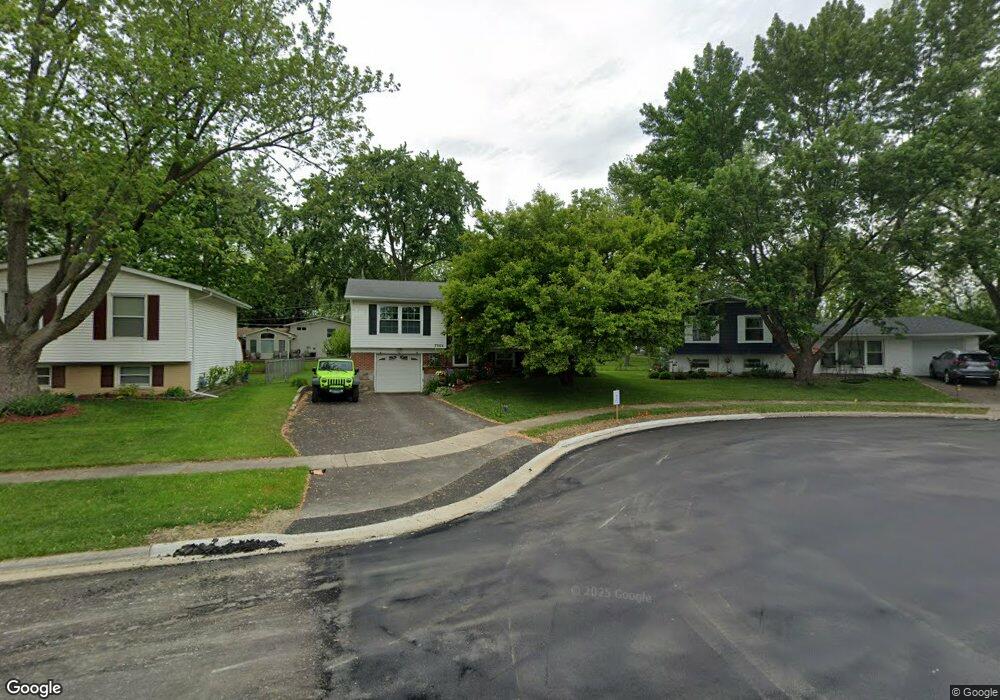
7964 Ramsgate Cir N Hanover Park, IL 60133
Estimated Value: $332,000 - $363,000
About This Home
This home is located at 7964 Ramsgate Cir N, Hanover Park, IL 60133 and is currently estimated at $350,796, approximately $309 per square foot. 7964 Ramsgate Cir N is a home located in Cook County with nearby schools including Albert Einstein Elementary School, Jane Addams Junior High School, and Hoffman Estates High School.
Ownership History
We collect this data history from publicly available records. To have your information removed, we recommend requesting removal directly through your county’s website.
Purchase Details
Purchase Details
Home Financials for this Owner
Home Financials are based on the most recent Mortgage that was taken out on this home.Purchase Details
Home Financials for this Owner
Home Financials are based on the most recent Mortgage that was taken out on this home.Purchase Details
Home Financials for this Owner
Home Financials are based on the most recent Mortgage that was taken out on this home.Home Values in the Area
Average Home Value in this Area
Purchase History
We collect this data history from publicly available records. To have your information removed, we recommend requesting removal directly through your county’s website.
| Date | Buyer | Sale Price | Title Company |
|---|---|---|---|
| -- | None Listed On Document | ||
| -- | Ticor Title Insurance Co | ||
| -- | Stewart Title | ||
| $139,500 | -- |
Mortgage History
We collect this data history from publicly available records. To have your information removed, we recommend requesting removal directly through your county’s website.
| Date | Status | Borrower | Loan Amount |
|---|---|---|---|
| Previous Owner | $152,000 | ||
| Previous Owner | $149,000 | ||
| Previous Owner | $137,219 |
Tax History
We collect this data history from publicly available records. To have your information removed, we recommend requesting removal directly through your county’s website.
| Year | Tax Paid | Tax Assessment Tax Assessment Total Assessment is a certain percentage of the fair market value that is determined by local assessors to be the total taxable value of land and additions on the property. | Land | Improvement |
|---|---|---|---|---|
| 2025 | $7,160 | $29,000 | $5,499 | $23,501 |
| 2024 | $7,160 | $26,000 | $4,766 | $21,234 |
| 2023 | $6,894 | $26,000 | $4,766 | $21,234 |
| 2022 | $6,894 | $26,000 | $4,766 | $21,234 |
| 2021 | $6,066 | $20,486 | $3,116 | $17,370 |
| 2020 | $6,072 | $20,486 | $3,116 | $17,370 |
| 2019 | $6,148 | $23,019 | $3,116 | $19,903 |
| 2018 | $5,370 | $18,585 | $2,749 | $15,836 |
| 2017 | $5,304 | $18,585 | $2,749 | $15,836 |
| 2016 | $5,276 | $18,585 | $2,749 | $15,836 |
| 2015 | $4,875 | $16,360 | $2,382 | $13,978 |
| 2014 | $4,800 | $16,360 | $2,382 | $13,978 |
| 2013 | $4,638 | $16,360 | $2,382 | $13,978 |
Map
- 7927 Sherwood Cir N
- 7777 Ramsgate Cir S
- 7798 Kingsbury Dr
- 1302 Kingsbury Dr Unit E
- 1305 Kingsbury Dr Unit E
- 1326 Kingsbury Dr Unit 6
- 2326 W Weathersfield Way
- 986 Yorkshire Dr
- 7604 Bristol Ln Unit B
- 7815 Carlisle Dr Unit 8
- 7544 Bristol Ln Unit 5
- 890 Yorkshire Dr
- 201 Charleston Ct Unit 3
- 225 Columbia Ct Unit 6
- 225 Columbia Ct Unit 5
- 2434 Charleston Dr Unit 3
- 2450 Charleston Dr Unit 1
- 7635 Manchester Manor Unit 1A
- 7801 Berkshire Ct
- 728 Haddam Way
- 7970 Ramsgate Cir N
- 7984 Ramsgate Cir N
- 7961 Huntington Cir N
- 8008 S Applewood Ct
- 7954 Ramsgate Cir N
- 8009 S Carnaby Ct
- 7953 Huntington Cir N
- 8007 S Applewood Ct
- 7983 Ramsgate Cir N
- 7961 Ramsgate Cir N
- 8021 S Carnaby Ct
- 7940 Ramsgate Cir N
- 7931 Huntington Cir N
- 7955 Ramsgate Cir N
- 7982 Huntington Cir N
- 8020 S Applewood Ct
- 8010 S Carnaby Ct
- 8019 S Applewood Ct
- 7943 Ramsgate Cir N
- 7925 Huntington Cir N
Ask me questions while you tour the home.