Estimated Value: $215,000 - $232,000
About This Home
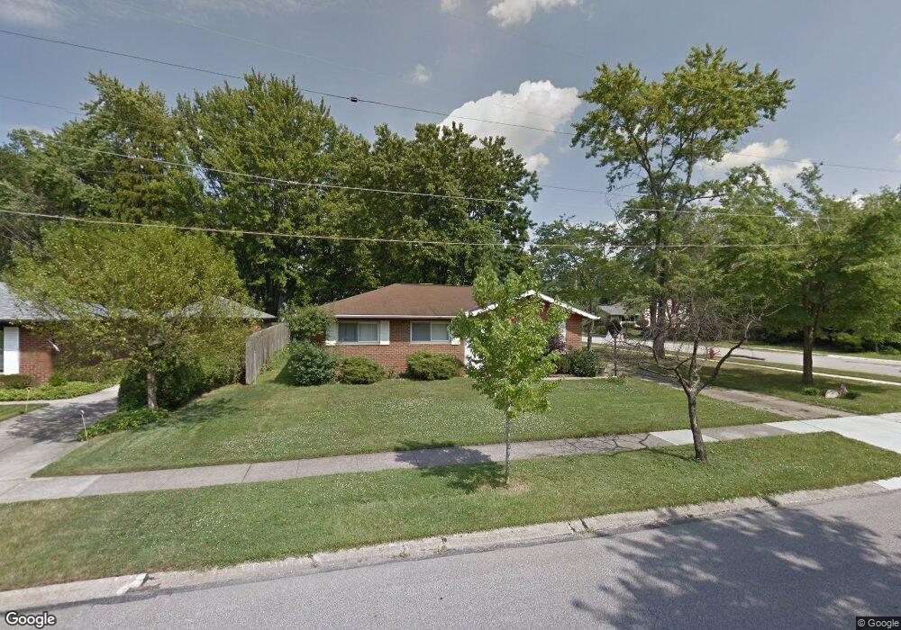
This home is located at 799 Edwards Dr, Berea, OH 44017 and is currently estimated at $222,956, approximately $201 per square foot. 799 Edwards Dr is a home located in Cuyahoga County with nearby schools including Grindstone Elementary School, Berea-Midpark Middle School, and Berea-Midpark High School.
Ownership History
We collect this data history from publicly available records. To have your information removed, we recommend requesting removal directly through your county’s website.
Purchase Details
Home Financials for this Owner
Home Financials are based on the most recent Mortgage that was taken out on this home.Purchase Details
Purchase Details
Purchase Details
Purchase Details
Purchase Details
Home Values in the Area
Average Home Value in this Area
Purchase History
We collect this data history from publicly available records. To have your information removed, we recommend requesting removal directly through your county’s website.
| Date | Buyer | Sale Price | Title Company |
|---|---|---|---|
| $117,500 | Executive Title Agency Corp | ||
| -- | -- | ||
| $56,000 | -- | ||
| $49,700 | -- | ||
| $47,000 | -- | ||
| $46,500 | -- | ||
| -- | -- |
Mortgage History
We collect this data history from publicly available records. To have your information removed, we recommend requesting removal directly through your county’s website.
| Date | Status | Borrower | Loan Amount |
|---|---|---|---|
| Open | $117,500 |
Tax History
We collect this data history from publicly available records. To have your information removed, we recommend requesting removal directly through your county’s website.
| Year | Tax Paid | Tax Assessment Tax Assessment Total Assessment is a certain percentage of the fair market value that is determined by local assessors to be the total taxable value of land and additions on the property. | Land | Improvement |
|---|---|---|---|---|
| 2025 | $2,923 | $60,340 | $10,325 | $50,015 |
| 2024 | $2,939 | $60,340 | $10,325 | $50,015 |
| 2023 | $2,671 | $47,640 | $10,260 | $37,380 |
| 2022 | $2,682 | $47,640 | $10,260 | $37,380 |
| 2021 | $2,658 | $47,640 | $10,260 | $37,380 |
| 2020 | $2,438 | $40,360 | $8,680 | $31,680 |
| 2019 | $2,373 | $115,300 | $24,800 | $90,500 |
| 2018 | $2,582 | $40,360 | $8,680 | $31,680 |
| 2017 | $2,321 | $37,590 | $7,070 | $30,520 |
| 2016 | $3,378 | $37,590 | $7,070 | $30,520 |
| 2015 | $2,971 | $37,590 | $7,070 | $30,520 |
| 2014 | $2,971 | $39,590 | $7,460 | $32,130 |
Map
- 156 Dorland Ave
- 165 Dorland Ave
- 9753 Prospect Rd
- 9985 Prospect Rd
- 21032 Breckenridge Ln
- 8036 Fair Rd
- 9981 Woodhurst Dr
- 30 French St
- 10108 Fair Rd
- 8345 Celianna Dr
- 11035 Steven David Dr
- 20424 Scotch Pine Way
- 262 Stanmary Dr
- 7679 S Eastland Rd
- 8407 Barton Dr
- 73 Harnagy St
- 80 Hamilton St
- 7640 S Eastland Rd
- 233 Baldwin Dr
- 21586 Little Brook Way
Ask me questions while you tour the home.