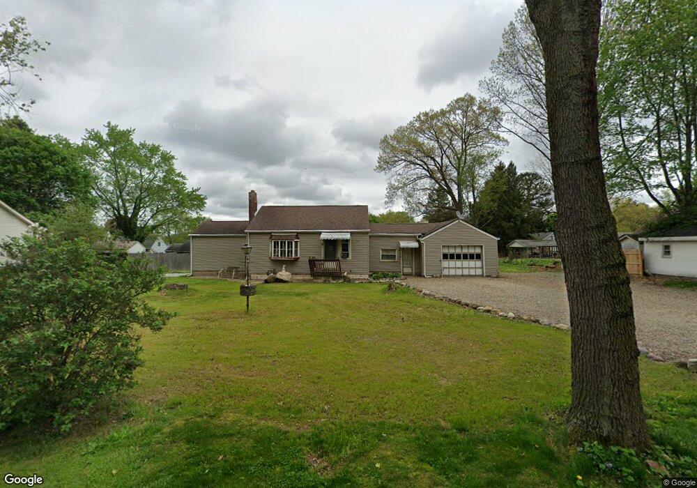
799 Mohawk Trail Akron, OH 44312
Ellet NeighborhoodEstimated Value: $132,000 - $162,000
About This Home
This home is located at 799 Mohawk Trail, Akron, OH 44312 and is currently estimated at $150,950, approximately $165 per square foot. 799 Mohawk Trail is a home located in Summit County with nearby schools including Ellet High School, Summit Academy Akron Elementary School, and Hatton Community Learning Center.
Ownership History
We collect this data history from publicly available records. To have your information removed, we recommend requesting removal directly through your county’s website.
Purchase Details
Home Financials for this Owner
Home Financials are based on the most recent Mortgage that was taken out on this home.Purchase Details
Home Values in the Area
Average Home Value in this Area
Purchase History
We collect this data history from publicly available records. To have your information removed, we recommend requesting removal directly through your county’s website.
| Date | Buyer | Sale Price | Title Company |
|---|---|---|---|
| $54,900 | Barrister | ||
| -- | -- |
Mortgage History
We collect this data history from publicly available records. To have your information removed, we recommend requesting removal directly through your county’s website.
| Date | Status | Borrower | Loan Amount |
|---|---|---|---|
| Open | $53,507 |
Tax History
We collect this data history from publicly available records. To have your information removed, we recommend requesting removal directly through your county’s website.
| Year | Tax Paid | Tax Assessment Tax Assessment Total Assessment is a certain percentage of the fair market value that is determined by local assessors to be the total taxable value of land and additions on the property. | Land | Improvement |
|---|---|---|---|---|
| 2026 | $5,610 | $47,933 | $16,489 | $31,444 |
| 2024 | $2,452 | $47,933 | $16,489 | $31,444 |
| 2023 | $2,452 | $47,933 | $16,489 | $31,444 |
| 2022 | $2,205 | $33,881 | $11,610 | $22,271 |
| 2021 | $2,207 | $33,881 | $11,610 | $22,271 |
| 2020 | $2,173 | $33,880 | $11,610 | $22,270 |
| 2019 | $2,034 | $28,810 | $11,610 | $17,200 |
| 2018 | $2,006 | $28,810 | $11,610 | $17,200 |
| 2017 | $2,039 | $28,810 | $11,610 | $17,200 |
| 2016 | $2,041 | $28,810 | $11,610 | $17,200 |
| 2015 | $2,039 | $28,810 | $11,610 | $17,200 |
| 2014 | $2,022 | $28,810 | $11,610 | $17,200 |
| 2013 | $2,107 | $30,690 | $11,610 | $19,080 |
Map
- 744 Utica Ave
- 2372 Triplett Blvd
- 2323 Mingo Trail
- 2293 Quayle Dr
- 916 Abington Rd
- 2310 Mingo Trail
- 751 Woodstock Rd
- 616 Plainfield Rd
- 2305 E Waterloo Rd
- 611 Herbert Rd
- 2077 Coleman Ave
- 2615 Leland Ave
- 671 Stevenson Ave
- 593 Stanley Rd
- 643 Stevenson Ave
- 625 Hillman Rd
- 2645 North Way
- 2115 Daniels Ave
- 404 Wirth Ave
- 1925 Quayle Dr
- 2275 Hillstock Ave
- 2275 Hillstock Ave
- 791 Mohawk Trail
- 2291 Hillstock Ave
- 804 Utica Ave
- 792 Utica Ave
- 848 Mohawk Trail
- 785 Mohawk Trail
- 858 Mohawk Trail
- 852 Utica Ave
- 852 Utica Ave
- 786 Utica Ave
- 836 Mohawk Trail
- 2276 Hillstock Ave
- 2276 Hillstock Ave
- 779 Plainfield Rd
- 780 Utica Ave
- 864 Utica Ave
- 772 Utica Ave
- 872 Mohawk Trail
Ask me questions while you tour the home.