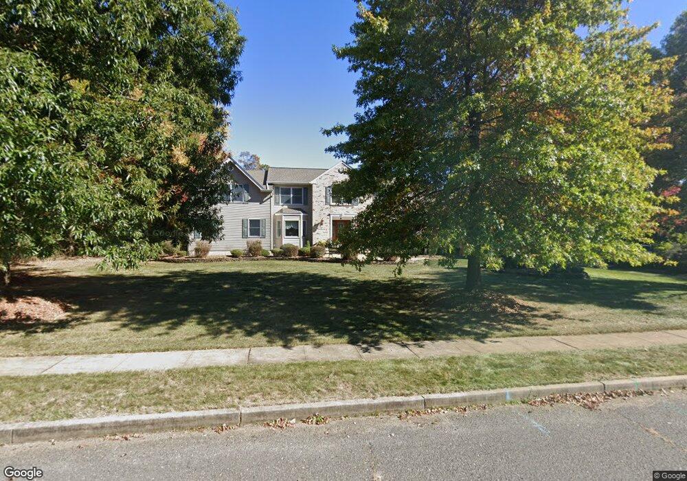
8 Assunpink Trail Freehold, NJ 07728
Estimated Value: $968,186 - $1,146,000
5
Beds
2
Baths
3,302
Sq Ft
$321/Sq Ft
Est. Value
About This Home
This home is located at 8 Assunpink Trail, Freehold, NJ 07728 and is currently estimated at $1,059,047, approximately $320 per square foot. 8 Assunpink Trail is a home located in Monmouth County with nearby schools including Marshall W. Errickson School, Dwight D. Eisenhower Middle School, and Freehold Township High School.
Ownership History
Date
Name
Owned For
Owner Type
Purchase Details
Closed on
Jan 12, 1994
Sold by
Farabaugth Thomas
Bought by
Risafi Christopher and Risafi Jeanne
Current Estimated Value
Home Financials for this Owner
Home Financials are based on the most recent Mortgage that was taken out on this home.
Original Mortgage
$190,000
Interest Rate
7.27%
Purchase Details
Closed on
Aug 27, 1992
Bought by
Risafi Christopher G and Risafi Jeanne E
Create a Home Valuation Report for This Property
The Home Valuation Report is an in-depth analysis detailing your home's value as well as a comparison with similar homes in the area
Home Values in the Area
Average Home Value in this Area
Purchase History
| Date | Buyer | Sale Price | Title Company |
|---|---|---|---|
| Risafi Christopher | $253,000 | -- | |
| Risafi Christopher G | $231,000 | -- |
Source: Public Records
Mortgage History
| Date | Status | Borrower | Loan Amount |
|---|---|---|---|
| Previous Owner | Risafi Christopher | $190,000 |
Source: Public Records
Tax History
| Year | Tax Paid | Tax Assessment Tax Assessment Total Assessment is a certain percentage of the fair market value that is determined by local assessors to be the total taxable value of land and additions on the property. | Land | Improvement |
|---|---|---|---|---|
| 2025 | $15,647 | $961,100 | $343,700 | $617,400 |
| 2024 | $15,011 | $864,500 | $276,100 | $588,400 |
| 2023 | $15,011 | $809,200 | $306,100 | $503,100 |
| 2022 | $14,055 | $734,300 | $256,100 | $478,200 |
| 2021 | $14,055 | $651,900 | $211,100 | $440,800 |
| 2020 | $13,629 | $629,500 | $201,100 | $428,400 |
| 2019 | $13,329 | $614,500 | $186,100 | $428,400 |
| 2018 | $13,712 | $608,600 | $171,100 | $437,500 |
| 2017 | $13,606 | $595,200 | $171,100 | $424,100 |
| 2016 | $13,668 | $587,100 | $171,100 | $416,000 |
| 2015 | $13,257 | $576,400 | $171,100 | $405,300 |
| 2014 | $13,343 | $557,600 | $171,100 | $386,500 |
Source: Public Records
Map
Nearby Homes
- 22 Burki Place
- 15 Lenape Trail
- 242 Bar Harbor Rd
- 92 Sargent Rd
- 32 Koenig Ln
- 16 Manchester Ct Unit H
- 13 Stuart Dr
- 48 Stonehurst Blvd Unit C
- 26 Windsor Terrace Unit E
- 60 Manchester Ct Unit A
- 53 Farnworth Close
- 23 Datchet Close Unit 1000
- 67 Farnworth Close Unit 1000
- 30 Remington Dr Unit 3
- 3 Gatley Close Unit 1000
- 47 Carnaby Close
- 1 Carnaby Close Unit 1000
- 95 Farnworth Close Unit 721
- 2902 Kapalua Ct
- 45 Jaffreyton Close
- 10 Assunpink Trail
- 6 Assunpink Trail
- 7 Assunpink Trail
- 9 Assunpink Trail
- 5 Assunpink Trail
- 4 Assunpink Trail
- 8 Mohawk Trail
- 10 Mohawk Trail
- 2 Hopi Ct
- 6 Mohawk Trail
- 3 Assunpink Trail
- 4 Hopi Ct
- 4 Mohawk Trail
- 2 Seminole Ct
- 9 Hopi Ct
- 1 Assunpink Trail
- 137 Three Brooks Rd
- 3 Seminole Ct
- 84 Brockton Rd
- 6 Hopi Ct
Your Personal Tour Guide
Ask me questions while you tour the home.