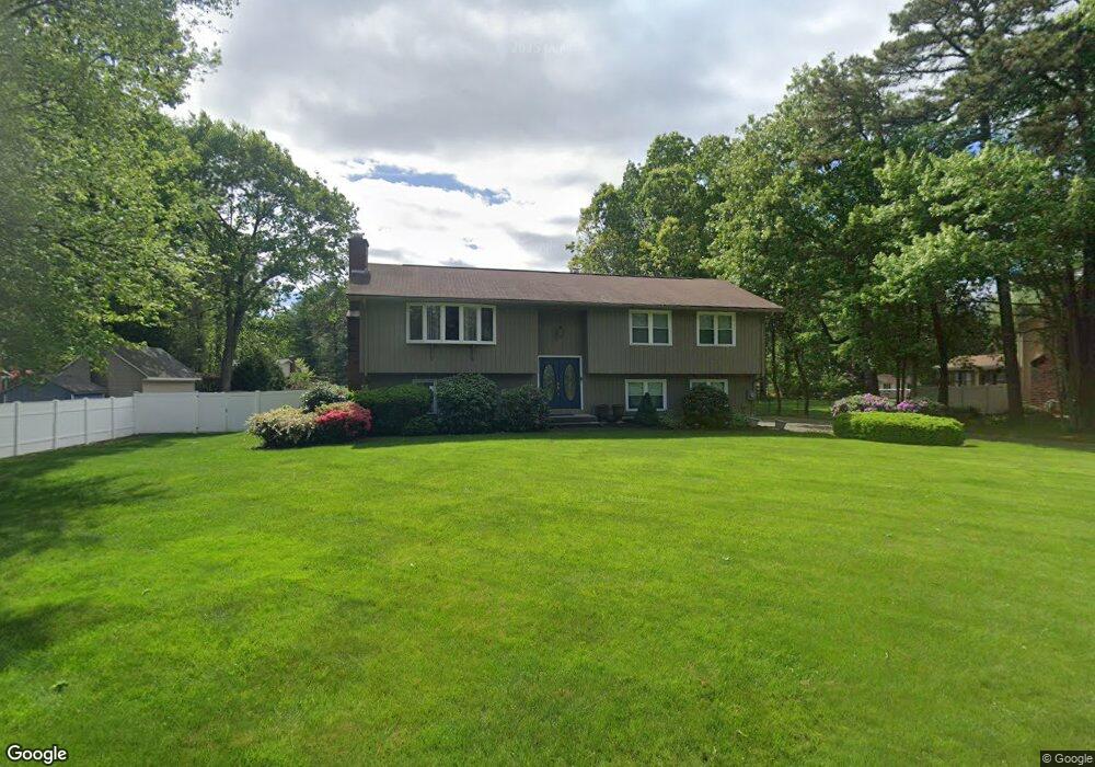
8 Briarcliff Dr Westfield, MA 01085
Estimated Value: $411,857 - $504,000
3
Beds
3
Baths
1,444
Sq Ft
$314/Sq Ft
Est. Value
About This Home
This home is located at 8 Briarcliff Dr, Westfield, MA 01085 and is currently estimated at $453,464, approximately $314 per square foot. 8 Briarcliff Dr is a home located in Hampden County with nearby schools including Westfield High School and Saint Mary High School.
Ownership History
Date
Name
Owned For
Owner Type
Purchase Details
Closed on
May 29, 1992
Sold by
Lindsey Frederick J and Lindsey Rose
Bought by
Schneider Mark and Schneider Gail A
Current Estimated Value
Create a Home Valuation Report for This Property
The Home Valuation Report is an in-depth analysis detailing your home's value as well as a comparison with similar homes in the area
Home Values in the Area
Average Home Value in this Area
Purchase History
| Date | Buyer | Sale Price | Title Company |
|---|---|---|---|
| Schneider Mark | $165,000 | -- |
Source: Public Records
Mortgage History
| Date | Status | Borrower | Loan Amount |
|---|---|---|---|
| Open | Schneider Mark | $100,000 | |
| Closed | Schneider Mark | $149,600 | |
| Closed | Schneider Mark | $6,698 | |
| Closed | Schneider Mark | $6,670 |
Source: Public Records
Tax History
| Year | Tax Paid | Tax Assessment Tax Assessment Total Assessment is a certain percentage of the fair market value that is determined by local assessors to be the total taxable value of land and additions on the property. | Land | Improvement |
|---|---|---|---|---|
| 2025 | $5,765 | $379,800 | $129,300 | $250,500 |
| 2024 | $5,776 | $361,700 | $117,800 | $243,900 |
| 2023 | $5,375 | $327,100 | $111,800 | $215,300 |
| 2022 | $5,375 | $290,700 | $99,900 | $190,800 |
| 2021 | $5,215 | $276,200 | $94,200 | $182,000 |
| 2020 | $5,107 | $265,300 | $94,200 | $171,100 |
| 2019 | $5,002 | $254,300 | $89,800 | $164,500 |
| 2018 | $4,923 | $254,300 | $89,800 | $164,500 |
| 2017 | $4,832 | $248,800 | $91,000 | $157,800 |
| 2016 | $4,837 | $248,800 | $91,000 | $157,800 |
| 2015 | $4,731 | $255,200 | $91,000 | $164,200 |
| 2014 | $3,540 | $255,200 | $91,000 | $164,200 |
Source: Public Records
Map
Nearby Homes
- 242 Eastwood Dr
- 181 Eastwood Dr
- 10 Marla Cir
- 120 Woodcliff Dr
- 336 Paper Mill Rd
- 0 E Mountain Rd
- 713 Holyoke Rd
- 0 Feeding Hills Rd
- 30 Deepwoods Dr
- 48 Blueberry Ridge
- 11 Laurel Terrace
- 14 Sylvan Dr
- 100 Meadow St
- 88 Woodmont St
- 149 Shaker Rd
- 76 Cardinal Ln
- 97 Mechanic St
- 57 Falley Dr
- 34 Pebble Path Ln
- 19 Arch Rd
- 12 Briarcliff Dr
- 14 Sunbriar Dr
- 10 Sunbriar Dr
- 23 Woodcliff Dr
- 27 Woodcliff Dr
- 7 Briarcliff Dr
- 20 Sunbriar Dr
- 16 Briarcliff Dr
- 19 Woodcliff Dr
- 33 Woodcliff Dr
- 15 Briarcliff Dr
- 20 Briarcliff Dr
- 24 Sunbriar Dr
- 20 Woodcliff Dr
- 11 Sunbriar Dr
- 9 Sunbriar Dr
- 15 Sunbriar Dr
- 28 Woodcliff Dr
- 19 Sunbriar Dr
- 37 Woodcliff Dr
Your Personal Tour Guide
Ask me questions while you tour the home.