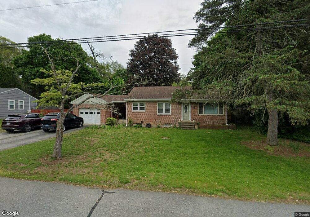
8 Harvard Rd Gales Ferry, CT 06335
Gales Ferry NeighborhoodEstimated Value: $357,781 - $423,000
3
Beds
2
Baths
1,236
Sq Ft
$319/Sq Ft
Est. Value
About This Home
This home is located at 8 Harvard Rd, Gales Ferry, CT 06335 and is currently estimated at $394,195, approximately $318 per square foot. 8 Harvard Rd is a home located in New London County with nearby schools including Ledyard Middle School, Ledyard High School, and Academy Of St Therese.
Ownership History
Date
Name
Owned For
Owner Type
Purchase Details
Closed on
Aug 1, 2000
Sold by
Daumy Gaston and Daumy Marie
Bought by
Steffey Michael
Current Estimated Value
Home Financials for this Owner
Home Financials are based on the most recent Mortgage that was taken out on this home.
Original Mortgage
$138,753
Interest Rate
8.18%
Create a Home Valuation Report for This Property
The Home Valuation Report is an in-depth analysis detailing your home's value as well as a comparison with similar homes in the area
Home Values in the Area
Average Home Value in this Area
Purchase History
We collect this data history from publicly available records. To have your information removed, we recommend requesting removal directly through your county’s website.
| Date | Buyer | Sale Price | Title Company |
|---|---|---|---|
| Steffey Michael | $139,900 | -- |
Source: Public Records
Mortgage History
We collect this data history from publicly available records. To have your information removed, we recommend requesting removal directly through your county’s website.
| Date | Status | Borrower | Loan Amount |
|---|---|---|---|
| Open | Steffey Michael | $160,000 | |
| Closed | Steffey Michael | $142,500 | |
| Closed | Steffey Michael | $138,753 |
Source: Public Records
Tax History
| Year | Tax Paid | Tax Assessment Tax Assessment Total Assessment is a certain percentage of the fair market value that is determined by local assessors to be the total taxable value of land and additions on the property. | Land | Improvement |
|---|---|---|---|---|
| 2025 | $5,449 | $146,720 | $44,380 | $102,340 |
| 2024 | $5,134 | $145,810 | $44,380 | $101,430 |
| 2023 | $5,039 | $145,810 | $44,380 | $101,430 |
| 2022 | $4,931 | $145,810 | $44,380 | $101,430 |
| 2021 | $4,899 | $145,810 | $44,380 | $101,430 |
| 2020 | $4,286 | $122,570 | $46,480 | $76,090 |
| 2019 | $4,297 | $122,570 | $46,480 | $76,090 |
| 2018 | $4,203 | $122,570 | $46,480 | $76,090 |
| 2017 | $3,988 | $122,570 | $46,480 | $76,090 |
| 2016 | $3,910 | $122,570 | $46,480 | $76,090 |
| 2015 | $3,726 | $122,570 | $46,480 | $76,090 |
| 2014 | $3,883 | $129,850 | $46,480 | $83,370 |
Source: Public Records
Map
Nearby Homes
- 59 Kings Hwy Unit 5
- 16 Kings Hwy
- 15 Ferry View Dr
- 72 Inchcliffe Dr
- 48 Kings Hwy Unit 103
- 32 Richard Rd
- 1098 Long Cove Rd
- 30 Patricia Ct
- 1561 Route 12
- 82 Christy Hill Rd
- 14 Anderson Dr
- 1 Holly Ln
- 932 Long Cove Rd Unit LOT 4
- 20 Inchcliffe Dr
- 17 Comstock Ave
- 1742 Route 12 Unit 2A
- 19 Power House Rd
- 1513 Connecticut 12
- 13 Hillside Dr
- 972 Long Cove Rd
- 10 Harvard Rd
- 6 Harvard Rd
- 48 Military Hwy
- 1 Ridge Rd
- 50 Military Hwy
- 7 Harvard Rd
- 5 Harvard Rd
- 52 Military Hwy
- 9 Harvard Rd
- 3 Harvard Rd
- 42 Military Hwy
- 2 Browns Crossing Rd
- 10 Browns Crossing Rd
- 10 Ridge Rd
- 11 Ridge Rd
- 51 Military Hwy
- 38 Military Hwy
- 49 Military Hwy
- 45 Military Hwy
- 53 Military Hwy
Your Personal Tour Guide
Ask me questions while you tour the home.