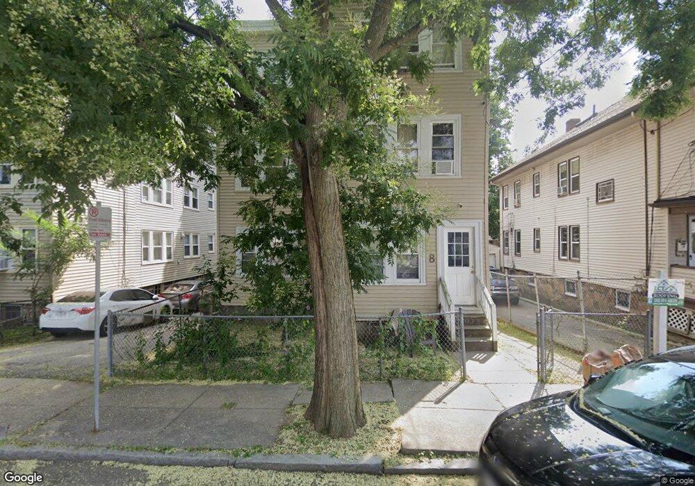
8 Lesher St Roslindale, MA 02131
Roslindale NeighborhoodEstimated Value: $902,373 - $1,251,000
9
Beds
3
Baths
3,648
Sq Ft
$300/Sq Ft
Est. Value
About This Home
This home is located at 8 Lesher St, Roslindale, MA 02131 and is currently estimated at $1,092,843, approximately $299 per square foot. 8 Lesher St is a home located in Suffolk County with nearby schools including Brooke Charter School Roslindale, The Croft School - Jamaica Plain, and St. Clare High School.
Ownership History
Date
Name
Owned For
Owner Type
Purchase Details
Closed on
Oct 27, 1989
Sold by
Chaisson Wilfred J
Bought by
Sanon Marie C
Current Estimated Value
Home Financials for this Owner
Home Financials are based on the most recent Mortgage that was taken out on this home.
Original Mortgage
$198,900
Interest Rate
9.94%
Mortgage Type
Purchase Money Mortgage
Create a Home Valuation Report for This Property
The Home Valuation Report is an in-depth analysis detailing your home's value as well as a comparison with similar homes in the area
Home Values in the Area
Average Home Value in this Area
Purchase History
| Date | Buyer | Sale Price | Title Company |
|---|---|---|---|
| Sanon Marie C | $216,000 | -- |
Source: Public Records
Mortgage History
| Date | Status | Borrower | Loan Amount |
|---|---|---|---|
| Open | Sanon Marie C | $235,000 | |
| Closed | Sanon Marie C | $195,500 | |
| Closed | Sanon Marie C | $198,900 |
Source: Public Records
Tax History
| Year | Tax Paid | Tax Assessment Tax Assessment Total Assessment is a certain percentage of the fair market value that is determined by local assessors to be the total taxable value of land and additions on the property. | Land | Improvement |
|---|---|---|---|---|
| 2025 | $11,685 | $1,009,100 | $254,500 | $754,600 |
| 2024 | $10,177 | $933,700 | $233,000 | $700,700 |
| 2023 | $9,551 | $889,300 | $221,900 | $667,400 |
| 2022 | $9,211 | $846,600 | $211,300 | $635,300 |
| 2021 | $8,770 | $821,900 | $205,100 | $616,800 |
| 2020 | $7,125 | $674,700 | $201,600 | $473,100 |
| 2019 | $6,464 | $613,300 | $156,500 | $456,800 |
| 2018 | $6,008 | $573,300 | $156,500 | $416,800 |
| 2017 | $5,780 | $545,800 | $156,500 | $389,300 |
| 2016 | $5,718 | $519,800 | $156,500 | $363,300 |
| 2015 | $5,670 | $468,200 | $123,800 | $344,400 |
| 2014 | $5,105 | $405,800 | $123,800 | $282,000 |
Source: Public Records
Map
Nearby Homes
- 61 Fawndale Rd
- 6 Dellmore Rd Unit 3
- 6 Dellmore Rd Unit 2
- 3886-3888 Washington St
- 348-350 Hyde Park Ave Unit 2
- 161 Florence St Unit 2
- 52 Southbourne Rd
- 375 Hyde Park Ave Unit 3
- 167 Hyde Park Ave Unit 167A
- 52 Patten St Unit 3
- 56 Patten St
- 2 Weld Hill St Unit PH2
- 40 Catherine St Unit B
- 40 Catherine St Unit 2
- 134 Sycamore St
- 132 Sycamore St
- 71 Wyvern St
- 7 Basto Terrace
- 441 Hyde Park Ave Unit 7
- 3 Rosemere Ct Unit 1
- 6 Lesher St Unit 2R
- 6 Lesher St
- 6 Lesher St Unit 2L
- 6 Lesher St Unit 1R
- 10 Lesher St Unit 12
- 12 Lesher St Unit 1
- 14 Lesher St Unit 16
- 14 Lesher St Unit 2
- 15 Mosgrove Ave
- 9 Mosgrove Ave Unit 11
- 4011 Washington St Unit 4019
- 57 Lesher St
- 1 Lesher St Unit 1
- 1 Lesher St
- 19 Mosgrove Ave
- 57 Mosgrove Ave
- 7 Mosgrove Ave Unit 1
- 7 Mosgrove Ave Unit 2
- 9 Lesher St Unit 11
- 15-17 Lesher St Unit 2
Your Personal Tour Guide
Ask me questions while you tour the home.