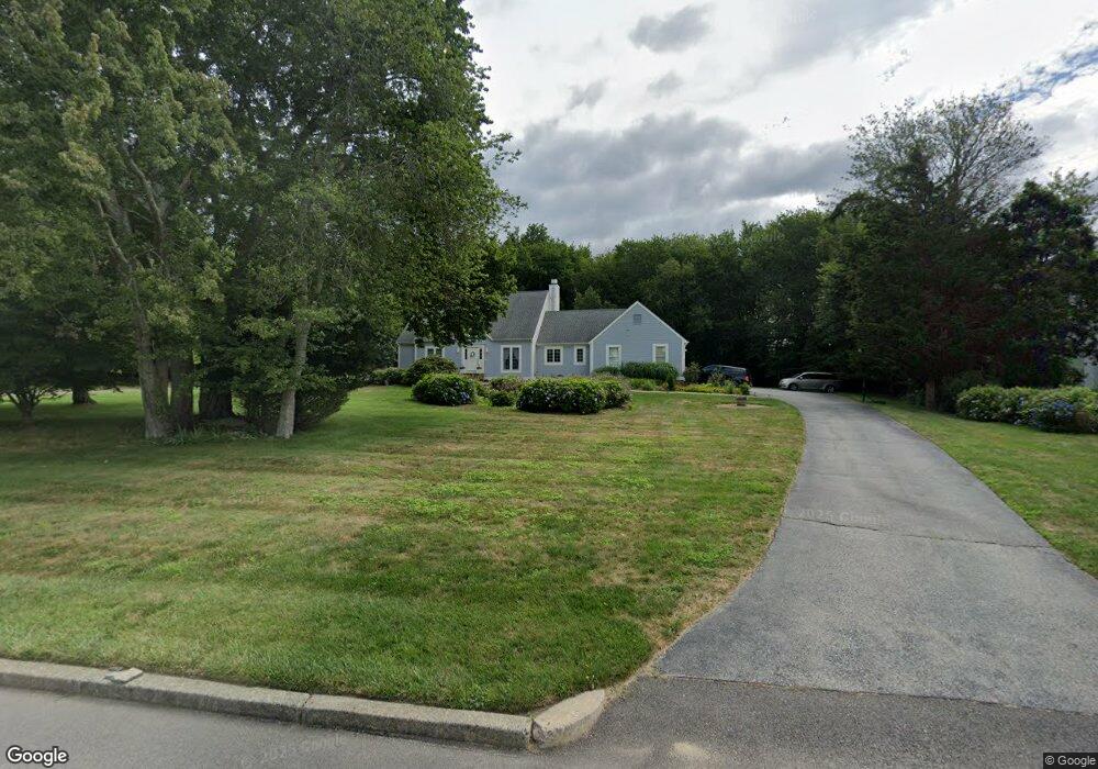
8 Port Cir Warwick, RI 02889
Warwick Neck NeighborhoodEstimated Value: $838,864 - $1,017,000
About This Home
This home is located at 8 Port Cir, Warwick, RI 02889 and is currently estimated at $901,716, approximately $265 per square foot. 8 Port Cir is a home located in Kent County with nearby schools including Saint Kevin School and Bishop Hendricken High School.
Ownership History
We collect this data history from publicly available records. To have your information removed, we recommend requesting removal directly through your county’s website.
Purchase Details
Purchase Details
Home Values in the Area
Average Home Value in this Area
Purchase History
We collect this data history from publicly available records. To have your information removed, we recommend requesting removal directly through your county’s website.
| Date | Buyer | Sale Price | Title Company |
|---|---|---|---|
| $445,000 | -- | ||
| $287,500 | -- |
Mortgage History
We collect this data history from publicly available records. To have your information removed, we recommend requesting removal directly through your county’s website.
| Date | Status | Borrower | Loan Amount |
|---|---|---|---|
| Open | $290,900 | ||
| Closed | $200,000 | ||
| Closed | $75,000 | ||
| Closed | $286,400 | ||
| Closed | $50,000 | ||
| Closed | $324,500 | ||
| Closed | $60,000 | ||
| Closed | $331,000 | ||
| Closed | $360,000 | ||
| Closed | $50,000 | ||
| Previous Owner | $210,000 |
Tax History
We collect this data history from publicly available records. To have your information removed, we recommend requesting removal directly through your county’s website.
| Year | Tax Paid | Tax Assessment Tax Assessment Total Assessment is a certain percentage of the fair market value that is determined by local assessors to be the total taxable value of land and additions on the property. | Land | Improvement |
|---|---|---|---|---|
| 2025 | $8,336 | $656,400 | $188,600 | $467,800 |
| 2024 | $9,406 | $650,000 | $188,200 | $461,800 |
| 2023 | $9,224 | $650,000 | $188,200 | $461,800 |
| 2022 | $7,904 | $422,000 | $100,800 | $321,200 |
| 2021 | $7,904 | $422,000 | $100,800 | $321,200 |
| 2020 | $7,904 | $422,000 | $100,800 | $321,200 |
| 2019 | $7,904 | $422,000 | $100,800 | $321,200 |
| 2018 | $8,520 | $409,600 | $134,000 | $275,600 |
| 2017 | $8,290 | $409,600 | $134,000 | $275,600 |
| 2016 | $8,290 | $409,600 | $134,000 | $275,600 |
| 2015 | $8,678 | $418,200 | $163,400 | $254,800 |
| 2014 | $8,389 | $418,200 | $163,400 | $254,800 |
| 2013 | $8,276 | $418,200 | $163,400 | $254,800 |
Map
- 22 Channel View Unit 2
- 140 Aldrich Ave
- 64 Channel View Unit 4
- 45 Newton Ave
- 30 Angell Ct
- 246 Channel View
- 127 Beacon Ave
- 25 Leroy Ave
- 230 Kirby Ave
- 158 Lewiston St
- 20 W View St
- 10 Progress St
- 102 Sayles Ave
- 10 Young Ave
- 299 Palmer Ave
- 0 Meadow View Ave
- 69 Beaver Ave
- 77 Huron St
- 79 Suburban Pkwy
- 0 Quonset Ave
- 22 Main Channel Unit A3
- 0 Port Cir
- 26 Port Cir
- 36 Meyers Ct
- 9 Port Cir
- 42 Port Cir
- 23 Port Cir
- 12 Meyers Ct
- 132 Randall Ave
- 53 Port Cir
- 0 Warwick Neck Ave Unit 1240272
- 128 Randall Ave
- 56 Port Cir
- 35 Meyers Ct
- 124 Randall Ave
- 147 Port Cir
- 146 Randall Ave
- 689 Warwick Neck Ave
- 91 Port Cir
- 116 Randall Ave
Ask me questions while you tour the home.